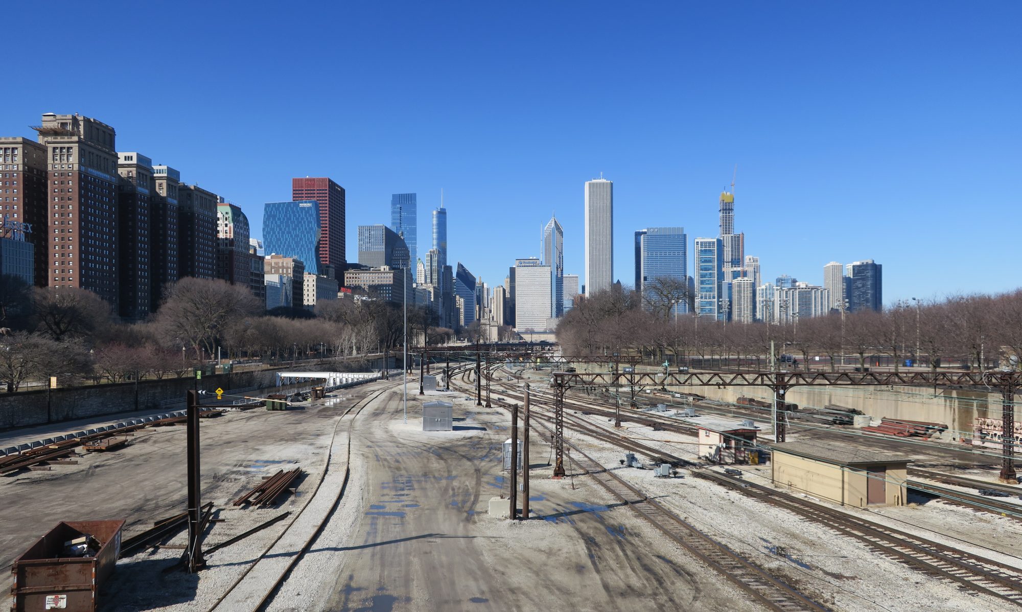
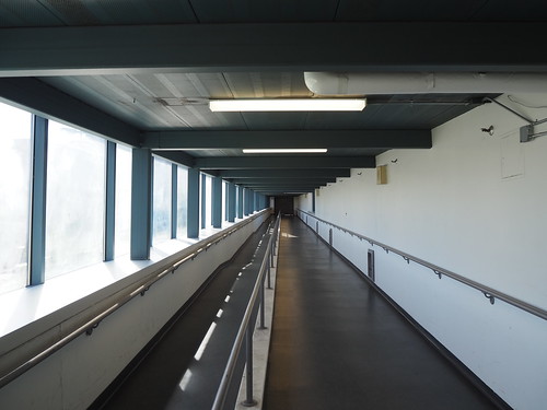
Anyone who has read basically any post on this blog will know I’m really big into urban transit. For some reason, I have found myself obsessed with the South Shore Line far more than any Metra line. I guess the reason being the South Shore Line’s uniqueness, both relative to Metra and to other commuter rail systems? Anyway, I have set out to photograph the entire South Shore Line. I also felt a stronger urgency to photograph the South Shore Line since a project is supposed to start relatively soon that will double-track the line between Gary and Michigan City and rebuild the stations along the line in the process. While this project will definitely be a major service improvement, I wanted to document what’s there now before it happens.
I have currently photographed every station in and east of Gary, but still have Hegewisch, Hammond, and East Chicago left. Since those are a lot closer to Chicago, they’ll be easier to get to. The further out ones were a bit more of a challenge.
The first big challenge is cost. The South Shore Line does not sell daily or weekly passes, only monthly passes. This means that I would have to pay a separate fare for each leg necessary to get all the stations, and when you add that up between all the stations, it gets real expensive real quick. However, I encountered a nice twist of fate. As part of the measures to welcome people back during the pandemic times, they temporarily made westbound travel free through the end of October. This was a game changer, since it meant in any given day I could take the train all the way out to the furthest east point I intended to photograph that day, then take short hops to various stations on the way back. In doing so, I would only have to pay the fare for the one outbound trip, since all the hops inbound were free.
The second big challenge was scheduling. This is not the L, this is a commuter rail line. Consequently, it does not run all that frequently, especially on weekends. This meant I needed to plan ahead based on the train schedule to avoid spending hours at a single station and not being able to photograph any others. I managed to make that work with a bit of cleverness and planning, but it did mean that my photography expeditions were full day endeavors. So, without further ado, here is how it went.
Expedition 1: South Bend and Michigan City
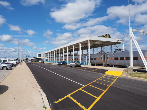
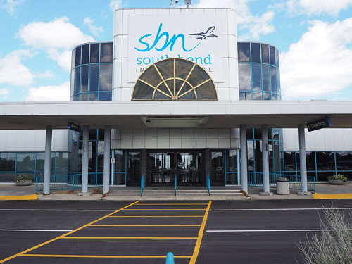
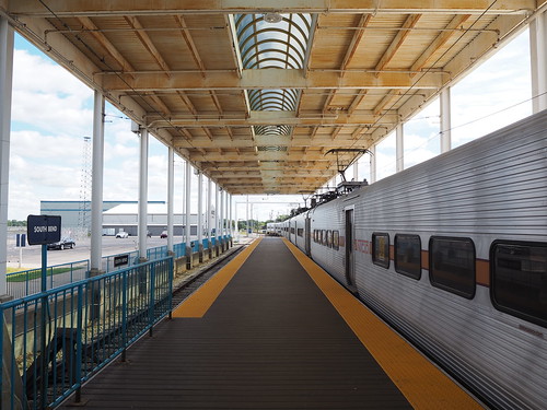
I figured I might as well knock out the furthest and most expensive stop first, so I went all the way out to South Bend. The weather that day was mostly sunny with scattered clouds. I caught the Red Line downtown, then got on the 8:45am train to South Bend (the first one of the day). I got to South Bend and quickly got to work taking pictures, since my train was going to leave again about an hour later.
From there, my plan was to take the train to Carroll Avenue and walk to 11th Street, since those two stations weren’t all that far apart. I got back on the train at South Bend, and the conductor recognized me from the trip out. When getting our destinations (they need to know where everybody’s getting off since there are a few flag stops) he automatically assumed I was going back to Chicago since he knew I got on there. I quickly explained I was going to Carroll Avenue and that was resolved. I didn’t particularly want to explain why I was going the route I was (not all transit employees like people photographing their systems), but later on he asked what I was doing and I had my camera bag pretty obviously visible so there was no hiding it and I explained briefly what I was doing, and he actually said it sounded like a cool project. It was nice to get approval from a transit employee for once.
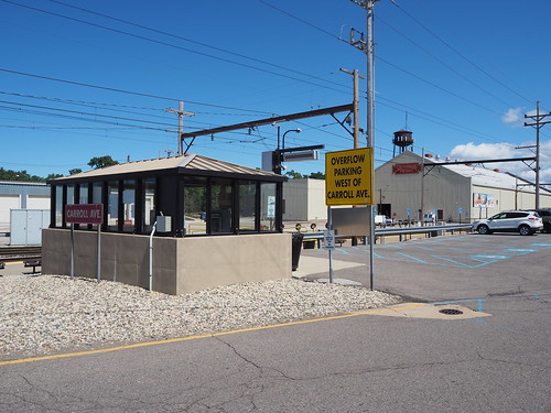
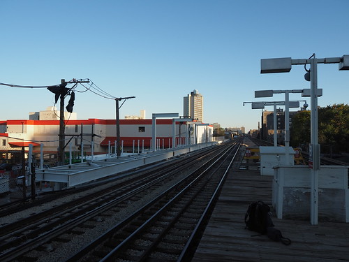
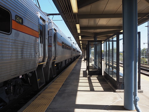
Once I got to Carroll Avenue and got off the train there, I got to work photographing the station. The station is a low platform with a wheelchair lift and located directly adjacent to both a South Shore Freight facility and the main South Shore Line storage yard and maintenance shops. I really was hoping to get some photos of the yard, but unfortunately it didn’t look like there was anywhere I could (legally) go to get a good photo. Still, I got plenty of pictures of the station. The sky had also cleared up some more, so I got some nice bright shots.

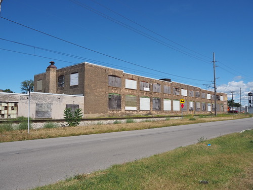
I was going to head out but then found my path was blocked by a pair of freight locomotives in the main driveway, so I had to wait for them to move before I could go anywhere. Once they did, I started walking towards 11th Street. Along the way I found a few abandoned buildings.

Then, I got to where the tracks enter the street. This is a very uncommon sight and will disappear in a few years, so I made sure to photograph it.
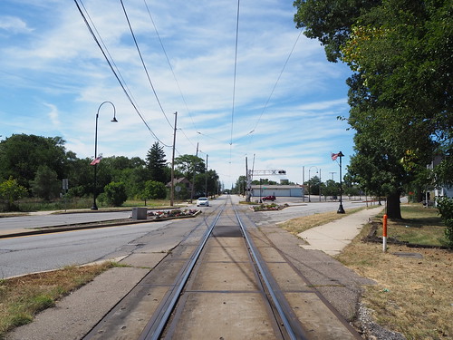
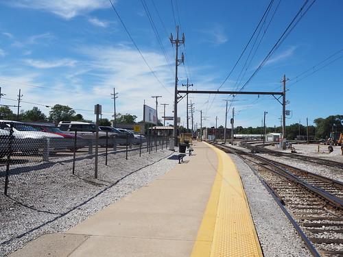
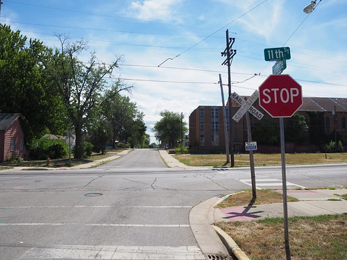
I then made my way down 11th Street to the station. There were a few people waiting at the station for the next (eastbound) train, so I didn’t take any pictures with them in it and waited for their train to arrive before taking pictures where the interior of the shelter was obviously visible. The 11th Street station is unique in that it is located in the middle of the street. No platform whatsoever, and you have to cross a lane of traffic to board. It’s similar to a tram stop, except this is a full-sized commuter train. The train runs in the middle of the street for two miles and some change, a very unusual setup these days. This is a relic from the interurban heritage of the line.


I then continued down 11th Street and eventually got to the point where the tracks switch from 11th to 10th and cross the Amtrak line. There were also a few abandoned buildings there.


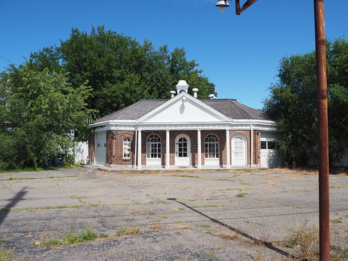
Seeing the abandoned buildings and run-down houses, I had the song “Boulevard of Broken Dreams” going in my head. That song wasn’t referring to any literal street, but I felt like if there was any street it applied to, this was probably pretty close. I didn’t take any pictures focusing on abandoned houses since I felt bad about doing that, since, ya know, that used to be someone’s home. I did take pictures of abandoned commercial properties though.
Then, I got to where the tracks leave 10th Street and return to their own right of way.


From there I headed back towards the 11th Street station. Once I got back to the station, I started getting photos of everything I couldn’t before. I also finally got to eat lunch (a sandwich I brought with me) and got a soda from a convenience store for a little caffeine. From there, I waited for my train. One thing that amused me at 11th Street was the electronic sign reminding me to watch the gap between the platform and the train. Uh, there is no platform at all? I have to step up from the street.
Expedition 2: Hudson Lake, Beverly Shores, and Dune Park
Taking advantage of another sunny day, I planned another expedition. Doing some research on Google Earth, I found that I could walk from Beverly Shores to Dune Park via the Calumet Trail, so my plan was to take the first train for the morning to Hudson Lake, then take a train from there to Beverly Shores and walk to Dune Park in order to maximize how many stations I could photograph on a weekend schedule.
The trip to Hudson Lake was pretty uneventful. I got on the train at Millennium and got off at Hudson Lake. The one important thing was I originally got on in the third car, while you can only get on/off at Hudson Lake in the first or second car since the platform is only long enough for one car (the doors at the back of the first car and front of the second car are the ones that stop by the platform). Thankfully I found this out from the conductor when he checked my ticket and saw it was to Hudson Lake, so I knew to head to one of those cars when we were getting near Hudson Lake. Once I got to Hudson Lake, it felt like I had entered a whole new world. After having been in Chicago for such a long time and only leaving to visit South Bend (and then just the airport) and Michigan City, my mind was entirely on urban areas. Hudson Lake is very much rural, so that was a bit of a shock. Still, I got to work photographing the station (not much of a task, given that the station is just a short concrete platform, shelter, and small parking lot).
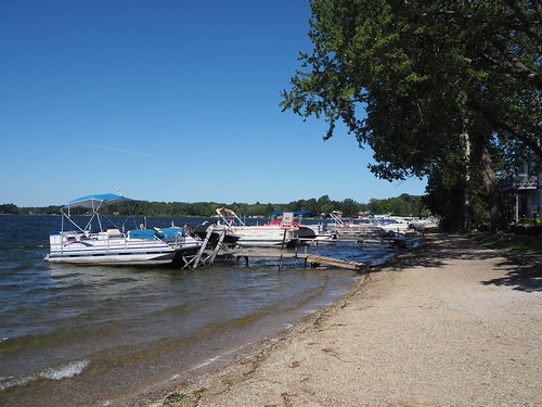
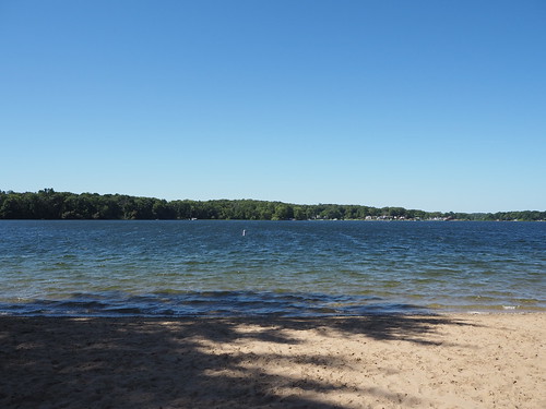
From there with an hour and some to kill, I walked around Hudson Lake photographing various things. It took a while to find a public beach, but eventually I did. I got some photos of the water from the beach and also found a sand mermaid someone made. There were a surprising amount of boats docked there as well. Then I continued walking around the lake and photographing the sights. Eventually I made my way back to the train station and caught the train to Beverly Shores.


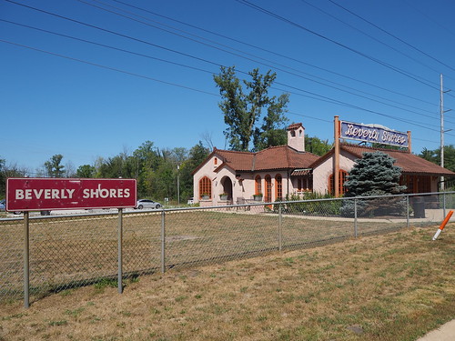
I got off at Beverly Shores with little fanfare, but did make sure to notify the conductor since it’s a flag stop and there was no guarantee anyone else was getting on. I then started photographing there. The station is strange in that while the actual railroad facilities are pretty minimal (standard platform, shelter, and parking lot kind of deal), there was an old station house that is now an art gallery. That station house was built in Mediterranean revival style, which felt very out of place for rural Indiana. Still, it was a cool piece of architecture, even if out of place.

Then, after I took a bunch of photos, I headed to the Calumet Trail to begin walking to the Dune Park station. The trail felt kind of desolate. While near the Indiana Dunes, I was not actually on the lakeshore. Instead, it was just a wide clearing in the forest containing (from left to right) the road, the railroad, power lines, and the trail.


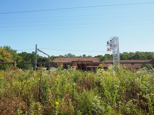
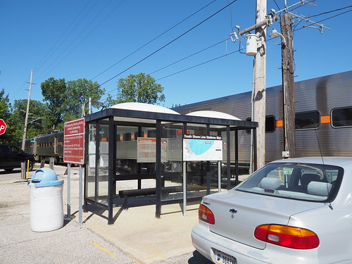
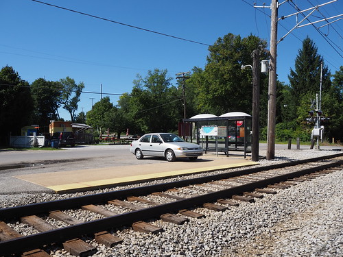
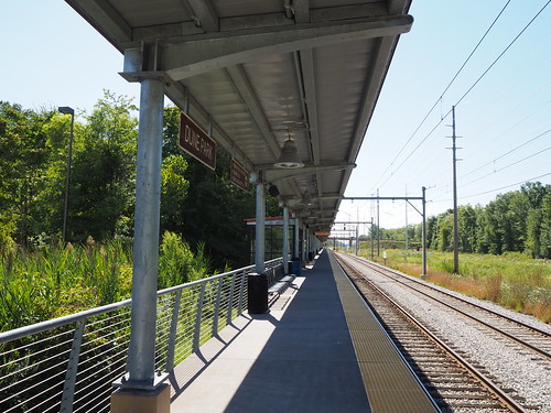
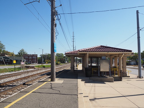
Still, despite the feeling of desolation, it was a nice feeling walking down it. I did see random pieces of power company infrastructure along the way and made sure to photograph those. Then after a few miles, I got to the Dune Park station. That station is an oasis in an otherwise fairly empty area. It has a big station house with a waiting room and high platform, despite not being all that close to any population centers. I immediately got to work photographing the station, and since it had a waiting room, nobody was hanging out on the platform, making it easier to avoid including people in my photos. I also got a soda from the vending machine there (gotta have that caffeine). Eventually my train arrived and I headed back home.

With that, I had photographed every station from Dune Park to South Bend.
Expedition 3: Portage/Ogden Dunes and Gary
For my third major expedition, I finished out the future construction zone. This time I actually took a day off work and went during the week since the first available opportunity with clear skies was during the week. Doing this meant that I could travel with the weekday schedule though, which meant more frequent trains. The weather definitely did not disappoint. It was in the 60s and completely clear skies. I could not have asked for better weather.
As usual, I caught the Red Line at Bryn Mawr in the morning. I hadn’t taken the Red Line in a while and they had started some construction work on a temporary platform for when the Red Line reconstruction project begins, so I photographed that while waiting for my train:
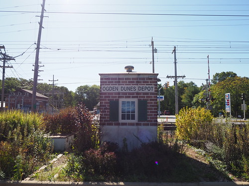
My train arrived in less than five minutes (yay, weekday schedule) and got me to Millennium Station without any trouble. At Millennium Station, my South Shore Line train was already waiting and boarding, so I just hopped right on. It didn’t leave for another 20 minutes, but I figured I’d rather wait on the train than in the station. Anyway, the train headed out right on schedule and got me out to Portage/Ogden Dunes.
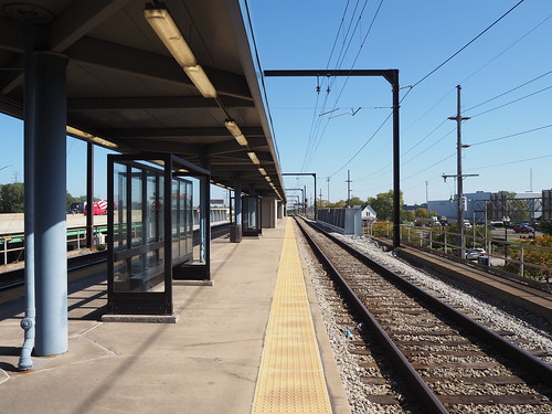
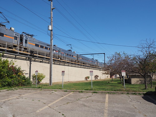
Once there and the other person disembarking there had left the station, I got to work photographing. The weather was absolutely beautiful, making for really good photography conditions. The station is interesting in that it is the only one on the line with mini-high platforms. All other stations either have low platforms that are not wheelchair accessible at all (Gary/Chicago Airport, Miller, Beverly Shores, Hudson Lake), use wheelchair lifts (Gary Metro Center, Carroll Avenue), or have high platforms. This made for an unusual detail to photograph. This was also my first time at a two track station with only one platform, so most eastbound trains require passengers to cross the westbound track to board/disembark. These both will be changed with the construction project, which will build a new high platform for the eastbound track (though it looks like it will keep the low platform with mini-high platform for the westbound track). Also, while I was there, several freight trains and two Amtrak trains passed by on the tracks to the north of the station.


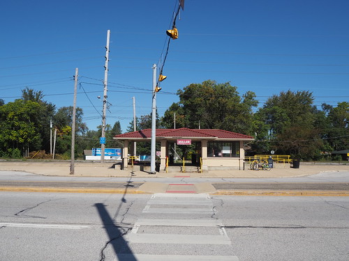
After photographing, I found that there were power outlets in one of the shelters, which gave me a chance to top off the batteries in my phone and camera. Some idiot had turned on the heat though, even though it was in the 60s. To make things even hotter, the shelter basically trapped sunlight, so it was really hot in there. I was able to turn off the heat, but it took a while to cool down to a reasonable temperature. Anyway, a while later, with a fully charged phone and camera, I caught the next train to Miller. Miller is just a low platform with one track (there is a second track, but that is a diverging line that does not carry South Shore Line trains). Once again, I waited for everyone to leave, then got to work.


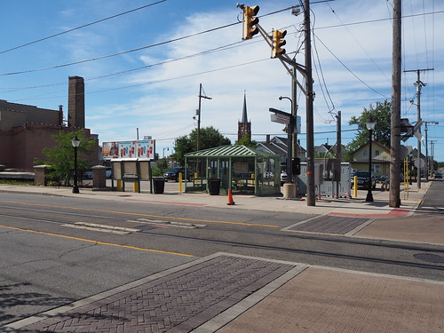
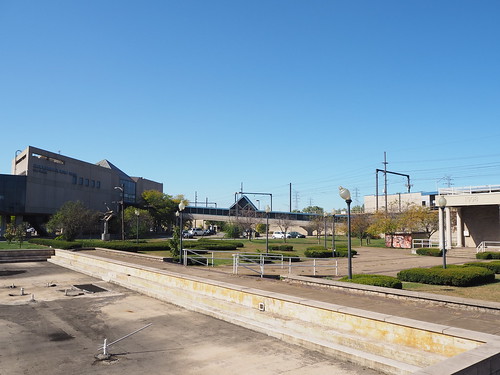
From there, my plan was to head to downtown Gary on the bus. However, I couldn’t find the bus stop. There was a reroute in effect due to some nearby street construction, but the GPTC website just listed the streets it was going on without an actual map. My guess for where the bus was going to arrive seemed to be incorrect, and no bus actually came at/soon after the scheduled time. With that unfortunate stroke of luck, I headed back to the train station since there was a train coming not that long later. That train did come, though about 10 minutes late. That train got me to Gary Metro Center within a few minutes. I got off there and also got started photographing once everyone had left the platform. It was a bit tricky since it was afternoon and sunny, so the shadow of the station canopy was not straight down but instead over the westbound track. This resulted in a major difference in lighting between the two, but I think in the end it came out ok. Gary Metro Center is definitely a major transit center, being directly connected to the main local bus hub and Greyhound station for Gary. The train portion is unusual in that it while part of a major transit center and on an elevated embankment, it has a low platform. From what I can tell, this is so freight trains can pass the station. without colliding with the platform. Other stations with high platforms deal with this by either having a second track that avoids the platform (Dune Park) or a guantlet track to provide extra clearance for freight trains (Hegewisch, Hammond, East Chicago). At Gary Metro Center, they just built the station with a lower platform and use a mobile wheelchair lift for accessibility.
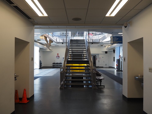
After photographing the platform, I headed into the main station building itself via the skybridge connecting it with the platform. A guy on the platform asked me if I was taking professional photographs. I don’t know why he was asking, as he wasn’t even a railroad employee. I responded that my photos are definitely not professional. It would be awesome if I could get paid for photographing train stations, but in the end I have a day job doing web development (also a fun thing, don’t get me wrong). I crossed the skybridge and entered the main station house. From the station house I walked around the plaza and parking lot photographing from various angles.


Then, I caught the R1 bus to get me to the Gary/Chicago Airport station (aka Clark Road). When I got on the bus, the driver asked me where I was going, so I said “Gary Airport train station” and he seemed really confused (it seemed like he thought I wanted to go all the way to Chicago?). I then followed that up with “Clark Road” and it still didn’t click with him, but then eventually another passenger emphasized that I meant the Clark Road train station and he got it. The bus got me there fairly quickly, and I started photographing the last station of the day. Thankfully, the sun was still high enough in the sky to avoid shadow issues.
The Gary/Chicago Airport station is another interesting one in that it’s a flag stop and a pretty basic station. It’s just a shelter adjacent to a single low-level platform, so like Portage/Ogden Dunes, eastbound passengers need to cross the westbound track to get on/off the train. However, unlike there, the platform is not the full length of the train and only can fit four cars (there are only two places where the track can be crossed, and one of them is road crossing by the platform, while Dune Park had four along a full length platform, allowing potentially all eight cars to board/disembark). The picture on Wikipedia (from 2016) shows it having some old cracked asphalt for the platform, but it looked like it had some fresh concrete since then, and the station looked pretty nice, even if minimal. As far as I’m aware, there are no plans to renovate the station due to its low ridership.


After another inbound train arrived, I took that to Millennium Station, then caught the Red Line back home.
One of these days once I get another sunny day I’ll also photograph Hegewisch, Hammond, and East Chicago (most likely all in the same day). That’ll be easier (and cheaper) since they’re a lot closer, so if I can’t get there while westbound travel is still free, having to pay a fare for each leg won’t be quite as expensive as it would be for the stations further out. I can even get to Hegewisch entirely on the CTA. Once that’s done, I will have conquered the South Shore Line! I haven’t taken pictures of Van Buren Street Station yet either, but I consider that to be part of the Metra Electric District and not the South Shore Line for the purposes of completely photographing lines.