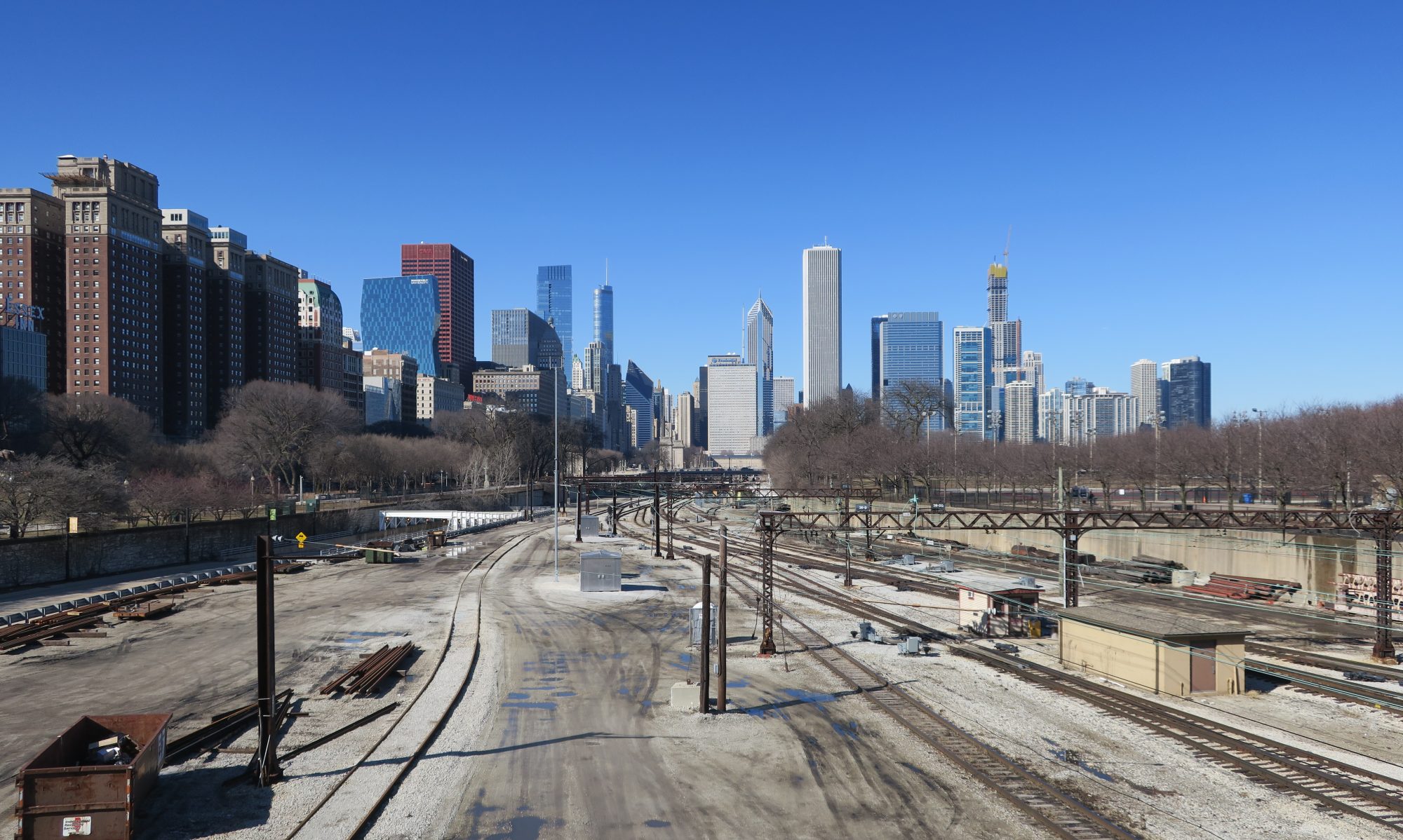
I took a pretty unusual route this time in order to 1. avoid paying more in fares than I have to (the South Shore Line is expensive and doesn’t offer any day passes, and the free westbound trips promotion I took advantage of earlier is no longer a thing) and 2. not have to constantly wait for trains. With this in mind, I checked Google Earth for where walking was feasible, as the stops are a lot closer together than further out on the line. I found that walking from East Chicago to Hammond was definitely doable, but Hammond to Hegewisch was probably not a good idea since there weren’t any direct routes with sidewalks. Hegewisch is on the CTA bus route 30, so that provided me alternate means home that was cheaper and ran more frequently than the South Shore Line. With that in mind, my route was this: 1. take the the train out to East Chicago, photograph there, 2. walk to Hammond, photograph there, 3. take the train one stop to Hegewisch, photograph there, then 4. take the 30 bus to 69th and transfer to the Red Line home.
With that plan in place, it was time to put it into action. This expedition started the day out as normal, by catching the Red Line at Bryn Mawr. The train got me downtown on time as usual, and I walked over to Millennium Station. Millennium Station had a few Metra trains operating on the South Shore Line platforms for some reason (probably maintenance on the Metra tracks/platforms).
I got on the train, and noticed that half the seats were roped off to facilitate social distancing:
Seat roped off to faciliate social distancing
This was not the case last time I was on the South Shore Line in October 2020. It was good to see that they are helping with COVID preventative measures, especially when this is a system that had a “mask-optional car” last year. The train left right on time, sailing across the South Side. The first good sign of the day was when I was somewhere around Hegewisch, I was able to see the downtown skyline across the lake. That meant the visibility was over 10 miles, which is as good as it gets.
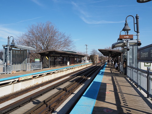
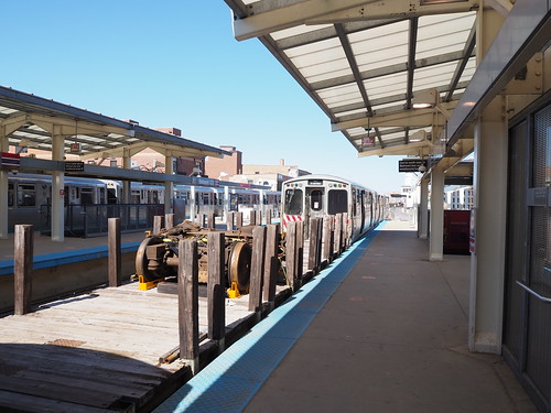
I got off at East Chicago, and immediately started snapping photos:
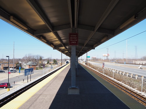
East Chicago platform
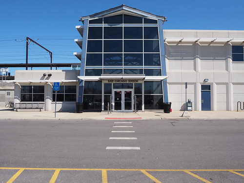
East Chicago headhouse
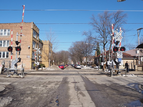
East Chicago seems to be the most substantial station on the line (other than those shared with Metra). It’s constructed on an alignment adjacent to the Indiana Toll Road, and has a center high-level platform with guantlet track to allow freight trains to pass the station without interference from the platform. There is a massive parking lot (and some overflow parking available nearby) and a station house. Due to the fact that there were two janitors cleaning the station lobby, I wasn’t able to photograph it, but it has a ticket counter, vending machines, ticket machines, water fountains, and restrooms. There also is an additional entrance further to the east to allow easier access from the far end of the parking lot.
From there, I started walking towards Hammond, and after the better part of an hour, I got there.
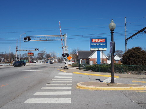
Main entrance to Hammond Station
Hammond has a large station house adjacent to the station with a coffee shop (closed while I was there) and restrooms, a large parking lot, and two high-level platforms (one for each track, rather than an island platform). While East Chicago is elevated, Hammond is at ground level.
Hammond station house
Interior of the station, with a view of the closed coffee shop
Outbound platform at Hammond
An interesting detail was that the outbound platform only had a canopy for a small part of the length, while the inbound platform had a canopy for the full length. I guess this is because there are probably a lot more people boarding inbound at Hammond than outbound.
Entrance to the platforms at the west end, by the station house
While waiting for the next inbound train, I ate my lunch, a peanut butter and jelly sandwich. Eventually, an inbound train arrived and I boarded it, only to get off one stop later at Hegewisch:
Inbound platform at Hegewisch
Hegewisch was laid out pretty similarly to Hammond, with a station house and two side platforms at ground level. Hegewisch also only had a full-length canopy on the inbound platform.
Station house at Hegewisch
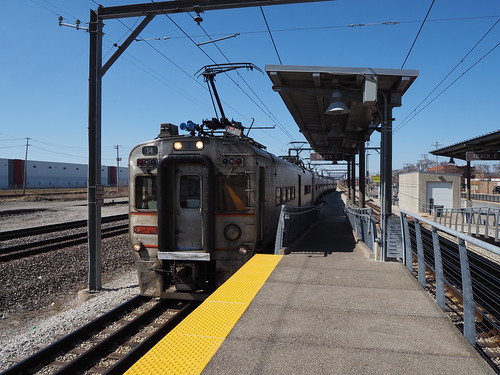
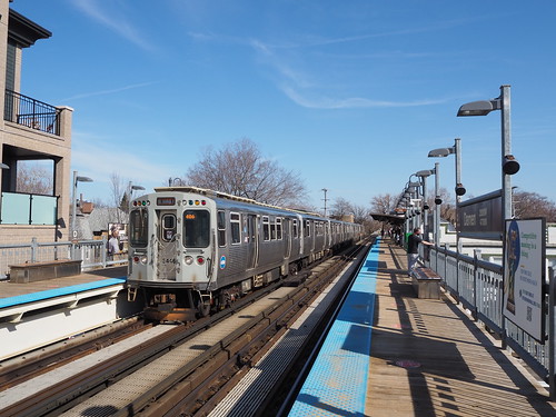
While I was photographing Hegewisch, an outbound train stopped there:
Outbound train arriving at Hegewisch
Hegewisch’s station house also had a coffee shop (also closed at the time), restrooms, and waiting area:
Waiting room at Hegewisch
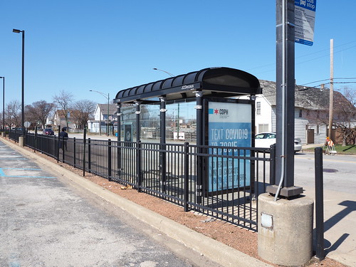
From there, I caught the 30 bus to 69th.
Bus shelter at Hegewisch
Along the way, there was a detour due to bridge construction, so we went over the 95th Street Bridge. To my disappointment, we did not jump the bridge while it was up, like Elwood Blues did with the Bluesmobile in the Blues Brothers.
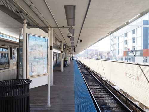
Then at 69th, I caught the Red Line home. I wasn’t able to get too many photos there since there were a lot more people than I expected on a Saturday, but I did get a few pictures of the platform.
Platform at 69th
This was my first time on the L anywhere south of Cermak Road, and my first time boarding on a freeway-median station (I have taken the Blue Line through the O’Hare Branch, but never actually boarded or disembarked there). I will definitely return to continue my photography, but that’s a project for another day.
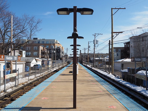
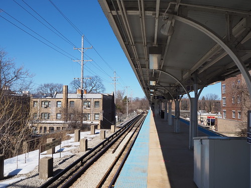
We had a pretty big cold snap for most of February this winter, so I was not about to go photographing anything during that time. It also didn’t help that the COVID situation was pretty bad for a while. However, the past two weekends have been quite pleasant (40 degrees or warmer and bright and sunny) and the COVID situation has improved. I took advantage of the weather to get out and photograph some more L stations. I had already photographed Paulina and Irving Park on the Brown Line, but none of the other ones. My first expedition took me out to Albany Park, on the Brown Line. I walked out to Kimball and started there.
My photos of Kimball were less than impressive, admittedly:
The entrance to Kimball
Platform with an empty track
There were a few reasons for a rough start to this photo expedition. It’s been a few weeks since I’ve done any photography, so I’m a bit out of practice. I like to shoot outdoor pictures in sunny weather whenever possible to get brighter and more vivid colors, but it does mean I need to be a bit more careful in terms of timing and positioning to have the sun where I want it (ideally the sun is high in the sky but behind me). Unfortunately I didn’t really think that through, and the sun was still in front of me when photographing the Kimball entrance, resulting in a lot of glare. Then in the station itself, I was limited in what I could do because there were a ridiculous number of CTA employees there, and also a surprising number of passengers given that it was the middle of the day on a Saturday. I understand all the CTA employees being there, given that it’s the end of the line and adjacent to the yard, but it limited what I could photograph.
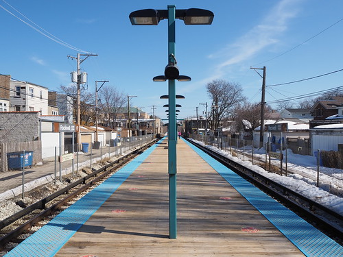
The outer portion of the Brown Line is a bit different from most of the rest of the L. It runs at ground level (with street crossings) rather than elevated, and the stations accordingly have a very different design. Also note all the snow in the picture. Even though it hadn’t snowed in a while and had been above freezing for about a week, there was still a lot of snow on the ground left to melt, and I heard water going down gutters even though it was completely sunny out.
Francisco also had an interesting mosaic design on the entrance ramp:
Mosaic on the Francisco main entrance ramp
And, of course, there were grade crossings adjacent to the station:
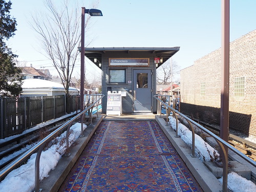
The station looked more or less the same as Francisco, and from there I waited for the next train to Western.
Outbound platform at Western
Unfortunately I didn’t have the opportunity to capture that many pictures at Western because a CTA employee spotted me taking photos and (incorrectly) informed me that I needed a permit to take photos. I explained that I am taking non-commercial photos and their own photo policy says “The general public is permitted to use hand-held cameras to take photographs, capture digital images, and videotape within public areas of CTA stations and transit vehicles for personal, non-commercial use.” My photos are for non-commercial purposes and were taken with a hand-held camera in a public area, therefore I was in compliance with the rule. She didn’t seem to care and told me “well in the future, be aware of this.” I will definitely return to take more photos, hopefully on a day that person isn’t stationed there.
Regardless, I headed over to Rockwell, and along the way got a photo of the tracks rising from grade level to the elevated structure:
Tracks rising from ground level to the elevated structure between Rockwell and Western
I also got a photo of the bridge over the North Branch of the Chicago River:
Brown Line bridge over the North Branch of the Chicago River
Unfortunately there doesn’t seem to be any pedestrian path along the river, so I couldn’t get a closer picture (this picture was taken from another bridge). Maybe one day I will be able to rent a kayak to get a photo from closer. From there, I entered Rockwell:
Platform at Rockwell
Rockwell is unusual in that it only has one entrance, while the other ground-level stations (except Kimball) have an entrance at both ends of the platform. Other than that though, it looks like the other ground-level Brown Line stations.
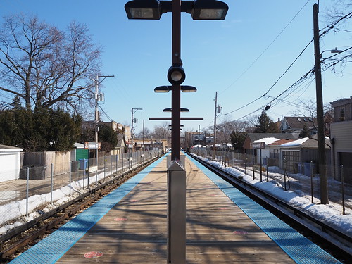
From Rockwell, I caught the next train to Montrose.
Platform at Montrose
Montrose had a cool set of exit-only stairs that met at a right angle (usually they either meet head-on or have separate exits) for a combined exit:
Brown Line structure and alley north of Montrose, just south of the curve
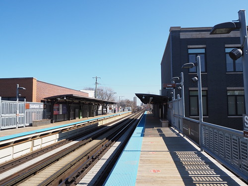
Platform at Damen
Outbound train entering Damen
There, I decided to call it a day and headed back home (this time using the train instead of walking). I caught the next inbound train to Belmont and transferred there. While waiting for the Red Line at Belmont, I saw a rather interesting traffic jam. A southbound Brown Line train was holding just south of the station on the Red Line track (southbound Brown Line trains were running on the Red Line track due to construction). However, it was not far enough past the station to clear the signal for the track by the platform, so a southbound Red Line train behind it had to hold north of the station. Where it was holding, it blocked the Clark Interlocking where the Brown Line diverges from the Red Line, so a northbound Brown Line train was stuck at the station since it couldn’t proceed due to the junction being blocked. (Note that the Red-Purple Bypass project will prevent this kind of problem in the future, but that’s still a work-in-progress right now.)
Eventually they announced over the PA system that there was “police activity” at Wellington, which was causing the delay. A few minutes later, the first southbound train resumed moving again, allowing the second southbound train to enter the station and clearing the interlocking for the northbound Brown Line train, clearing the traffic jam and allowing trains to resume as normal. While waiting, I got a photo of the current state of the Red-Purple Bypass:
Red-Purple Bypass
Then a northbound Red Line train came and I took that back home.
The next weekend, Saturday, March 6, I continued my work. I first walked to Addison on the Brown Line to finish photographing the Brown Line, with only Addison and Southport left. They were doing some welding on the track structure at Addison by the entrance (I don’t have any pictures since I didn’t want to risk damaging my eyes by looking at welding), but otherwise it was a pretty quiet morning there.
Inbound platform at Addison
I definitely was off to a better start than I was at Kimball the previous weekend. Not a bad photo to start the day. From there, I caught the next inbound train to Southport.
Southport Station
Entrance to Southport
From Southport, I walked over to Belmont. I got a bit confused in terms of what direction I was walking from Southport since I was paying too much attention to my photos and not what direction I was going (I was watching for cars and other people though). At Belmont, I got a treat I hadn’t seen before: a work train.
Work train heading north on the Red Line track, strangely with a “Midway” destination sign
Flatcar carrying a rail truck on it
I don’t know what that train was for, but it was cool to see. With that, I had conquered the Ravenswood Branch! From there, I set about finishing my work on conquering the Evanston Branch. I had already photographed Howard, Main, Dempster, Davis, Central, and Linden on other expeditions, so I just had to get the remaining three: South Boulevard, Foster, and Noyes. I caught the next northbound Red Line train at Belmont to make that happen.
At Howard while waiting to transfer to the Purple Line, I saw that work train again. Since there were so many people out, I didn’t photograph it again, but my guess is it was headed to the Howard Yard.
Eventually, a Purple Line train came, and I took that to Noyes.
Platform at Noyes
Several of the northern Purple Line stops used to be stops on the interurban North Shore Line, which had separate platforms (with separate fare collection). The platforms have mostly been demolished, but the supports remain:
Remnants of the North Shore Line platform at Noyes
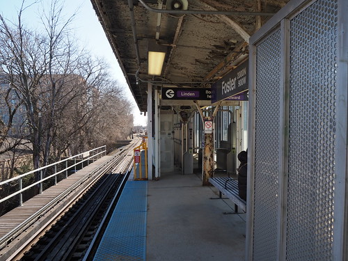
Leaving Noyes, I walked to Foster, only a few blocks south:
Platform at Foster
It was also interesting that Foster and Noyes had platform-level faregates, while most other elevated stations do fare collection at ground level. It was difficult to photograph this because people tend to congregate by the entrance.
Platform-level faregates at Foster
Finally, for what I figured would be my last station to photograph for the day, I took the next train to South Boulevard:
Platform at South Boulevard
South Boulevard is interesting for having a “team track,” a diverging spur track. According to chicago-l.org, it dates back to when the line still carried freight for local businesses to load/unload content from railcars. Unfortunately, I couldn’t photograph the team track from ground level since there was a fenced-off area between the parking lot and the end of the track, so I was only able to photograph it from the platform:
“Team track” diverging from the northbound track at South Boulevard
From there, I started walking back to Howard. Just outside the Howard Yard, I saw another photography opportunity: where the Purple and Yellow Lines cross Chicago Avenue (which changes names to Clark Street just south of there):
Purple Line bridge
Yellow Line trench
Then, as I was walking east on Howard Street, I saw a new angle from which I could photograph the Howard Station that captured a good full-profile image of the station in a way I hadn’t before:
Howard Station from the northwest on Howard Street
With that, I had photographed every station on the Ravenswood and Evanston Branches! Not bad. I will definitely go back for better pictures at some of those stations as time permits, but still a good start to my project to photograph every Chicago L station. The remainder are going to be a bit trickier, since they require going downtown (or in the case of the outer portion of the Blue Line, catching a bus). Because COVID is still a thing, I’m trying to avoid going downtown if possible, and I hardly think this photography project counts as “essential travel.” The vaccine is coming though, so fingers crossed we can safely resume mostly-normal life soon.