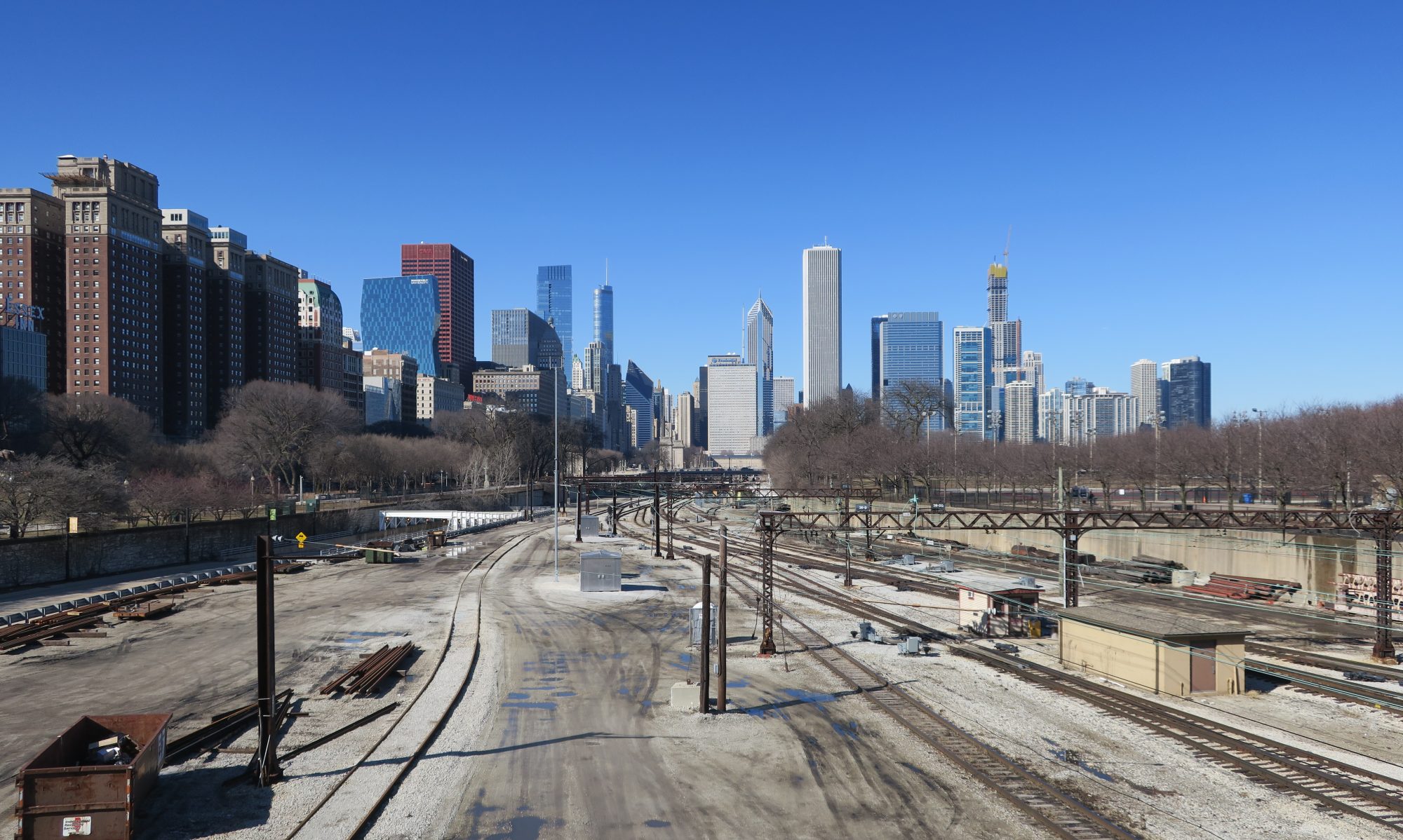
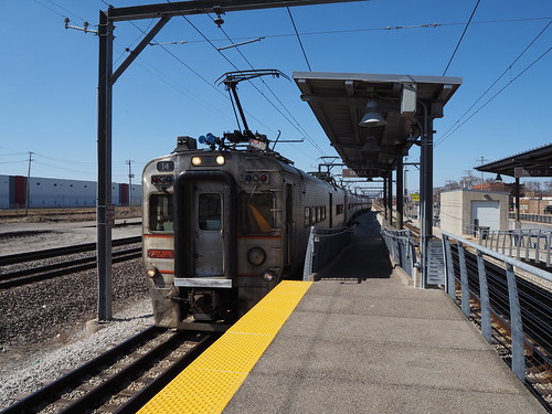
After three years, Double Track NWI is coming to a close. While most other interurban lines in the United States bit the dust decades ago, the South Shore Line has survived all these years, and now is getting a well-deserved upgrade. The most notable feature of this upgrade was the loss of the street-running track in Michigan City, but this also included double tracking the entire route from Gary to Michigan City that used to be mostly single-track and building several entirely new stations.
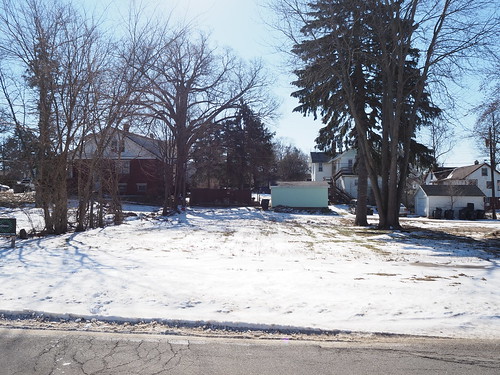
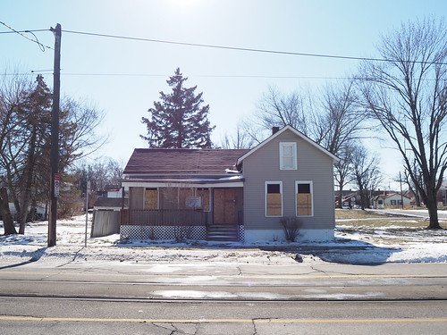
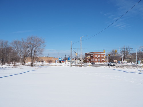
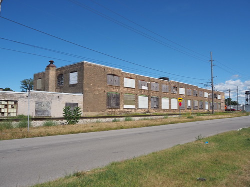
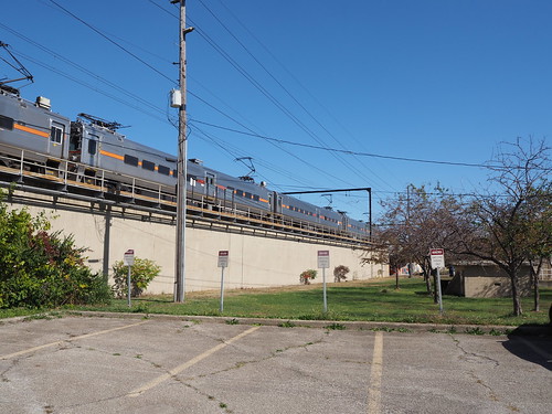
First, Miller. The station used to be a single-track low platform station with a sheltered but open-air waiting area. The second track was a connection to another line, not a passing track and was not electrified.
Old platform at Miller
Old shelter at Miller
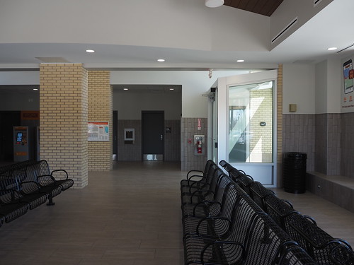
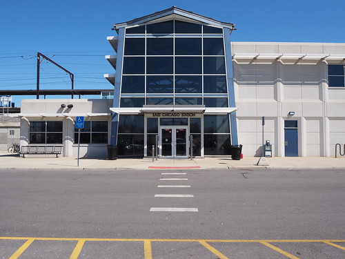
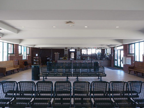
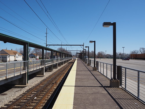
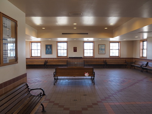
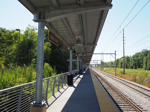
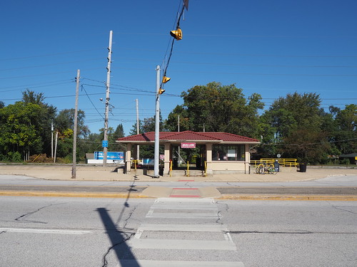
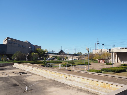
Now, the station has two tracks, high platforms, and an entirely new station building. The station building contains seating, ticket machines, restrooms, and a currently unoccupied space for a snack bar or coffee stand.
One of the platforms
Station building exterior
Station building interior
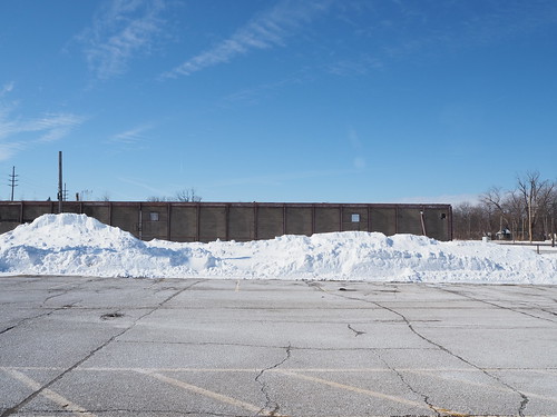
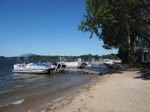
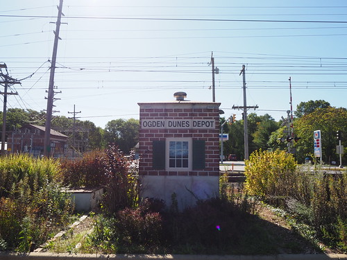
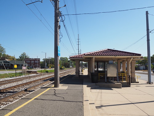
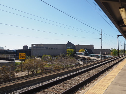
Portage also saw an upgrade, though not quite as major. It used to be a single low-level platform to the north of the tracks with an adjacent parking lot. They kept everything that was there but also added a high-level platform to the south and a new parking lot to the south of the Dunes Highway (with a signaled pedestrian crossing).
Old station at Portage/Ogden Dunes
New high-level platform
Secondary parking lot
So, overall a pretty sweet project. The South Shore Line in many ways is the last of its kind, and I’m glad to see it’s not only continuing to operate, but being upgrade so it can provide even better service. This will provide clean, fast, reliable, and comfortable transportation for the people of Northwest Indiana for generations to come.
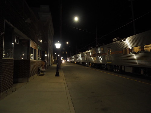
Two and a half years after the closure of the last of its kind street-running 11th Street station, the station has returned to life this past week. The South Shore Line is one of the last interurbans left operating in the United States, and until 2021 retained one street-running section in Michigan City. However, as part of a project to upgrade the line the street-running section needed to be removed since, despite how interesting it may be to railfans, it is slow, dangerous, and single-tracked.
Train on the old street running section in Michigan City
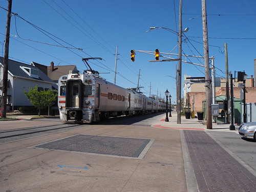
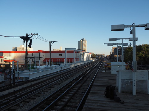
After a long period of running shuttle buses, the street running alignment has been replaced by a double track alignment with a one-way street adjacent to it. Here is a typical section:
New dedicated ROW for the South Shore Line and the street running next to it
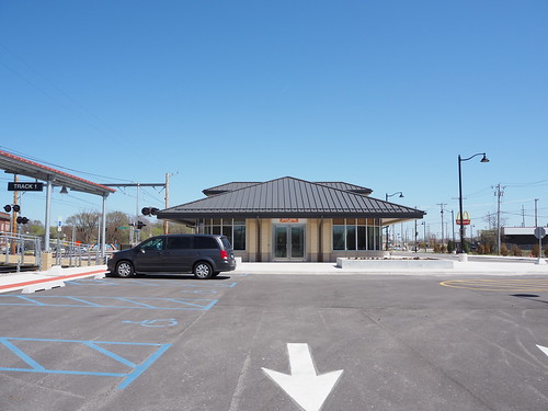
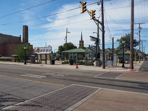
The station itself has been replaced with a new modern station with high-level platforms instead of crossing a lane of traffic:
Rebuilt 11th Street station
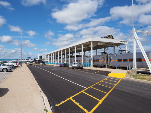
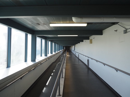
In addition to building new platforms, a new station building is planned, which will not only feature a parking garage and ground-level retail and a waiting area, but also feature apartments above the building.
On my trip to and from the station, we got to go fast. We were no longer crawling for two miles, but instead actually going fast. Boarding also was very quick thanks to the high platforms.
While most interurbans bit the dust decades ago, this one held on and has survived to today, and now is receiving some much-needed upgrades that will allow it to continue being a vital transportation artery for generations to come.
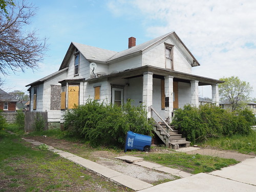
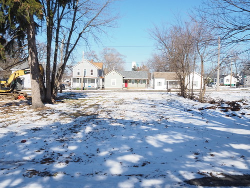
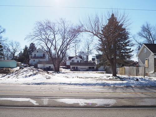
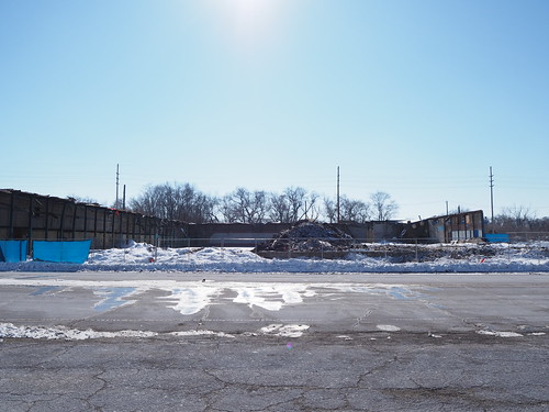
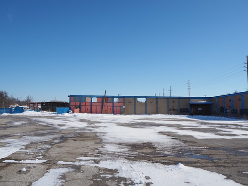
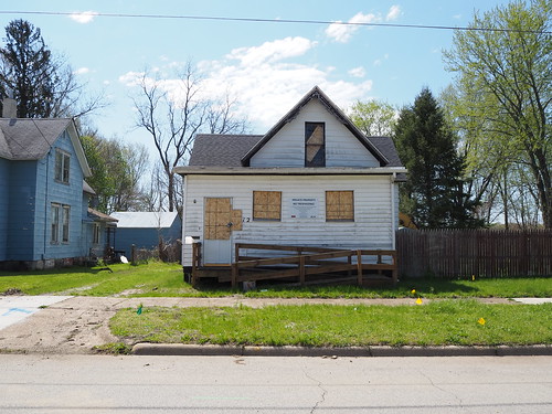
As promised in my earlier photo set on demolition in Miller Beach (Gary), here is a photo set of all the demolition in Michigan City. I originally was planning to do this in March or April after all the snow melts, but the construction schedule forced a change of schedule. It looks like they’re planning on starting new construction on 11th Street right at the beginning of March, and I wanted to photograph everything after demolition was (mostly) completed but no new construction had started. As a result, there were a few buildings left standing that will be demolished in the future and there is a bunch of snow in my pictures.
Unlike Miller where only a few buildings near the station were demolished to make way for station expansion and a new parking lot, the demolition in Michigan City was widespread. They are moving from the current alignment of a single track down the middle of 10th and 11th Streets to a double track alignment adjacent to a one-way street, repurposing the southern (eastbound) lane to take the place of a second track. As part of the process, a number of buildings need to be demolished. Additionally the area north of 11th Street between Franklin and Pine Streets is being demolished to allow building a new parking garage and station building. As a result, there were a large number of houses and other buildings that needed to be demolished.
Additionally, to my knowledge, only commercial properties were demolished in Miller. However most of the buildings demolished in Michigan City were homes.
I did my best to capture as many homes as possible before demolition, but I didn’t really make concrete plans for this project until after some demolition had already begun so in a good number of these I am missing the “before” photo. Due to the large number of buildings, I don’t have much to say for most of these, just pictures.
Without further ado, I present the Requiem for Northwest Indiana, Part 2: Michigan City. This is without a doubt the longest post I have ever made here.
716 E 11th St
Before demolition
After demolition
523 E 11th St
After demolition (from a side street)
517 E 11th St
Before demolition
After demolition
After demolition (from the back)
513 E 11th St
Before demolition
Before demolition
Before demolition
After demolition
After demolition
509 E 11th St
Rear view
505 E 11th St
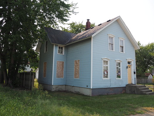
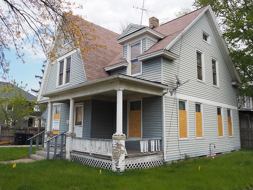
This house is still standing but will be demolished soon.
Back of the house
Front of the house
501 E 11th St
416 E Main St
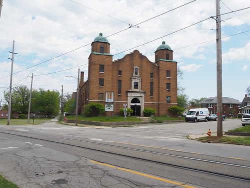
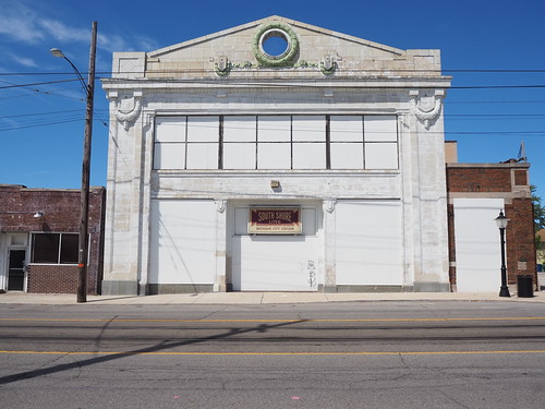
1102 Cedar St (First Christian Church)
This site used to house the First Christian Church. This is by far the biggest building that was demolished, it was nearly a whole block long by itself. It is also used on Wikipedia (as of the time I write this) as the headline image in the article about the South Shore Line.
For those not aware, the South Shore Line is currently undertaking a major project to double track the line from Gary to Michigan City (currently mostly a single track) and make a number of other improvements to the line, including improving access and parking to stations, making most stations accessible to passengers with disabilities, increasing speeds, and other things. However, as is often the case with major public works projects, there are property impacts. Specifically, buildings near the Miller station (in Miller Beach, Gary), Portage/Ogden Dunes station, and all along 10th and 11th Streets in Michigan City need to be demolished to allow for the construction.
I have been undertaking a major project to catalog the construction, and as part of that I have been photographing as many buildings as I can before and after demolition. New construction hasn’t started yet, but demolition is mostly complete, giving a strange intermediate state with a lot of empty land full of what once was. This is a grim reminder of that progress always comes at a cost.
I thus present the Requiem for Northwest Indiana. This is part 1, specifically focused on the area around the Miller station.
For this photo set, I took the train out to Miller and arrived just before noon. This was my first time traveling out there in the snow (and thanks to the snow last week there was quite a lot). I got off the train at a snowy station:
Miller station in the snow
And now, I present the buildings that were lost.
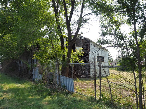
Warehouse
The largest structure demolished as part of this process was a warehouse. This barn had been seized by eminent domain before I photographed it and judging by the condition was probably already abandoned well before then.
Warehouse before demolition from the west
Another view of the warehouse before demolition from the northwest
The demolition was still in progress, but most of the walls had been demolished by this point.
Warehouse during demolition from the north
Warehouse during demolition from the west
Barn
There was a barn nearby that also had been slated for demolition. I have no idea what the barn was used for or who owned it. I also imagine this had been abandoned for quite a while before I photographed it.
Barn before demolition
Empty lot after demolition from the north (the fence is no longer there either)
Empty lot from the south
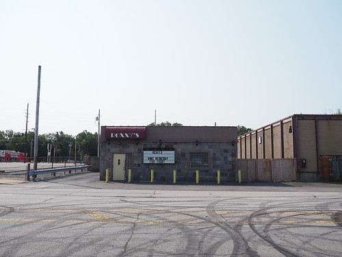
Roxxy’s
Roxxy’s was a bar along the Dunes Highway. According to Google Maps it celebrated its 75th birthday relatively recently (the picture was uploaded in April 2019). I actually had to submit an update to Google to explain that the business was now gone (for my “proof” I gave one of the pictures below).
Roxxy’s before demolition
Same view of Roxxy’s after demolition
View from the side of the former site of Roxxy’s
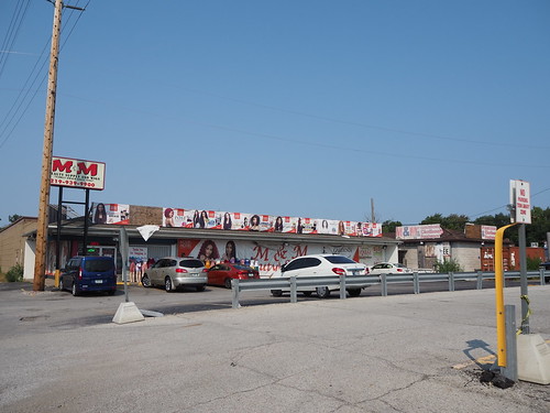
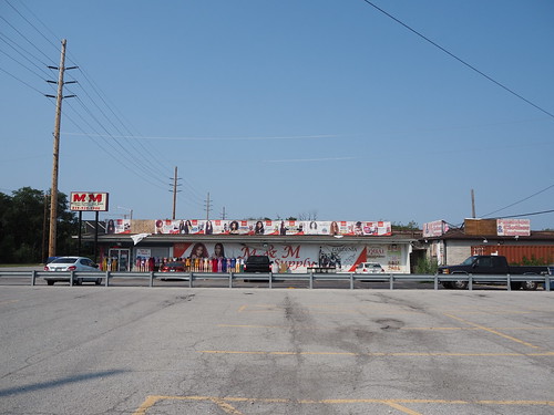
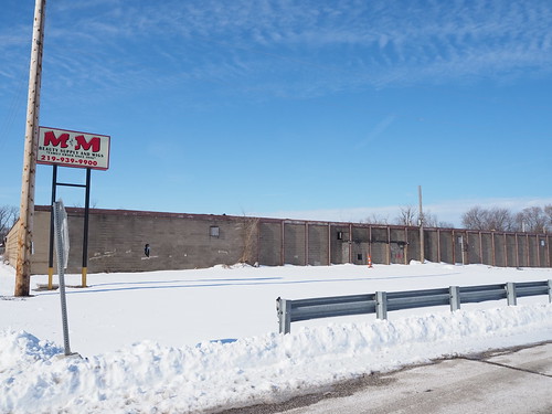
M&M Beauty Supply
Just south of Roxxy’s was the M&M Beauty Supply. According to Google Maps, they have a few other locations in/around Gary. The building itself was demolished, but the sign remained, at least for the time being. As I did with Roxxy’s, I had to submit an update to Google Maps explaining that this location no longer existed.
M&M Beauty Supply before demolition
Another view of M&M Beauty Supply before demolition
In this case, I was able to pretty closely mirror the viewpoints of the “before” pictures (I did not have the pictures with me when doing this photo set).
M&M Beauty Supply lot after demolition
M&M Beauty Supply lot after demolition
Garage
At about 5811 US-12, there was some sort of garage building that also looked like it had been abandoned well before I got there. I do not know what used to be there, unfortunately.
Garage at 5811 US-12 from the north before demolition
Garage at 5811 US-12 from the southwest before demolition
Empty lot where the garage used to stand from the north
Empty lot where the garage used to stand from the south
Porky’s Pit
Next to the garage was Porky’s Pit, a barbecue place which also appeared to be abandoned before I started my “before” pictures.
Porky’s Pit prior to demolition from the north
Empty lot where Porky’s Pit used to stand after demolition from the north
Empty lot where Porky’s Pit used to stand after demolition from the south
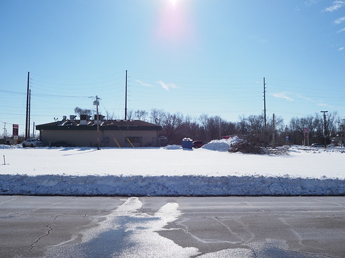
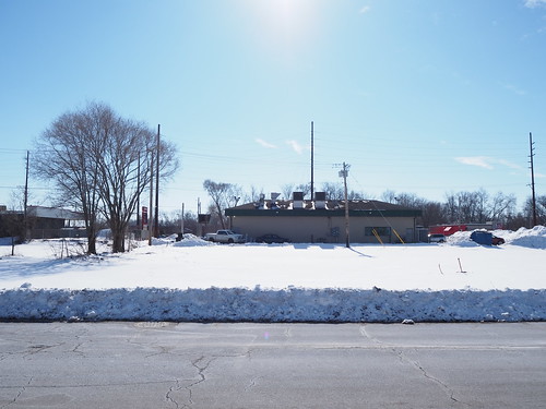
Empty Lots West of Lake Street
Next to Porky’s were two empty lots that were still empty before I started. They were overgrown at the time but it looks like they’ve been cleared.
Empty lots west of Lake Street from the north before land clearing
Empty lots west of Lake Street from the north after land clearing
Empty lots west of Lake Street from the south after land clearing
With all of this, demolition in Miller Beach is mostly complete. New construction will start soon, and it will be interesting to see what develops. However we cannot lost sight of what was lost in the process.
In March or April (once all this snow melts), I’ll continue this project in photographing all the demolished buildings in Michigan City.
On May 1, 2021, the 11th Street Station in Michigan City closed for reconstruction. The closure is expected to last about two and a half years, after which a new, more modern station will take its place. This is a bit of a bittersweet moment, as the new station and other associated improvements will provide a much better experience for riders (faster, fewer delays, easier boarding, etc.) but this is also the end of nearly 100 years of history.
The station as it existed prior to the closure was a fairly unique setup. It was in the middle of a street running segment on 11th Street in Michigan City, where the train runs in the middle of the street. The street is configured with one lane in each direction, with a third “lane” in the middle which carries the track.
Street running track in Michigan City, with one lane in each direction plus a third “lane” in the middle to carry the track
Trains run down that track in the middle, and they also have to stop at red lights, just like cars. The crossings are generally unsignaled, with just a stoplight or stop sign.
Street crossing the street-running track
Train running in the middle of the street
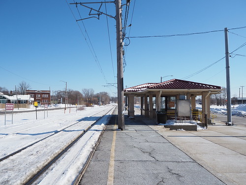
The station is similar to a streetcar stop. The train stops in the middle of the street, and then passengers have to cross a lane of traffic to board or disembark. There is a stoplight to protect passengers from oncoming traffic while trains are stopped. The station just consists of a shelter, parking lot, and no platform. There used to be a station house adjacent to the current location of the station, but the building has since fallen into disuse.
Station shelter at 11th Street
Former station house at 11th Street
Boarding a train from the street
This station design is a relic from the line’s interurban heritage. Interurbans basically operate like streetcars within cities but like regular trains between cities. The way the line was originally built, it had a number of street running segments, including this one in Michigan City, as well as segments in East Chicago and South Bend. The other ones were removed long ago: the East Chicago segment was rerouted to a new alignment adjacent to the Indiana Toll Road in 1956 and the South Bend segment was removed with the line first truncated before entering the street and then rerouted to a new station at the airport in 1992.
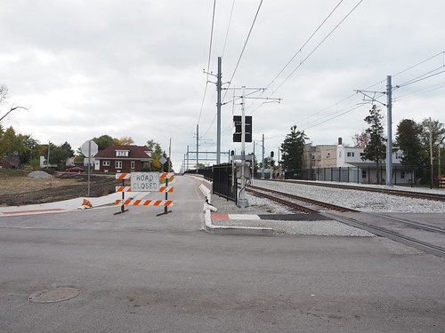
The Michigan City segment remained the last holdout on the line, continuing to operate street running tracks. Plans had existed for a long time to remove the tracks from the street, however due to the expense and property impact involved, it took a long time to come to fruition. Finally, as part of a larger project to double track the line from Gary to Michigan City (the line east of Gary is mostly a single track), they decided they would commence work on removing street running track in Michigan City. The new alignment will replace 10th and 11th Streets with one way streets and putting a second track where one of the lanes used to be.
While the South Shore Line initially announced that there would be no extended station closures during the double tracking project, they recently announced that the 11th Street Station would close starting May 1, 2021. I decided to seize the opportunity to photograph trains on the last day. I took the 5:58 train from Millennium Station out to Michigan City with plans to spend the night. I usually only get out to Indiana on weekends, where they only run single-level cars, but this time since it was a weekday they ran a bilevel railcar. I got to Michigan City right on schedule, and got off at 11th Street.
The train I took to Michigan City
I found out I was hardly the only person with the idea to photograph the station. There is a pretty large railfan community in the area, and a lot of them were also out there photographing, and I felt way outclassed since they definitely knew way more about this than I did and a lot of them had way fancier camera equipment. Still, I got to talk to some of them, and it was really cool to meet them.
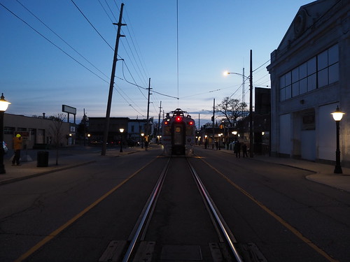
While I didn’t stay for the last ever train to stop at the street-running 11th Street station (I didn’t particularly want to stay up until 2:18am), I did photograph a few more trains, including the last inbound train ever to stop there (there were several more outbound trains after it).
Last inbound train to ever stop at the street-running 11th Street Station
I quickly realized I was out of practice in terms of nighttime photography, as all of my recent photography expeditions have been during the daytime (and mostly during sunny weather). Still, I did my best.
One interesting detail is that the ticket machines were turned off, even though there were still trains running. I wonder if this means that passengers would have to pay the surcharge for buying a fare onboard the train.
The ticket machines have been turned off
I spent the next few hours chatting with other railfans, photographing trains as they went by, including another passenger train and a freight train:
Passenger train at 11th Street
Freight train passing 11th Street
From there, I caught a ride to the hotel where I was staying.
The next day, after getting my second COVID vaccine dose (I got it in Michigan City since at the time of my first dose, it was still pretty hard to get one in Chicago), I went back to the station to see if any demolition or construction had started yet. None had, but I got a few photos of the station from angles I hadn’t before. One other person was out photographing at this time. A train also passed by during this time, not stopping at the station. I realized I hadn’t gotten a good photo of a train including the shelter (to make it clearer how it looks when passengers actually board), so I took such a photo with this train, even if it wasn’t actually stopping.
Outbound train bypassing 11th Street
Then, I got to work photographing various points along the line as well as the buildings that were slated for demolition (or at least the ones that had notices on them at the time).
Building slated for demolition
Firme office slated for demolition – the only commercial building I saw slated for demolition, probably because the land will be needed for building the new station
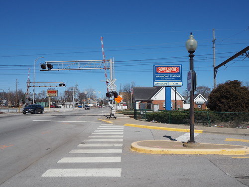
Willard Avenue grade crossing, one of two crossings with lights
I also got some photos of some very old interurban cars used on the line.
Old Chicago South Shore and South Bend cars formerly used on the South Shore Line
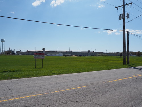
I also got a photo of the Indiana State Prison (from across the street):
Indiana State Prison
Then I headed back to downtown Michigan City for lunch, and went to a burger place called Royale. The food was excellent, even if service was kinda slow. From there, I explored Downtown Michigan City a bit more, heading to the waterfront. Due to the blowing sand, I didn’t get many photos since I didn’t want to damage my camera. I did get a photo of the lighthouse though:
Michigan City lighthouse
Then I walked over to Carroll Avenue (the other train station in Michigan City) since I could no longer board at 11th Street to get home. Along the way I photographed the eastern street running portion in Michigan City a bit more, as well as a few more condemned buildings.
Another condemned building
Along the way, another train passed by.
Outbound train passing Lafayette Street
Then, I got to the end of the street running.
The eastern end of the tracks in 11th Street
Tracks entering the street
From there, I walked over to Carroll Avenue.
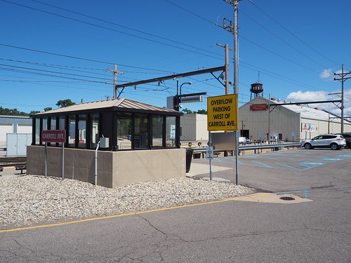
Entrance sign at Carroll Avenue
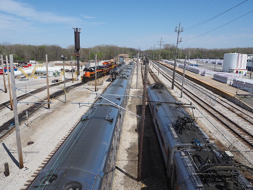
I also took some photos of the rail yard and shops.
Railcars at the yard
Then, I went to the station to wait for my train home. An outbound train passed by while I was waiting:
Outbound train leaving Carroll Avenue
Finally, my train entered from the yard.
Inbound train waiting on the yard lead at Carroll Avenue
From there, I caught the train back to Chicago.
I look forward to seeing the progress in upgrading the line. It will be cool to see a new modern station in Michigan City (as well as Miller, and some improvements at other stations as well). The new station will have a full parking garage, two tracks, and high platforms, which will significantly improve the experience for passengers. The double track work will allow them to run more trains and improve reliability, while removing the tracks from the street in Michigan City will significantly improve speed and safety. Still, it is a bit sad to see a piece of history be lost.
With that, the last street-running station on the South Shore Line is no more, and all that’s left are the memories.
I took a pretty unusual route this time in order to 1. avoid paying more in fares than I have to (the South Shore Line is expensive and doesn’t offer any day passes, and the free westbound trips promotion I took advantage of earlier is no longer a thing) and 2. not have to constantly wait for trains. With this in mind, I checked Google Earth for where walking was feasible, as the stops are a lot closer together than further out on the line. I found that walking from East Chicago to Hammond was definitely doable, but Hammond to Hegewisch was probably not a good idea since there weren’t any direct routes with sidewalks. Hegewisch is on the CTA bus route 30, so that provided me alternate means home that was cheaper and ran more frequently than the South Shore Line. With that in mind, my route was this: 1. take the the train out to East Chicago, photograph there, 2. walk to Hammond, photograph there, 3. take the train one stop to Hegewisch, photograph there, then 4. take the 30 bus to 69th and transfer to the Red Line home.
With that plan in place, it was time to put it into action. This expedition started the day out as normal, by catching the Red Line at Bryn Mawr. The train got me downtown on time as usual, and I walked over to Millennium Station. Millennium Station had a few Metra trains operating on the South Shore Line platforms for some reason (probably maintenance on the Metra tracks/platforms).
I got on the train, and noticed that half the seats were roped off to facilitate social distancing:
Seat roped off to faciliate social distancing
This was not the case last time I was on the South Shore Line in October 2020. It was good to see that they are helping with COVID preventative measures, especially when this is a system that had a “mask-optional car” last year. The train left right on time, sailing across the South Side. The first good sign of the day was when I was somewhere around Hegewisch, I was able to see the downtown skyline across the lake. That meant the visibility was over 10 miles, which is as good as it gets.
I got off at East Chicago, and immediately started snapping photos:
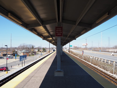
East Chicago platform
East Chicago headhouse
East Chicago seems to be the most substantial station on the line (other than those shared with Metra). It’s constructed on an alignment adjacent to the Indiana Toll Road, and has a center high-level platform with guantlet track to allow freight trains to pass the station without interference from the platform. There is a massive parking lot (and some overflow parking available nearby) and a station house. Due to the fact that there were two janitors cleaning the station lobby, I wasn’t able to photograph it, but it has a ticket counter, vending machines, ticket machines, water fountains, and restrooms. There also is an additional entrance further to the east to allow easier access from the far end of the parking lot.
From there, I started walking towards Hammond, and after the better part of an hour, I got there.
Main entrance to Hammond Station
Hammond has a large station house adjacent to the station with a coffee shop (closed while I was there) and restrooms, a large parking lot, and two high-level platforms (one for each track, rather than an island platform). While East Chicago is elevated, Hammond is at ground level.
Hammond station house
Interior of the station, with a view of the closed coffee shop
Outbound platform at Hammond
An interesting detail was that the outbound platform only had a canopy for a small part of the length, while the inbound platform had a canopy for the full length. I guess this is because there are probably a lot more people boarding inbound at Hammond than outbound.
Entrance to the platforms at the west end, by the station house
While waiting for the next inbound train, I ate my lunch, a peanut butter and jelly sandwich. Eventually, an inbound train arrived and I boarded it, only to get off one stop later at Hegewisch:
Inbound platform at Hegewisch
Hegewisch was laid out pretty similarly to Hammond, with a station house and two side platforms at ground level. Hegewisch also only had a full-length canopy on the inbound platform.
Station house at Hegewisch
While I was photographing Hegewisch, an outbound train stopped there:
Outbound train arriving at Hegewisch
Hegewisch’s station house also had a coffee shop (also closed at the time), restrooms, and waiting area:
Waiting room at Hegewisch
From there, I caught the 30 bus to 69th.
Bus shelter at Hegewisch
Along the way, there was a detour due to bridge construction, so we went over the 95th Street Bridge. To my disappointment, we did not jump the bridge while it was up, like Elwood Blues did with the Bluesmobile in the Blues Brothers.
Then at 69th, I caught the Red Line home. I wasn’t able to get too many photos there since there were a lot more people than I expected on a Saturday, but I did get a few pictures of the platform.
Platform at 69th
This was my first time on the L anywhere south of Cermak Road, and my first time boarding on a freeway-median station (I have taken the Blue Line through the O’Hare Branch, but never actually boarded or disembarked there). I will definitely return to continue my photography, but that’s a project for another day.
Anyone who has read basically any post on this blog will know I’m really big into urban transit. For some reason, I have found myself obsessed with the South Shore Line far more than any Metra line. I guess the reason being the South Shore Line’s uniqueness, both relative to Metra and to other commuter rail systems? Anyway, I have set out to photograph the entire South Shore Line. I also felt a stronger urgency to photograph the South Shore Line since a project is supposed to start relatively soon that will double-track the line between Gary and Michigan City and rebuild the stations along the line in the process. While this project will definitely be a major service improvement, I wanted to document what’s there now before it happens.
I have currently photographed every station in and east of Gary, but still have Hegewisch, Hammond, and East Chicago left. Since those are a lot closer to Chicago, they’ll be easier to get to. The further out ones were a bit more of a challenge.
The first big challenge is cost. The South Shore Line does not sell daily or weekly passes, only monthly passes. This means that I would have to pay a separate fare for each leg necessary to get all the stations, and when you add that up between all the stations, it gets real expensive real quick. However, I encountered a nice twist of fate. As part of the measures to welcome people back during the pandemic times, they temporarily made westbound travel free through the end of October. This was a game changer, since it meant in any given day I could take the train all the way out to the furthest east point I intended to photograph that day, then take short hops to various stations on the way back. In doing so, I would only have to pay the fare for the one outbound trip, since all the hops inbound were free.
The second big challenge was scheduling. This is not the L, this is a commuter rail line. Consequently, it does not run all that frequently, especially on weekends. This meant I needed to plan ahead based on the train schedule to avoid spending hours at a single station and not being able to photograph any others. I managed to make that work with a bit of cleverness and planning, but it did mean that my photography expeditions were full day endeavors. So, without further ado, here is how it went.
Expedition 1: South Bend and Michigan City
I figured I might as well knock out the furthest and most expensive stop first, so I went all the way out to South Bend. The weather that day was mostly sunny with scattered clouds. I caught the Red Line downtown, then got on the 8:45am train to South Bend (the first one of the day). I got to South Bend and quickly got to work taking pictures, since my train was going to leave again about an hour later.
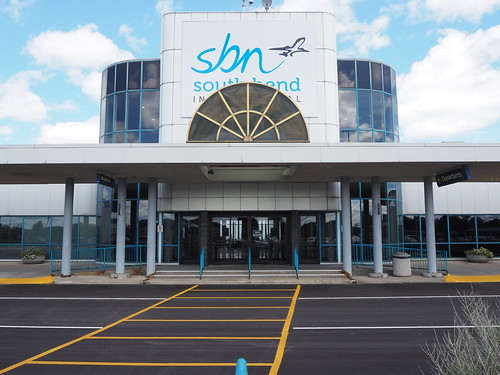
South Bend Airport station
The main entrance to the airport itself
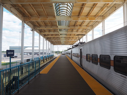
The platform
From there, my plan was to take the train to Carroll Avenue and walk to 11th Street, since those two stations weren’t all that far apart. I got back on the train at South Bend, and the conductor recognized me from the trip out. When getting our destinations (they need to know where everybody’s getting off since there are a few flag stops) he automatically assumed I was going back to Chicago since he knew I got on there. I quickly explained I was going to Carroll Avenue and that was resolved. I didn’t particularly want to explain why I was going the route I was (not all transit employees like people photographing their systems), but later on he asked what I was doing and I had my camera bag pretty obviously visible so there was no hiding it and I explained briefly what I was doing, and he actually said it sounded like a cool project. It was nice to get approval from a transit employee for once.
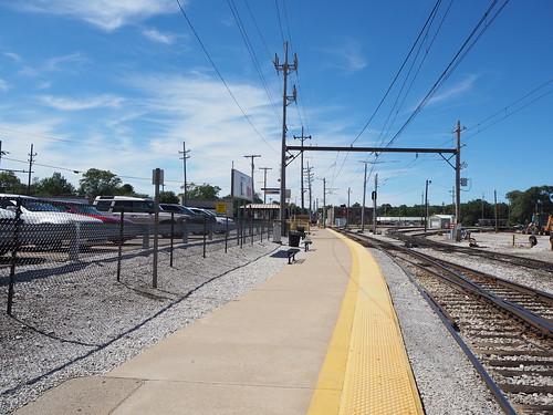
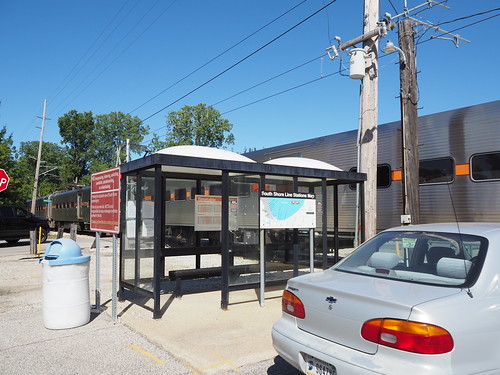
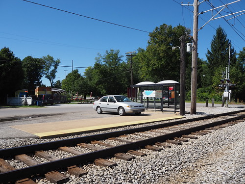
Once I got to Carroll Avenue and got off the train there, I got to work photographing the station. The station is a low platform with a wheelchair lift and located directly adjacent to both a South Shore Freight facility and the main South Shore Line storage yard and maintenance shops. I really was hoping to get some photos of the yard, but unfortunately it didn’t look like there was anywhere I could (legally) go to get a good photo. Still, I got plenty of pictures of the station. The sky had also cleared up some more, so I got some nice bright shots.
The platform
My train after letting me off
The shelter
I was going to head out but then found my path was blocked by a pair of freight locomotives in the main driveway, so I had to wait for them to move before I could go anywhere. Once they did, I started walking towards 11th Street. Along the way I found a few abandoned buildings.
Locomotives blocking the driveway
Abandoned building just outside of the station
Another abandoned building at Michigan and Porter
Then, I got to where the tracks enter the street. This is a very uncommon sight and will disappear in a few years, so I made sure to photograph it.
East end of 11th Street, where the tracks enter the street
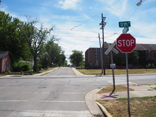
I then made my way down 11th Street to the station. There were a few people waiting at the station for the next (eastbound) train, so I didn’t take any pictures with them in it and waited for their train to arrive before taking pictures where the interior of the shelter was obviously visible. The 11th Street station is unique in that it is located in the middle of the street. No platform whatsoever, and you have to cross a lane of traffic to board. It’s similar to a tram stop, except this is a full-sized commuter train. The train runs in the middle of the street for two miles and some change, a very unusual setup these days. This is a relic from the interurban heritage of the line.
Some in-street trackage
An outbound train stopped at the station
I then continued down 11th Street and eventually got to the point where the tracks switch from 11th to 10th and cross the Amtrak line. There were also a few abandoned buildings there.
Crossing the Amtrak line
Abandoned auto body shop
Abandoned print shop
Seeing the abandoned buildings and run-down houses, I had the song “Boulevard of Broken Dreams” going in my head. That song wasn’t referring to any literal street, but I felt like if there was any street it applied to, this was probably pretty close. I didn’t take any pictures focusing on abandoned houses since I felt bad about doing that, since, ya know, that used to be someone’s home. I did take pictures of abandoned commercial properties though.
Then, I got to where the tracks leave 10th Street and return to their own right of way.
The tracks leaving 10th Street for the rest of the journey to Chicago
Tracks in 10th Street
A typical intersection with the street running track – no bells or anything, just a crossbuck and stop sign
From there I headed back towards the 11th Street station. Once I got back to the station, I started getting photos of everything I couldn’t before. I also finally got to eat lunch (a sandwich I brought with me) and got a soda from a convenience store for a little caffeine. From there, I waited for my train. One thing that amused me at 11th Street was the electronic sign reminding me to watch the gap between the platform and the train. Uh, there is no platform at all? I have to step up from the street.
The former station house – from what I can tell this will be converted into a parking garage as part of the reconstruction project
The station shelter
Expedition 2: Hudson Lake, Beverly Shores, and Dune Park
Taking advantage of another sunny day, I planned another expedition. Doing some research on Google Earth, I found that I could walk from Beverly Shores to Dune Park via the Calumet Trail, so my plan was to take the first train for the morning to Hudson Lake, then take a train from there to Beverly Shores and walk to Dune Park in order to maximize how many stations I could photograph on a weekend schedule.
The trip to Hudson Lake was pretty uneventful. I got on the train at Millennium and got off at Hudson Lake. The one important thing was I originally got on in the third car, while you can only get on/off at Hudson Lake in the first or second car since the platform is only long enough for one car (the doors at the back of the first car and front of the second car are the ones that stop by the platform). Thankfully I found this out from the conductor when he checked my ticket and saw it was to Hudson Lake, so I knew to head to one of those cars when we were getting near Hudson Lake. Once I got to Hudson Lake, it felt like I had entered a whole new world. After having been in Chicago for such a long time and only leaving to visit South Bend (and then just the airport) and Michigan City, my mind was entirely on urban areas. Hudson Lake is very much rural, so that was a bit of a shock. Still, I got to work photographing the station (not much of a task, given that the station is just a short concrete platform, shelter, and small parking lot).
My train after dropping me off
The station in all its glory
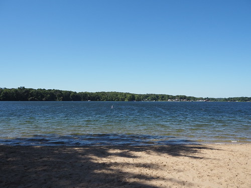
From there with an hour and some to kill, I walked around Hudson Lake photographing various things. It took a while to find a public beach, but eventually I did. I got some photos of the water from the beach and also found a sand mermaid someone made. There were a surprising amount of boats docked there as well. Then I continued walking around the lake and photographing the sights. Eventually I made my way back to the train station and caught the train to Beverly Shores.
Sand mermaid
Boats docked at the beach
View across the lake
Typical street near the lake
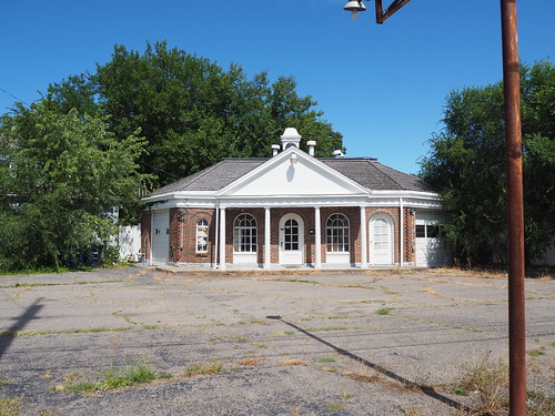
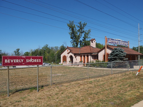
I got off at Beverly Shores with little fanfare, but did make sure to notify the conductor since it’s a flag stop and there was no guarantee anyone else was getting on. I then started photographing there. The station is strange in that while the actual railroad facilities are pretty minimal (standard platform, shelter, and parking lot kind of deal), there was an old station house that is now an art gallery. That station house was built in Mediterranean revival style, which felt very out of place for rural Indiana. Still, it was a cool piece of architecture, even if out of place.
The station platform
The station building turned art gallery
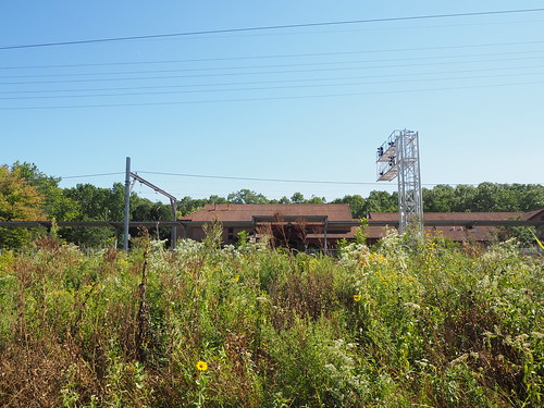
Then, after I took a bunch of photos, I headed to the Calumet Trail to begin walking to the Dune Park station. The trail felt kind of desolate. While near the Indiana Dunes, I was not actually on the lakeshore. Instead, it was just a wide clearing in the forest containing (from left to right) the road, the railroad, power lines, and the trail.
Pretty standard view on the trail
Power substation
Trail with a view of the railroad
Dune Park Station! Made it!
Still, despite the feeling of desolation, it was a nice feeling walking down it. I did see random pieces of power company infrastructure along the way and made sure to photograph those. Then after a few miles, I got to the Dune Park station. That station is an oasis in an otherwise fairly empty area. It has a big station house with a waiting room and high platform, despite not being all that close to any population centers. I immediately got to work photographing the station, and since it had a waiting room, nobody was hanging out on the platform, making it easier to avoid including people in my photos. I also got a soda from the vending machine there (gotta have that caffeine). Eventually my train arrived and I headed back home.
The platform at Dune Park
Main station house entrance
With that, I had photographed every station from Dune Park to South Bend.
Expedition 3: Portage/Ogden Dunes and Gary
For my third major expedition, I finished out the future construction zone. This time I actually took a day off work and went during the week since the first available opportunity with clear skies was during the week. Doing this meant that I could travel with the weekday schedule though, which meant more frequent trains. The weather definitely did not disappoint. It was in the 60s and completely clear skies. I could not have asked for better weather.
As usual, I caught the Red Line at Bryn Mawr in the morning. I hadn’t taken the Red Line in a while and they had started some construction work on a temporary platform for when the Red Line reconstruction project begins, so I photographed that while waiting for my train:
Temporary platform adjacent to the southbound express track
My train arrived in less than five minutes (yay, weekday schedule) and got me to Millennium Station without any trouble. At Millennium Station, my South Shore Line train was already waiting and boarding, so I just hopped right on. It didn’t leave for another 20 minutes, but I figured I’d rather wait on the train than in the station. Anyway, the train headed out right on schedule and got me out to Portage/Ogden Dunes.
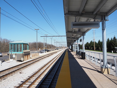
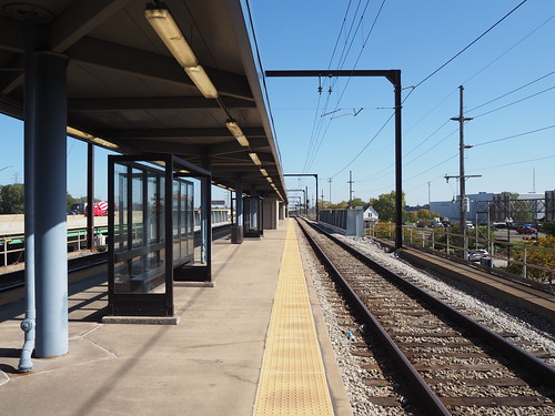
Once there and the other person disembarking there had left the station, I got to work photographing. The weather was absolutely beautiful, making for really good photography conditions. The station is interesting in that it is the only one on the line with mini-high platforms. All other stations either have low platforms that are not wheelchair accessible at all (Gary/Chicago Airport, Miller, Beverly Shores, Hudson Lake), use wheelchair lifts (Gary Metro Center, Carroll Avenue), or have high platforms. This made for an unusual detail to photograph. This was also my first time at a two track station with only one platform, so most eastbound trains require passengers to cross the westbound track to board/disembark. These both will be changed with the construction project, which will build a new high platform for the eastbound track (though it looks like it will keep the low platform with mini-high platform for the westbound track). Also, while I was there, several freight trains and two Amtrak trains passed by on the tracks to the north of the station.
One of the mini-high platforms
The single platform
The single platform looking the other way (west)
A cutesy power box at the entrance to the station
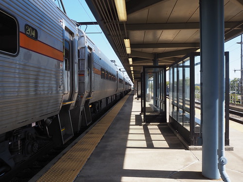
Inbound bilevel train
After photographing, I found that there were power outlets in one of the shelters, which gave me a chance to top off the batteries in my phone and camera. Some idiot had turned on the heat though, even though it was in the 60s. To make things even hotter, the shelter basically trapped sunlight, so it was really hot in there. I was able to turn off the heat, but it took a while to cool down to a reasonable temperature. Anyway, a while later, with a fully charged phone and camera, I caught the next train to Miller. Miller is just a low platform with one track (there is a second track, but that is a diverging line that does not carry South Shore Line trains). Once again, I waited for everyone to leave, then got to work.
The train after dropping me off
The station shelter by the platform
The shelter from across the street
A sign for the parking lot
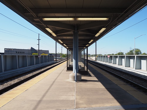
From there, my plan was to head to downtown Gary on the bus. However, I couldn’t find the bus stop. There was a reroute in effect due to some nearby street construction, but the GPTC website just listed the streets it was going on without an actual map. My guess for where the bus was going to arrive seemed to be incorrect, and no bus actually came at/soon after the scheduled time. With that unfortunate stroke of luck, I headed back to the train station since there was a train coming not that long later. That train did come, though about 10 minutes late. That train got me to Gary Metro Center within a few minutes. I got off there and also got started photographing once everyone had left the platform. It was a bit tricky since it was afternoon and sunny, so the shadow of the station canopy was not straight down but instead over the westbound track. This resulted in a major difference in lighting between the two, but I think in the end it came out ok. Gary Metro Center is definitely a major transit center, being directly connected to the main local bus hub and Greyhound station for Gary. The train portion is unusual in that it while part of a major transit center and on an elevated embankment, it has a low platform. From what I can tell, this is so freight trains can pass the station. without colliding with the platform. Other stations with high platforms deal with this by either having a second track that avoids the platform (Dune Park) or a guantlet track to provide extra clearance for freight trains (Hegewisch, Hammond, East Chicago). At Gary Metro Center, they just built the station with a lower platform and use a mobile wheelchair lift for accessibility.
My train after letting me off
Eastbound track
Middle of the platform
Main building from the train platform
After photographing the platform, I headed into the main station building itself via the skybridge connecting it with the platform. A guy on the platform asked me if I was taking professional photographs. I don’t know why he was asking, as he wasn’t even a railroad employee. I responded that my photos are definitely not professional. It would be awesome if I could get paid for photographing train stations, but in the end I have a day job doing web development (also a fun thing, don’t get me wrong). I crossed the skybridge and entered the main station house. From the station house I walked around the plaza and parking lot photographing from various angles.
The skybridge
Waiting room
Parking lot entrance
Something about 1998? Not sure what
The main building and skybridge
Eastbound train
Then, I caught the R1 bus to get me to the Gary/Chicago Airport station (aka Clark Road). When I got on the bus, the driver asked me where I was going, so I said “Gary Airport train station” and he seemed really confused (it seemed like he thought I wanted to go all the way to Chicago?). I then followed that up with “Clark Road” and it still didn’t click with him, but then eventually another passenger emphasized that I meant the Clark Road train station and he got it. The bus got me there fairly quickly, and I started photographing the last station of the day. Thankfully, the sun was still high enough in the sky to avoid shadow issues.
The Gary/Chicago Airport station is another interesting one in that it’s a flag stop and a pretty basic station. It’s just a shelter adjacent to a single low-level platform, so like Portage/Ogden Dunes, eastbound passengers need to cross the westbound track to get on/off the train. However, unlike there, the platform is not the full length of the train and only can fit four cars (there are only two places where the track can be crossed, and one of them is road crossing by the platform, while Dune Park had four along a full length platform, allowing potentially all eight cars to board/disembark). The picture on Wikipedia (from 2016) shows it having some old cracked asphalt for the platform, but it looked like it had some fresh concrete since then, and the station looked pretty nice, even if minimal. As far as I’m aware, there are no plans to renovate the station due to its low ridership.
A rather simplistic entrance
Shelter and platform
Platform from the far end
Platform looking west
After another inbound train arrived, I took that to Millennium Station, then caught the Red Line back home.
One of these days once I get another sunny day I’ll also photograph Hegewisch, Hammond, and East Chicago (most likely all in the same day). That’ll be easier (and cheaper) since they’re a lot closer, so if I can’t get there while westbound travel is still free, having to pay a fare for each leg won’t be quite as expensive as it would be for the stations further out. I can even get to Hegewisch entirely on the CTA. Once that’s done, I will have conquered the South Shore Line! I haven’t taken pictures of Van Buren Street Station yet either, but I consider that to be part of the Metra Electric District and not the South Shore Line for the purposes of completely photographing lines.


