I recently had the good fortune of being able to take a vacation to Toronto. The chief reason I took this trip when I did was because Line 3 of the Toronto Subway, also known as the Scarborough RT, is closing soon.
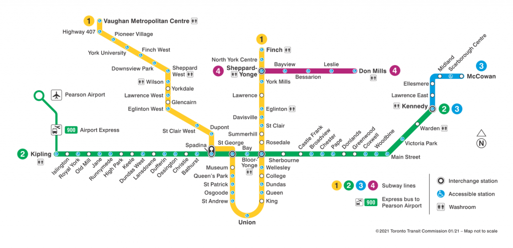
For some context, here is a map of the Toronto Subway as of the time I post this:
Toronto Subway map (from TTC)
Line 3 is that short blue one way off to the east. It serves Scarborough, a suburban part of Toronto, Unlike Lines 1, 2, and 4, which run conventional rapid transit equipment mostly underground, Line 3 runs smaller automated railcars powered by linear induction motors and is fully above-ground. The idea was that since Scarborough was a lower-density area than most of the rest of the Toronto Subway service area, they would use a somewhat “lighter” technology that cost less to operate and maintain.
The route is only six stations over four miles, and is entirely suburban, requiring a connection at Kennedy to reach downtown Toronto. Additionally, the ridership is very low compared to the rest of the system, with only one station besides Kennedy (Scarborough Centre) ranking better than 40th out of 75 among subway stations.
Owing to the fact that the line currently has fairly low ridership, operates different technology than the rest of the subway, and the fixed infrastructure and rolling stock are old enough that they all would need to be majorly overhauled or replaced entirely, the government of Ontario has decided to replace it with an extension of Line 2. The extended Line 2 would cut farther east to a more residential area instead of the current industrial corridor seen between Ellesmere and Kennedy.
I wanted to see what was there before it’s lost to time, so here’s what I found:
Interior of a train
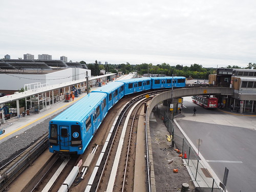
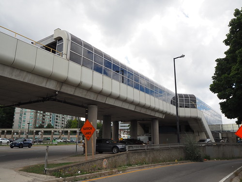
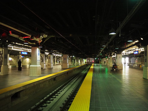
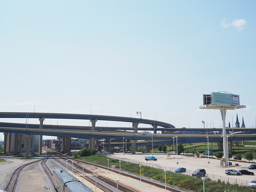
Train departing Kennedy
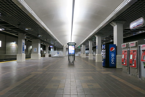
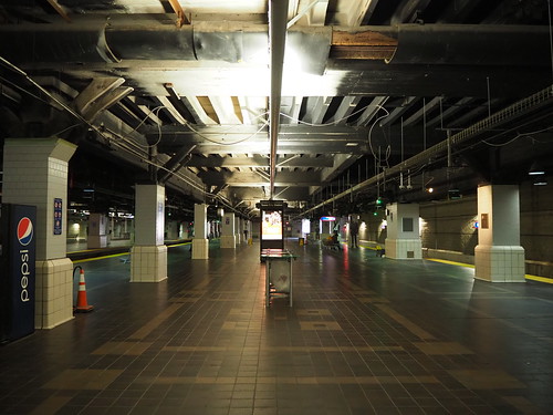
Train at Kennedy
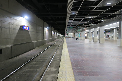
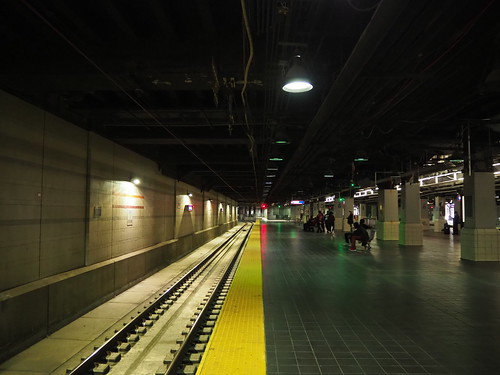
The design of the stations definitely looked pretty dated. There hasn’t been much change since they opened in 1985, and you can definitely see that in their design. I also was delayed because of mechanical problems at Kennedy, reflective of the issues the line faces right now.
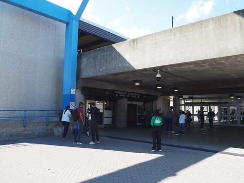
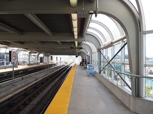
Scarborough Centre
Entrance at Scarborough Centre
Scarborough Centre was definitely the most active part of the line. I actually saw a good number of people getting on here. It’s right next to the Scarborough Town Centre shopping mall, and also has a number of connections with TTC and GO buses. This is the only station (other than Kennedy) that will be served in approximately the same location by the Line 2 extension.
Entrance at Ellesmere
Other entrance at Ellesmere
Platform at Ellesmere
Ellesmere is the lowest ridership station in the entire Toronto Subway system, and I could see why. It’s pretty isolated, and it doesn’t even directly connect with Ellesmere Road (which bypasses the station on the overpass). There really isn’t anything around the station.
Platform at Lawrence East
Entrance at Lawrence East
Lawrence East also felt somewhat isolated, but not as bad as Ellesmere. It helps that it has a bus connection on Lawrence.
McCowan
McCowan
Platform at McCowan
I’m surprised McCowan doesn’t have higher ridership numbers, given that it’s located in what looks to be a reasonably high density area with several bus connections. I guess this can be attributed partly to its proximity to Scarborough Centre.
Entrance at Midland
Platform at Midland
Midland, on the other hand, doesn’t surprise me it has low ridership (second lowest in the entire system after Ellesmere). It only has one bus connection and appears to be in a fairly low density area without any major housing or employment centers or other destinations nearby.
With all this, it makes sense why they’re replacing this with an extension of Line 2 and rerouting it. The current train mainly just serves commuters from the Scarborough Centre area heading to Kennedy, and they have to make a transfer there, while a Line 2 extension would eliminate that transfer. The rerouting will also hopefully attract more passengers by going through a residential area instead of an industrial one. Of course avoiding having one short line that’s incompatible with the rest of the system (increasing maintenance costs and adding operational complexity) will also be a good thing. However, it is a shame that the residents of Scarborough will have to go roughly seven years without rail service between when Line 3 closes and the Line 2 extension opens.
I arrived mid morning at Little Italy-University Circle, one of the first stations I photographed during my time at CWRU by virtue of it being right by campus. Most of my photos of that station were from freshman year, when my photography skills were nowhere near what they are now. Here’s an example:
Photo of the Little Italy-University Circle station I took in 2016
Compare with a photo from this time:
Photo of Little Italy-University Circle from 2021
Definitely an improvement: better lighting (I got lucky with the weather admittedly), better angling of the camera, etc.
From there I went to Cedar-University, one stop down the line, and serving the southern portion of the CWRU campus. The story was similar to Little Italy for the most part: my photos from 2016 weren’t the best quality due to my inexperience. However, also important was that Cedar-University had a major bus loop attached which I never photographed.
First, see a typical photo of that station from 2016:
Photo of the Cedar-University station from 2016
Now compare with a photo taken in 2021:
Photo of the platform at Cedar-University taken in 2021
Much better lighting (once again lucked out with the weather, but also knew to photograph in the middle of the day instead of in the evening as I did with the first photo), better angles, all that.
Then, I photographed the bus loop which I somehow never did in my four years at CWRU:
Bus loop at Cedar-University
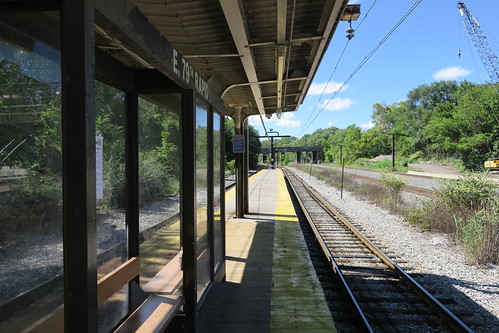
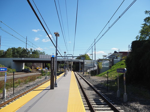
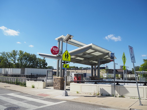
Having finished there, I started the main focus of my expedition, photographing the stations renovated since I had left Cleveland. First, I went to East 79th. For reference, here’s what the station used to look like:
Platform at East 79th in 2016
The station at the time was a pretty simple affair: a staircase (behind where I’m standing with the camera) and a wooden platform with a basic bus-like shelter and a roof. The renovations, on the other hand, significantly improved it:
Renovated East 79th station platform in 2021
Renovated East 79th platform in 2021 from across the track
New entrance to East 79th in 2021
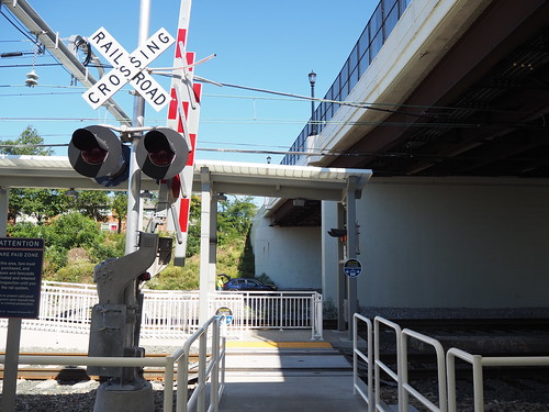
The new station has a concrete platform, a ramp for ADA accessibility, new signage, a significantly improved roof, and a much better-looking entrance. Overall it is a significantly improved passenger experience from the original. It did add one interesting twist though, a grade crossing. For a while the only grade crossing on the Red Line was at Brookpark, where passengers had to cross a track to reach the platform. Renovations at the station in 2016-2017 removed that grade crossing and replaced it with a tunnel under the track, but later on one was added at East 34th which saw a similar renovation to East 79th, including a set of ramps on the adjacent hillside.
Grade crossing to access the platform at East 79th
From there I headed to Tower City. When I was a freshman at CWRU in 2016, they replaced the northern track, which resulted in westbound trains going to a temporary station on a normally non-revenue track. They did the same thing again to replace the southern track, and the work was completed prior to my arrival. Here is what the track looked like prior to renovation:
Old eastbound track at Tower City in 2016
After several years with a new northern track but retaining the old southern and stub tracks, they were all replaced. Here are the new and improved tracks:
New eastbound track at Tower City in 2021
Red Line stub track at Tower City in 2021
Meanwhile, the Blue and Green Lines were not operating due to an eight week construction project shutting down the lines entirely, with them being replaced by shuttle buses in the meantime. However, I did notice that the ceiling had been removed:
Old platform ceiling at Tower City in 2018
Platform with ceiling removed at Tower City in 2021
I don’t know the reasoning for removing the ceiling, and whether it’s temporary or permanent, but it definitely takes away some of the character of the station. I hope it will be added back. Given that a lot of the mall above was temporarily closed for construction, it wouldn’t be surprising if that were another part of the construction.
From there I took the shuttle bus out to Farnsleigh. Here’s what it looked like prior to renovation:
Farnsleigh station in 2016
It’s a pretty basic median station on the Blue Line with two platforms and a shelter. Now see it post-renovation from approximately the same viewpoint:
Heading back to Cleveland was a nice experience, and this photo expedition brought things full circle. I got to see the stations I first photographed when I was still fairly inexperienced and bring to it a new camera and better skills. It really shows how far I’ve come in photography and also brings some closure to my time in Cleveland which was sadly cut short by the pandemic. I’ll definitely be back there another day, and it’ll be nice to see what’s changed and what’s stayed the same then. According to the RTA website, no new station renovations are planned, though they do intend to replace their railcar fleet.
I have been to Milwaukee a number of times in my life, as I have family that has lived there in the past. However, this was my first time traveling there for non-family reasons. I just wanted to get out of dodge for a bit and also experience the Hiawatha.
It was a bit tough finding a time for this to work, since I wanted to be in Chicago for the Fourth of July (more on that in a bit). I also needed a time when it was going to be sunny, and I didn’t want to take more than two days off work. I ended up choosing the Monday-Wednesday after July 4 (July 5-7), since I already got the Monday off anyway, and the weather looked favorable.
In the meantime, it looked like Chicago cancelled the fireworks, so I looked at options in the suburbs. It ended up looking like Wilmette was my best option since I could easily get there on the Purple Line. However, when I was downtown on July 3, I saw a service alert indicating that there would be restrictions on carrying bikes and strollers on the L in the evening, leading me to check again the firework situation. It turned out that much like when they announced they cancelled the annual dyeing of the Chicago River for St. Patrick’s Day then did it anyway, they did the same for the fireworks and uncancelled them. My guess is that they did so to avoid people traveling from out of the area and also that gave them leeway to make a decision based on case numbers at the time. They did somewhat modify the firework setup, not having a singular viewing area but instead having a seven mile long stretch along the lakeshore where they could be viewed (using bigger and higher fireworks to accomplish this). I thus changed my plans and went downtown, and watched from just north of Museum Campus since that seemed to be approximately in the middle of the viewing area. The fireworks were pretty awesome, just a bit odd having the sound lag behind the visual due to the distance.
Fourth of July fireworks in Chicago
Then, on Monday, I hopped on the 1:05pm Hiawatha to Milwaukee from Chicago Union Station. Union Station was a lot more chaotic than I expected, I guess people are starting to travel again.
“Cabbage” (cab+baggage) unit at the back of the Hiawatha at Chicago Union Station
From there everything seemed to go smoothly until somewhere just north of the Wisconsin border, we stopped. After a few minutes, the conductor announced that there was a “vehicle on the tracks” and that they were being “inspected for damage.” My first thought was that we hit a car. However, I didn’t hear any crashes (I was two cars from the front of the train), and I checked Google Maps and didn’t see any traffic advisories in the area.
View out the window from near where we stopped
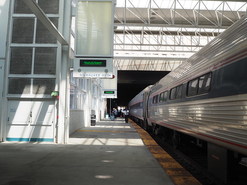
After about ten minutes they announced that they had moved the vehicle so it only blocked the northbound track, so we just needed to wait for a southbound train to clear the area so we could go around it on the southbound track. After about five more minutes, the southbound Hiawatha passed us and we were moving again. We ended up only being about fifteen minutes late, nothing terrible. From there, I photographed the train in Milwaukee:
My train at Milwaukee Intermodal Center
I also photographed the Marquette Interchange, a famously obnoxious traffic interchange:
Marquette Interchange
A friend of mine from middle school met me at the station, and we walked around for a bit and got an early dinner at the Brat House, where he got a burger and I got the “southsider,” a bratwurst with melted cheddar, jalapenos, and bacon. It was pretty delicious and a good introduction to Milwaukee. I also got a picture of the Milwaukee river from the park where we ate our dinner:
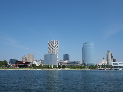
Milwaukee River from State Street
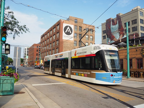
The Milwaukee River and all the drawbridges was definitely a reminder of Chicago, giving a nice familiar vibe. After that, we parted ways and I continued exploring the city. I scoped out a skyline photography spot, Veterans Park, and determined it would probably be good after the sun set. While waiting for the sun to go down, I got some ice cream and then went back to the hotel to rest my legs for a bit. Then, as dusk approached, I headed back out and caught the “The Hop,” the Milwaukee downtown streetcar, at Wisconsin Avenue and took it to Burns Commons.
The Hop streetcar at Burns Commons
After getting off the streetcar, I walked over to Veterans Park again. This time I did not forget my tripod, so I was able to get some good long-exposure shots. This was probably my best one:
Downtown Milwaukee skyline at night from Veterans Park
Then, pretty exhausted from all the walking, I headed back to the hotel and called it a night.
The next day I hit the ground running, so to speak. Due to COVID measures, the hotel wasn’t serving breakfast, so I went to the Canary Coffee Bar and got a muffin and chai tea, both of which were great. The weather indicated it was going to be sunny in the morning but cloud over later in the day, so I took the morning for some more photography. Importantly, all my photos from the lakeshore needed to be in the morning anyway so the sun would be behind me. Naturally, I started with photographing the streetcar:
The Hop streetcar at Wisconsin Avenue southbound
I took it to Burns Commons again and got a daytime photo from Veterans Park again.
Milwaukee skyline from Veterans Park during the day
I then walked down to Discovery World and got some photos from there.
Milwaukee skyline from Discovery World
I explored Downtown Milwaukee some more for a while, then figured I’d head up to Glendale to get frozen custard at Kopp’s. I took the bus up to Glendale and from there got Kopp’s. I’m finally old enough that if I say I’m having frozen custard for lunch, I’m having frozen custard for lunch. Kopp’s only has four flavors: chocolate, vanilla, and two rotating flavors (apparently there was only one rotating flavor at a time in the past). One of the rotating flavors when I was there was “grasshopper fudge,” which is a mint base with fudge chunks. I got a cup of that, which was also delicious.
Sign in front of Kopp’s
After having enjoyed my Kopp’s frozen custard, I caught the bus back downtown. It was starting to cloud over, so I figured that would be a good chance to check out the Grohmann museum, a museum about art related to labor and industry (and one of the only museums open on a Tuesday). The museum was pretty cool, featuring a rooftop sculpture garden and a massive amount of paintings. The paintings dated from the 17th century (that’s the earliest I remember anyway) to 2020 and featured all sorts of industries. Pretty cool museum, worth a visit.
After leaving the museum, I walked around downtown a bit. One particularly interesting detail is that The Hop isn’t electrified for its entire length, operating on battery power for one stretch. I caught a video of a streetcar raising its pantograph:
The Hop streetcar raising its pantograph at City Hall
The Hop streetcar at Historic Third Ward
Eventually, for dinner, I headed to the Milwaukee Public Market for dinner and got dinner at the Foltz Family Market, a BBQ cheddar burger with fries. Also amazing; I definitely ate well on this trip. After dinner, I walked around downtown for a while longer and photographed some more stuff.
Raised bridge at Wells Street
Milwaukee City Hall
For my third and final day, I headed to Discovery World in the morning. I first visited it within a year of it opening, in the winter of 2006. It was interesting seeing it from the perspective of an adult vs. a kid and also what’s changed vs. what hasn’t changed. It’s still definitely a cool museum, featuring a bunch of different exhibits about science, technology, and engineering as well as an aquarium and an old restored ship. Also definitely a worthwhile trip for anyone traveling to Milwaukee.
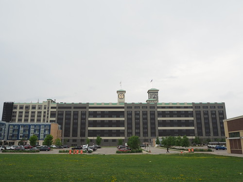
After leaving Discovery World, I headed south to photograph the Allen-Bradley clock tower.
Allen-Bradley clock tower
It was cloudy so the colors were a bit dull, but I can only ask for so much. With that photo in the bag I started heading back downtown, only to be interrupted by a sudden onset of rain. Of course of all things I forgot to pack, I forgot my umbrella. I stood under a bridge for a while hoping to wait out the rain.
The underside of a bridge where I tried to wait out the rain
After about an hour under the bridge and the rain giving no signs of letting up, I figured I had to leave somehow. I ended up timing it so I was able to get to a nearby bus stop only about two minutes before the bus arrived, so I avoided being totally drenched. Once I got back downtown, I got dinner at Smoke Shack.
Smoke Shack
Being originally from North Carolina, I wanted to see what sort of barbecue game they had in Milwaukee. The building was clearly supposed to mimic the shacks you see down south, but unlike those this was definitely a well-constructed modern building, as opposed to an actual shack. This was definitely a more upscale place trying to pull off a “casual southern” vibe. All that aside, the food there (I got a pulled pork sandwich) was also excellent (as a former North Carolinian, I approve). I also got a “pecan pie in a glass” cocktail to go with my food:
“Pecan pie in a glass” cocktail
After finishing dinner, I waited out the rain a bit longer in the public market seating area, then headed back to the Amtrak station to catch the train home. Unlike the journey north, the journey south was pretty quiet. Very few people on the train. I guess that’s what happens with an evening train on a Wednesday.
Almost empty railcar
We pulled into Chicago Union Station right on time, but interestingly came in on one of the run-through tracks and unloaded on the southern side of the station.
Hiawatha (left) on the southern tracks of Chicago Union Station
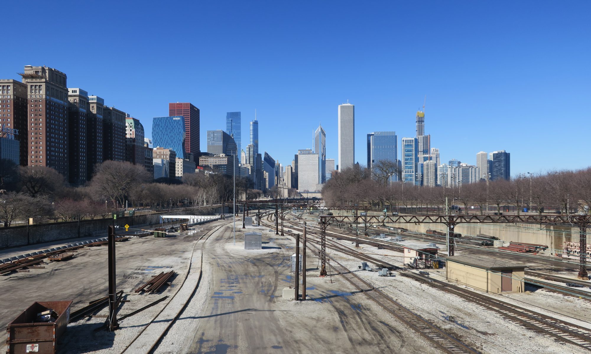
My guess is that since this was the last run of the night, they were going to take it to the Amtrak yard, which is located south of Union Station. Anyway, I headed back home. Walking through downtown Chicago was a bit of a shock though, since I headed through several blocks surrounded by skyscrapers. While Milwaukee definitely had tall buildings, they are nowhere near as tall and there are nowhere near as many as in Chicago. Anyway, I made it to Monroe and caught the Red Line home.
Overall, a fun trip! This was my first major vacation in the past year, and it was nice to get out for a bit. Milwaukee is also a pretty cool city and while this wasn’t my first time there, it was my first time really experiencing the city itself rather than the city just being a meeting place.
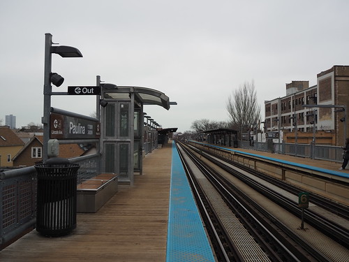
So today I continued my apartment hunting adventure. As was the case with the past two days, my day started with an apartment visit. This time, it was in Edgewater. Not all that much to say on that front, so I’ll continue to the fun stuff. I had some hot bar food from Mariano’s for lunch, which was pretty good. I will likely be shopping either there or Jewel-Osco for groceries, so I figured I might as well start getting familiar with their stores. Once that was done, I got back on the L and headed towards another barrage of apartment visits. This was the first set I saw not on the Red Line, but instead on the Brown Line, making this my first time taking that line (I also have not yet ridden the Green or Pink lines). I got off at Paulina:
Outbound platform at Paulina
From there, I headed to my first apartment of this set of visits. I then traveled across that part of the city (the realtor driving me between apartments), and visited a number of units in Lakeview and Uptown, but further west than I was before. After that was done, I caught the Brown Line at Irving Park. Due to fairly large the number of people there (it was about 3:30pm at this point, so rush hour was approaching), I didn’t get any photos, and it was cloudy anyway. I headed back downtown and hung out there for a while, then headed back north to get dinner. Since I wanted something light, I took the train back to Bryn Mawr to go back to Mariano’s and get a chicken caesar salad:
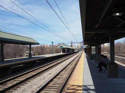
Southbound tracks at Bryn Mawr
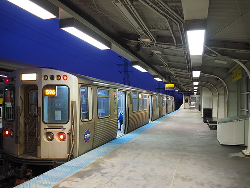
After some dinner, I figured I would explore a more remote part of the L system, and figured I’d head to Howard and from there either go to Linden or Skokie, depending on which train arrived first. It just so happened that both were there, so I opted for Skokie for no particular reason. Thus, I boarded the Yellow Line and went out to Dempster-Skokie.
Train waiting at Dempster-Skokie
Dempster-Skokie termination platform
Dempster-Skokie main entrance
From there, I headed back to Howard, then transferred to the Red Line and called it a night. It’s feeling a lot more real that I’m moving here now that I’m apartment hunting. With any luck, I’ll have a place to live soon. From there, I’ll have a whole new city to explore.
Since I’m moving here soon, I need to find a place to live. My plan for this trip was to scope out neighborhoods, tour apartments, and do other things necessary to get ready to live here.
To start with, my journey was an interesting time. I had a flight from Cleveland to Chicago-Midway scheduled at 4:25pm. Since there was work being done on the Red Line between East 55th and Tower City that took that section out of service, I needed to budget extra time. Also, to avoid a train-bus-train combo, I took the HealthLine to Tower City instead. Being the paranoid person I am, I left at about 12:30 after a quick lunch from Panera (which is conveniently located right next to the East 115th Street HealthLine stop). That gave me four hours to get to the airport, which was less than 20 miles away. Anyway, from there things went without any problems. I made it to the airport and through security with over two hours to departure. Thus, I killed some time at the airport waiting for my flight. My flight then went without any trouble.
The fun began when I actually arrived in Chicago. The place I’m staying is very close to the Rogers Park Metra station, but somewhat further from the L. I normally wouldn’t mind walking, but I had a suitcase and didn’t want to be walking through a city more than I absolutely had to carrying a suitcase. Therefore, I planned my trip so that I would catch the Orange Line to Washington/Wells, then transfer to Metra at the Ogilvie Transportation Center. One catch: I was cutting it close. I had to get from the gate to Ogilvie in under an hour, and that included picking up a checked bag. The instant I got my bag off the carousel (which conveniently was one of the first ones), I made a mad dash for the L. Of course, I just missed the train, so I had to wait a while for the next one. While all this was happening, I was constantly eyeing my watch for how much time I had left to catch Metra, seeing how much time I had. Soon after another train pulled in, but it didn’t leave for several more minutes. Eventually, my train left and headed in towards Downtown Chicago. The L went pretty smoothly, but I still knew I was basically playing Tetris with train schedules. I got to Washington/Wells at 5:38, and I had to be on board the train at Ogilvie by 5:45. Thus, I got to make a mad dash across Downtown to catch Metra. I was sprinting with a backpack and suitcase across Downtown and being as opportunistic as I could with stoplights. After finally making it to Ogilvie, I had a new challenge: how on earth do I actually get in? There were a bunch of doors, but most were for adjacent shops. The actual entrance wasn’t exactly clear it was for the station, since it had a bigger sign for a restaurant. Anyway, I finally found my way in, ran as quickly as I could to the platform, and boarded the train with two minutes to spare. From there, it was a pretty uneventful journey. I got to Rogers Park right on time and quickly got to my lodging.
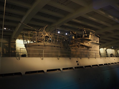
On Sunday, since I had a Metra weekend pass from the day before, I decided to go the Museum of Science and Industry. The Metra Electric District left Millennium Station at 10:10 and 10:40 on Sundays, followed by a very long gap. I caught the Red Line at Morse, hoping to make the 10:10 train. I ended up missing it (due in part to an unexplained delay at Loyola), so I instead caught the 10:40 train. That whisked me right to the museum, and I had a fun time. The museum remains very cool, and is absolutely giant. They have a model railroad of Downtown Chicago as well as a bunch of freight/intercity stuff across the country. They also have U-505, a captured German World War II submarine.
The conning tower of U-505
Then, I grabbed some lunch at the museum cafe, having a chicken caesar salad. After that, I caught the 2:10 Metra Electric back to Millennium Station.
Platforms at 55th-56th-57th Street
My train back downtown
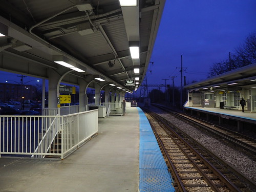
Once back downtown, I caught the Red Line and headed up to Belmont to begin checking out some of the apartments I will be touring and get a feel for the neighborhoods.
Red Line tracks at Belmont
From there, I explored the Lakeview, Uptown, and Edgewater neighborhoods. I found that Lakeview is probably a bit too happening for me, but Uptown and Edgewater looked like good matches, since both of those are within easy access of Lakeview (I still want to be able to access all the things happening in Lakeview, just not necessarily be living right there) and a bit quieter. They also have the right kind of density for me. I will be touring several apartments in that area over the next few days, so here’s hoping.
Anyway, after walking up to Thorndale, I caught the train up to Rogers Park to see what’s up there.
Northbound track at Thorndale
From there, I headed up to Jarvis to look at the neighborhood there. Tonight I’m going to get dinner somewhere in Chinatown, so that’ll be nice.
Chicago definitely has the right feel for a city for me, and I think I have found where I want to live in it (that is, Edgewater or Uptown). The L makes it very easy to get around, and the Red Line runs super frequently, even on Sunday, which is very nice. Here’s hoping I can find a good apartment. My tours begin tomorrow, so stay tuned.
For my final winter break of college, I went to visit family in Los Angeles and also traveled to San Diego. The family visits were pretty standard and not exactly the kind of thing I post here, but I also got some amazing photographs.
Getty Center
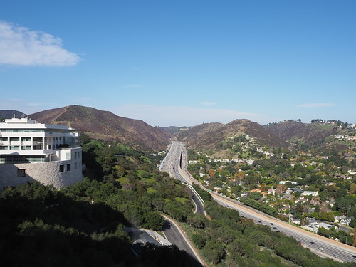
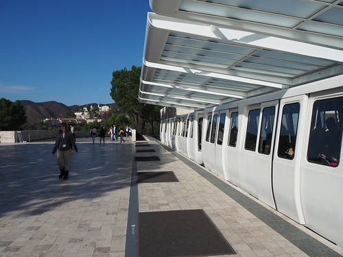
After getting over the jet lag (to some degree), we traveled to the Getty Center on the first full day in Los Angeles. I am personally not one for art museums, but the Getty Center has both interesting architecture and amazing views. While the rest of my family looked at the artwork, I went around photographing the buildings and the views. The museum is also at the top of a mountain, which is traversed by a tram, affording me an opportunity to photograph a unique rail system.
I-405 Sepulveda Pass
Upper tram station
Fountain in the garden
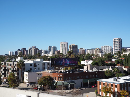
Wilshire Boulevard and Century City
I have pictures of the Downtown Los Angeles skyline from previous trips, but Los Angeles does not have a single high-density urban core the way that most cities I travel to do. So, I set my sights on Wilshire Boulevard. After a bunch of scouting out locations on Google Earth (which was no easy task when all I had was my cell phone), I concluded that the parking garage at the Westfield Mall in Century City would be the best vantage point. The view did not disappoint. While the first time I tried was a cloudy day, the weather forecast revealed that the next day would be sunny. And sunny it was:
Wilshire Boulevard skyline from Westfield Century City
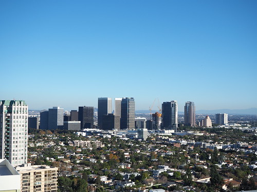
However, that was to be outdone later that day. Thanks to some help from my family, I was able to get access to the roof of one of those buildings on Wilshire and photograph Century City. Los Angeles requires helipads be on the top of tall buildings, and that is exactly where I was standing. This gave me a nice 360 degree view of the Westside of Los Angeles.
Century City skyline from the roof of a Wilshire building
That was a once-in-a-lifetime photo opportunity. It’s not every day that you can access the top of a skyscraper in the middle of Los Angeles, and I am extremely grateful for my family and the property management for letting me up there.
Exploring the Metro (a bit)
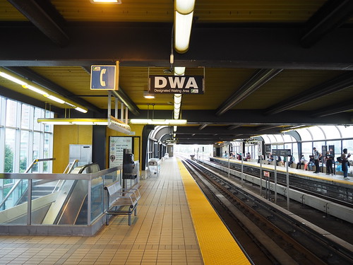
I had a free afternoon and nobody had any specific plans, so I figured I would take the opportunity to explore the Metro some more. I have always been a fan of the Los Angeles Metro since it’s such a new system and serves a metropolitan area vastly different than most other rapid transit systems. Nothing new had been opened since I was there last (though a whole lot is coming very soon), so I didn’t have any obvious candidates to explore. I thought about it, and decided maybe I should go to Boyle Heights since it has the only two underground light rail stations outside of Downtown (until the Crenshaw/LAX Line opens in a few months). After a long trip in from Westwood on the Expo Line, followed by short trips on the Purple Line and Gold Line (once the Regional Connector project finishes, this entire trip will be a one-seat ride), I got off in Boyle Heights at Soto. The design of the platform was pretty standard in keeping with the heavy rail stations on the Red and Purple Lines, but the entrance design was unique and well-incorporated into the local community.
Soto entrance
Soto mezzanine
Soto platform
I then traveled back towards Downtown, not sure what to do next. I remembered along the way that the Little Tokyo/Arts District station will be demolished and replaced with an underground station as part of the Regional Connector project, so I decided to get off there and grab some pictures since I had no idea when I would be back next and I may never get a chance to photograph that station again.
Little Tokyo station with all the construction activity behind it
Little Tokyo station north entrance
From there, I took the Gold Line back to Union Station, then the Purple Line to Wilshire/Western, and the 720 bus back to Westwood.
Traveling to San Diego
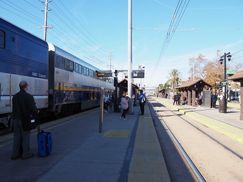
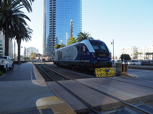
After a nice time in Los Angeles, I headed down to San Diego. I traveled on Amtrak’s Pacific Surfliner, getting on at Los Angeles Union Station:
The Siemens Charger locomotive for my train
The coach-cab car back of my train
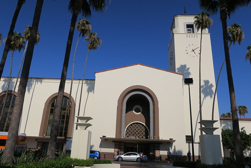
The station entrance (taken several years earlier on another trip)
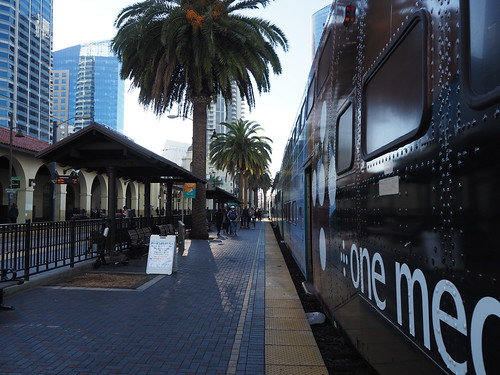
The train trip itself was pretty uneventful. Everything went smoothly, and we arrived at San Diego Old Town station right on time. The view from the train was somewhat varied. The leg from Los Angeles to San Juan Capistrano was just industrial backlots, going through pretty gritty areas. However, from there on to San Diego was absolutely beautiful, going right by the ocean.
My train at San Diego Old Town
The station house
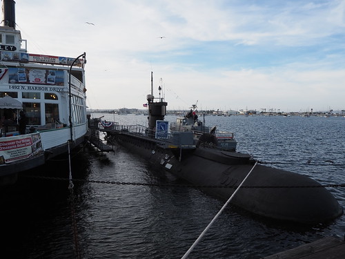
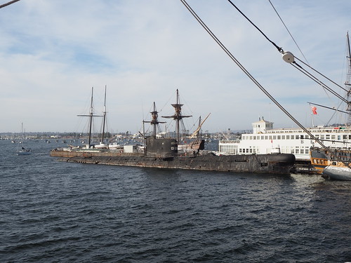
Maritime Museum
After getting off the train and meeting everyone else at the station, we drove downtown and spent a few hours at the Maritime Museum. The museum was pretty cool, containing a bunch of old boats and two submarines. We started off on the Star of India:
Star of India from the coast
While I normally get a lot of skyline pictures when I visit cities, the prospects weren’t all that promising in San Diego with the time and resources I had available, so my only ones were taken from the Maritime Museum:
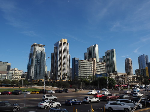
San Diego skyline from the Maritime Museum
We also visited a few of the other boats and submarines:
USS Dolphin
Former Soviet submarine
San Diego Trolley
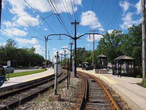
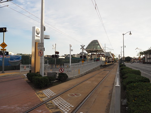
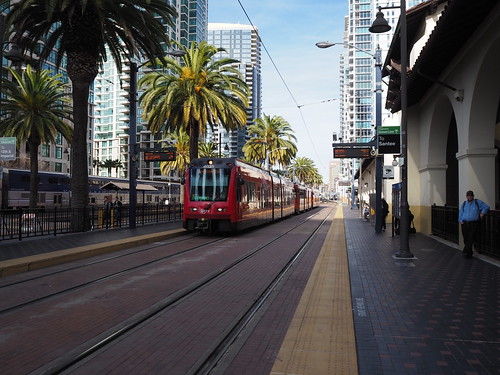
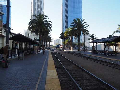
I had the opportunity to explore the San Diego Trolley system on the second day there, so I made sure to do that. I had done no planning whatsoever, so I just figured I’d go around randomly and see where it took me. I started at Santa Fe Depot and figured I’d head inbound.
Green Line train at Santa Fe Depot
So, I caught the train and took it to 12th and Imperial where I had the chance to transfer to the other lines. To my surprise, the Green Line ended as a single track and reversed from there, rather than the double track setup common at most termini.
My train after turning around
I then headed over to the other lines:
Blue and Orange Line platforms
Without any real idea where I wanted to go, I figured I’d hop on a Blue Line train. I rode it inbound to the end of the route at America Plaza, which at first I didn’t realize put me right back at Santa Fe Depot where I started.
America Plaza Station
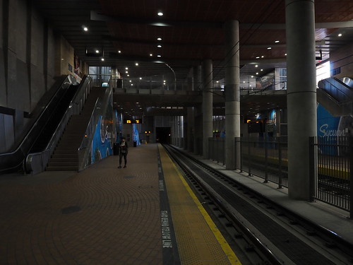
I then walked back to Santa Fe Depot and hopped on an outbound train to see what the line was like further out from downtown. I wondered if all the stops were fairly close together like they were downtown, or if they were much further apart like I experienced in Charlotte (which, by the way, operates the same type of vehicle). It turned out it was the latter, with my phone informing me we hit speeds of up to 50 MPH. I was on the lookout for any particularly notable stations, and ended up deciding Stadium fit the bill. It was a rather bizarre station, having both an island platform and side platforms and being designed to look like the stadium it serves.
The station is designed to look like the stadium
The platform setup
The mezzanine level between the entrance and platform
After leaving Stadium, I was planning on heading out to Grossmont and transferring to a train back to downtown. However, I was much surprised to find ourselves going underground, nowhere near downtown. An underground station on an otherwise above-ground system is too interesting to pass up, so I jumped ship at San Diego State University.
SDSU underground platforms
SDSU Entrance Plaza
I then continued on my way to Grossmont and turned around there. Turns out I just missed the inbound train, so I had to wait 15 minutes for the next one. Oh well. I busied myself with photography in the meantime:
Outbound train at Grossmont
Entrance to the station from street level
Benches at Grossmont
Eventually, my train came and I headed back inbound. For whatever reason, 32nd and Commercial really caught my attention, so got off to get some more pictures:
Platform at 32nd and Commercial
I then continued on my way back into Downtown, with dusk approaching. Once I got back Downtown, I took pictures of a bunch of the stations there:
Civic Center
Park and Market
Gaslamp Quarter
Fifth Avenue
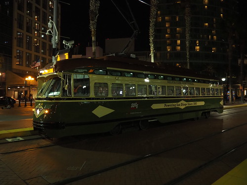
Trolley at Gaslamp Quarter
The trolley really interests me since it’s an old streetcar, but also has a pantograph and LED destination sign. Interesting renovations.
After that, I met with everyone for dinner.
The Coaster
The next day, it was time to return to Los Angeles. I decided to take the Coaster up to Oceanside while everyone else drove in order to give me another photography opportunity. It went well except for one tactical error: it was Saturday. I lost track of the days and thought it was during the week, where the Coaster leaves Santa Fe Depot at 9:18am. The clock hit 9:18, and no train. To make sure I got it right, I looked at a posted schedule and then checked my watch to make sure I got the day right. Turns out I got the day wrong. Oooooops…
Empty track. Dude, where’s my train?
Amtrak Charger locomotive lying out of service
Anyway, the weekend train left at 9:35, so it wasn’t that bad of a delay. The train arrived as expected and I boarded.
My train waiting at San Diego Santa Fe Depot
The train ride went fine. I got another beautiful view of the coast heading back north to Oceanside. The train arrived in Oceanside, then I got off and met up with everyone else, and we drove the rest of the way back to Los Angeles.
The back of my train at Oceanside
A Metrolink train to Los Angeles waiting at Oceanside
Sprinter light rail platform
The station house at Oceanside
With that, we returned to Los Angeles, and the next day we flew back home.
All in all, this was a pretty nice trip. I spent some time with family but also got plenty of time to explore and photograph on my own.