Photographing all of Metra… without a car

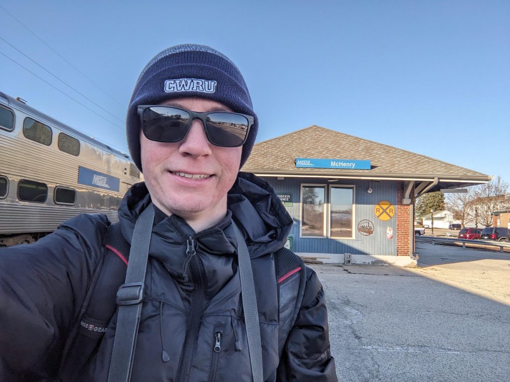
I am about halfway through photographing all of the stations on Metra right now. According to Wikipedia, there are 242 stations in the system, with two additional ones under construction. According to Flickr, I have photographed 120 of them so far (as of the time I write this there are three stations where I have the photos but haven’t uploaded them). My definition of a station may slightly differ from Wikipedia’s (for example I am counting Prairie Crossing on the North Central Service and Milwaukee District west as a single station), but regardless this puts me at about halfway done.

It certainly has been an adventure trying to photograph all of these stations when I don’t have a car. I was able to photograph the entire L system in about 2.5 years (and most of it was in 1.5 years after I moved here), but Metra is going to take a lot longer. For the L, the stops are mostly relatively close together, all lines run every day, and the frequencies are pretty good. Thus I was usually able to knock out 5-10 stations in a single expedition, using a combination of walking and trains between stations. However Metra isn’t so easy. For one thing, three lines don’t even run on weekends at all (I work a standard Monday-Friday schedule), so for those lines I’m limited to going during the week or finding alternate means to get to the stations. Then for the lines that do run on weekends, they run pretty sparse schedules, once an hour at best. Making things harder, way out in the suburbs the stations are often several miles apart and in many cases there isn’t any sidewalk or pedestrian path to take between them, limiting my ability to walk between them.

Despite these challenges, I have been able to get the photos I have so far. I was lucky enough that last summer, the Heritage Corridor offered promotional Saturday service, allowing me to photograph all but one of the stations on there (and the remaining one appears to be walkable from Joliet on the Rock Island District). I was also able to get a ride with a friend to photograph all of the stations on the SouthWest Service. The North Central Service will be more of a challenge, with so far only Antioch photographed (I took a day off work originally for another purpose but that ended up being cancelled, but since I still had the day off I took advantage of it being a sunny day).

For the other lines, I have used a combination of taking the train and walking long distances between stations where possible. For example there is a pedestrian trail between Ingleside and Fox Lake, allowing me to get those stations in one go. Also a lot of the stations closer to the city are in areas that do have sidewalks, allowing me to walk between them more easily (though it can still be a long walk).

Here are the tallies for each line, not counting the downtown terminus for each:

  • BNSF: 8 out of 25 (32%)
  • Heritage Corridor: 5 out of 6 (83%)
  • Metra Electric: 33 out of 48 (69%, including all stations within the Chicago city limits and on the South Chicago and Blue Island branches)
  • Milwaukee District/North: 6 out of 21 (29%)
  • Milwaukee District/West: 6 out of 21 (29%)
  • North Central Service: 2 out of 17 (12%)
  • Rock Island District: 15 out of 25 (60%, including all stations on the Beverly Branch)
  • SouthWest Service: 12 out of 12 (100%)
  • Union Pacific/North: 16 out of 26 (62%)
  • Union Pacific/West: 9 out of 22 (41%)
  • Union Pacific/West: 7 out of 18 (39%)

I have a lot more work to do for sure, but I’m getting there. I’ve got one line fully complete, only one station left on the Heritage Corridor, and four lines above halfway done. I also have photographed all of the stations on the South Shore Line, but will need to go back out there once Double Track is done to photograph the newer stations, and also once West Lake opens. Some of the stations are in Chicago city limits or inner suburbs and will allow me to walk between them, but some will require a combination of taking trains and walking. I’m not sure how I’ll get the stations on the North Central Service, but I’m sure I’ll make it work.

Here are a few photos I’ve gotten so far:

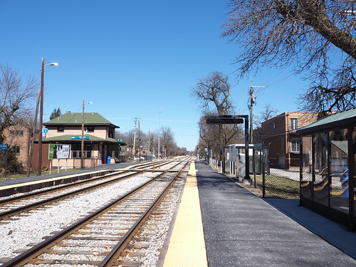
Outbound platform at Elgin - National Street, looking north
Elgin – National Street
Outbound platform at Hanover Park, looking west
Hanover Park
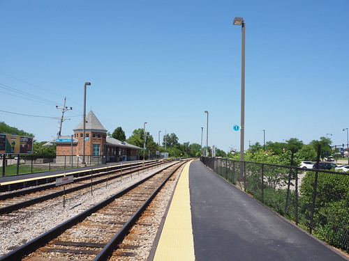
Platform at Fox Lake, looking west
Fox Lake
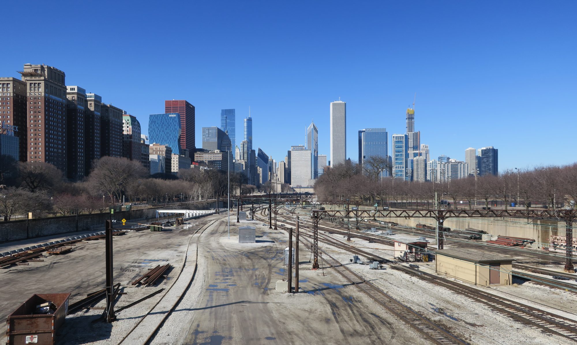
Southbound local track at Museum Campus/11th Street Station
11th Street/Museum Campus
Inbound platform at 107th Street - Beverly Hills, looking north
107th Street – Beverly Hills
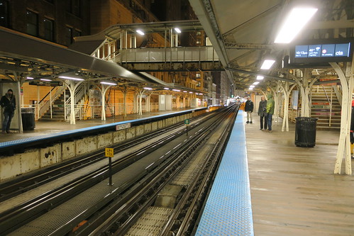
Inbound Northwest Line platform at Clybourn
Clybourn
Platform at Manhattan, looking north
Manhattan
Platform at McCormick Place, looking north
McCormick Place
Tracks at Wheaton, looking west
Wheaton
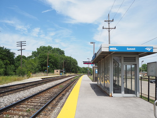
Inbound platform at Summit, looking northeast
Summit

CTA Holiday Train 2022

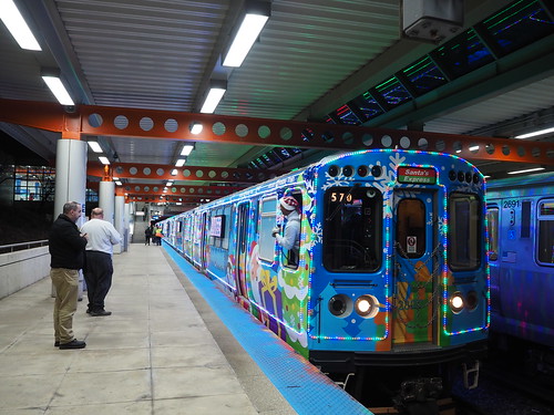
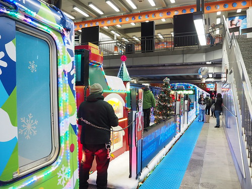
It’s that wonderful time of year, where the Chicago L runs the Holiday Train! I was able to catch it on the Green Line (and apparently the Orange Line). I caught it heading west/south on the Green Line towards Cottage Grove:

CTA 2022 Holiday Train at Kedzie (Green)
At Kedzie

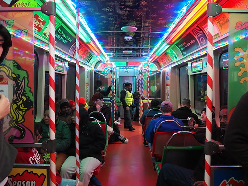
Inside, it was decked out for Christmas:

CTA 2022 Holiday Train interior
Inside the Holiday Train

We then headed down to Cottage Grove, where I got some exterior pictures as they turned the train around:

CTA 2022 Holiday Train at Cottage Grove
Back of the Holiday Train at Cottage Grove
CTA 2022 Holiday Train at Cottage Grove
Santa flatcar

The train then headed back towards downtown, but then at Roosevelt they announced that instead of continuing back towards Harlem/Lake it would turn into an Orange Line train, running around the loop then heading out towards Midway. That was an unexpected twist of events.

CTA 2022 Holiday Train at Midway
At Midway
CTA 2022 Holiday Train at Midway
At Midway
CTA 2022 Holiday Train at Midway
Santa flatcar at Midway

At Midway, the train sat on the yard platform for a while, then was moved into the yard to end its run for the day.

It’s always nice to see some Christmas spirit on the CTA. It’s also a nice touch for something so many of us rely on every day. Christmas season has begun.

CTA 75th Anniversary

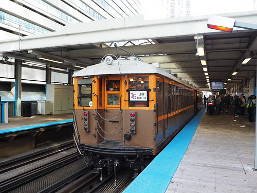
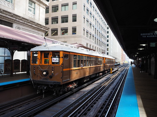
On October 1, 1947, the Chicago Transit Authority was formed, taking over operations for city buses, streetcars, and rapid transit lines. Today marks the 75th anniversary, and to mark that occasion, they ran several old railcars and buses in the Loop today.

First, I got to Daley Plaza around 8:45am so I could get a ticket on the first train. Not only did I get a ticket, I also scored a 75th anniversary pin and two awesome posters. The main boarding location was Clark/Lake, and the first railcar to arrive was a 4000 series train:

CTA 4272 at Clark/Lake

Then came the train I was booked on, a 6000 series:

CTA 6711 approaching Clark/Lake
CTA 6712, approaching Clark/Lake

I then got to take a ride around the Loop in that car:

CTA 6712 interior
Interior of CTA 6712

After that, I was able to ride on a 2400 series train:

CTA 2455 arriving at Clark/Lake

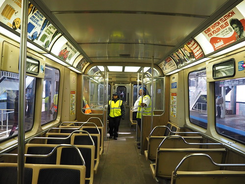
I took that train around the Loop as well. The 2400 series felt a lot more familiar, not being all that different (at least from a passenger point of view) from the 2600 and 3200 series we still use today.

CTA 2489 interior
CTA 2489 interior

After returning to Clark/Lake a second time, I photographed trains from the other platform:

CTA 4271 at Clark/Lake
CTA 6711 at Clark/Lake

I then finally was able to catch a ride on the 4000 series train:

CTA 4000 series interior

I then returned to Clark/Lake yet again and photographed the 2400 series train and the 4000 series train together:

CTA 4271 and 2490 at Clark/Lake
2400 series and 4000 series trains together at Clark/Lake

Then I headed over to Quincy to photograph the historic trains in the context of the one station that has retained its historic appearance.

CTA 2490 at Quincy
CTA 2490 at Quincy
CTA 4271 at Quincy
CTA 4271 at Quincy
CTA 6711 at Quincy
CTA 6711 at Quincy

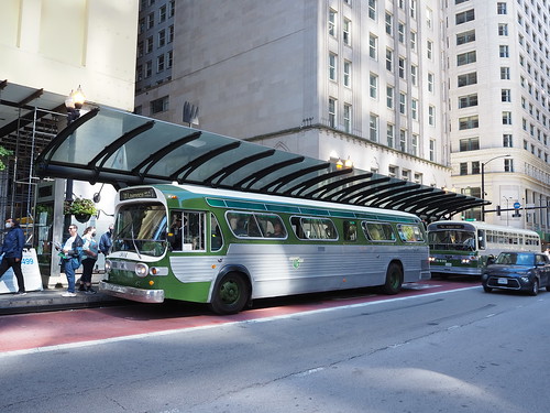
Then, I rounded out the day taking an old bus, GMC 301, around downtown from Daley Plaza:

CTA bus 301 at Washington/Clark
CTA 301 at Daley Plaza

They also had bus 3706 on static display in Daley Plaza:

CTA bus 3706 at Daley Plaza
CTA 3706 in Daley Plaza

All in all cool to see. It’s a reminder of everything that it took to get us to where we are now. We are now awaiting the 7000 series L cars which will result in the retirement of the 2600 and 3200 series, and I guess that means the next time they do an event like this those will be part of their heritage fleet. Here’s to another 75 years of the CTA.

I have photographed the entire Chicago L!

At long last, I have photographed all 145 stations on the Chicago L! If you just want to see the pictures and not read the rest of this post, check them out here.

My first published photo was taken on March 9, 2019 at Adams/Wabash:

Adams/Wabash station after some rain
Photo at Adams/Wabash

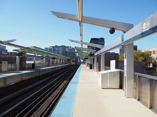
…and my last published photo to complete the set was taken at Morgan on November 6, 2021:

Outbound platform at Morgan, looking west
Photo at Morgan

This was a really fun project, even if exhausting at times, especially near the end where I was trying to finish before it started snowing and we were less likely to get clear skies so I had to take advantage of the chances I got. This involved a lot of days getting up, eating breakfast, loading a day pass onto my Ventra card, and heading out the door to the Red Line then spending most of the day out on the train in parts of the city far from home and ending the day with an hour or two of sorting photos and choosing which ones to upload.

In the course of this project I really came to appreciate the diverse nature of the system. It ranges from utilitarian like Bryn Mawr (for now) to very old-fashioned like Ashland (Green Line) and Quincy to modern like Washington/Wabash and Wilson and everything in between. Meanwhile, the track structures range from elevated to embankment to ground-level to freeway median to open-cut to tunnels. Adding to that, the scenery ranges from industrial to suburban to medium density to ultra-high density as well. Really a big mix of everything.

This project also was a really cool way to experience the city, since I didn’t just go to the stations and take some photos and leave, but instead often walked between adjacent stations and on occasion got lunch on the go (best one was Italian Beef at Nicky’s near 35th/Archer). Walking through the neighborhoods really helped me get a good feel for the area. This also helped me improve my photography skills and figure out more about what conditions are/aren’t good and which techniques work and which ones don’t.

Going forward, I do have a few gaps to fill, between certain parts of stations I couldn’t/forgot to get to for various reasons or stations that received significant changes since I originally photographed them (for example, the three Blue Line stations under Milwaukee Avenue received new flooring). I’ll hit those as I have time, but am not in any hurry. I also of course will continue photographing the ongoing construction in my part of the city. I want to photograph Metra stations (I already have photographed all the stations on the South Shore Line), but am in less of a hurry to do that. After all, Metra doesn’t run anywhere near as frequently as the L does (and some lines don’t run on weekends at all).

Touring an abandoned prison

Today I took a trip down the Joliet Correctional Center in, you guessed it, Joliet. It was an active maximum security Illinois state prison from 1858 to 2002 and held a number of well-known inmates, including Nathan Leopold and Richard Loeb, Baby Face Nelson, John Wayne Gacy, and most famous of all, Jake Blues. It’s interesting that the most famous inmate is fictional.

To get there, I took the Metra Rock Island District to Joliet, then a Pace bus. Of course I got some pictures of the Metra station on the way:

Front of a waiting Rock Island District train at Joliet
The train that took me to Joliet
Rock Island District waiting room at Joliet
Waiting area
Rock Island District train at Joliet from the Amtrak/Heritage Corridor platform
Amtrak/Heritage Corridor platform
Joliet station building from across the street
Station building

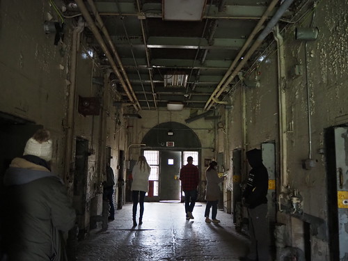
Then, I went into the prison on a tour. It was definitely very eerie being in there. The building is a little worse for wear (it was closed due in part to being in poor condition and has seen virtually no maintenance in the intervening two decades). You can see all of the photos I deemed worthy of publication in my Flickr album, but keep reading to see a selection of them with more detailed descriptions.

We entered via the eastern gate where Jake Blues famously walked out. According to the tour guide the gate was actually welded shut, they only opened it after the film company bribed the warden to let them use it and have a crew break the welding. Even then, they only got one shot and five minutes.

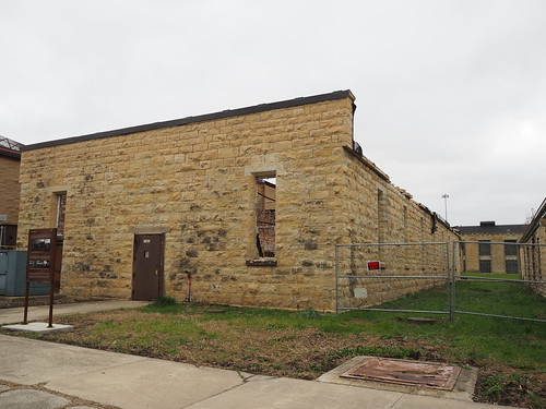
Along the path from that gate were the industry buildings to the north and a few other buildings like inmate intake processing to the south.

Industry buildings at the Joliet Prison
Industry buildings (or what’s left of them after severe fire damage)
Industries building at the Joliet Prison
Another burned out industry building
Auto shop building at the Joliet Prison
Burned out auto shop building
Joliet Prison inmate processing building
Inmate intake processing building (also burned out)
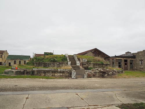
Joliet Prison water cistern
Water cistern

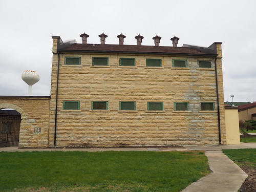
We then headed to the solitary confinement building, which had solitary confinement cells on the first floor and death row cells on the second.

Joliet Prison solitary confinement building
Solitary confinement building
Joliet Prison solitary confinement building side view
Solitary confinement building – the windows here were the cell windows at the top of the cells
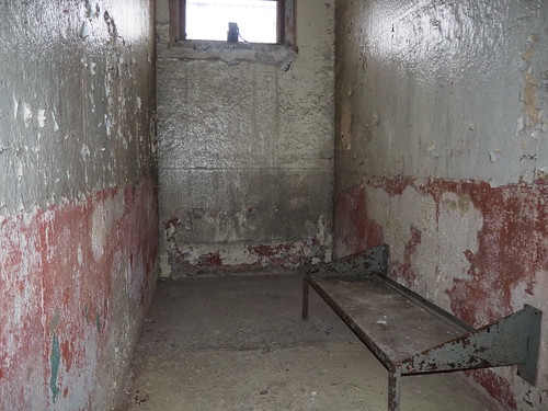
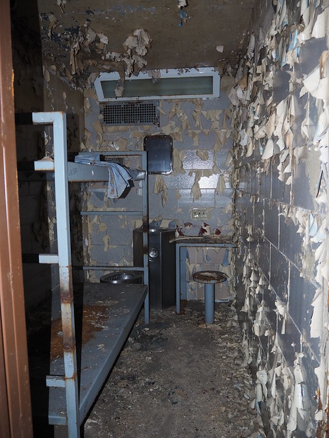
Joliet Prison original cell interior
Original cell (preserved), apparently three people were held at a time in these cells
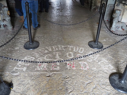
"It's never too late to mend" at the Joliet Prison in the solitary confinement building
“It’s never too late! To mend.” (I wonder if that was always there or added because of the Blues Brothers)
Joliet Prison solitary confinement building lower level
Solitary confinement cellblock
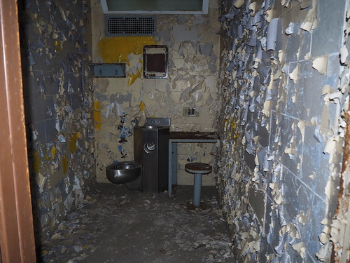
Solitary confinement cell at the Joliet Prison
Solitary confinement cell (there was also a toilet-sink unit to the right)
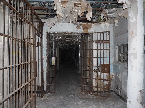
Death row cells at the Joliet Prison
Death row cellblock
Death row cell at the Joliet Prison
Death row cell

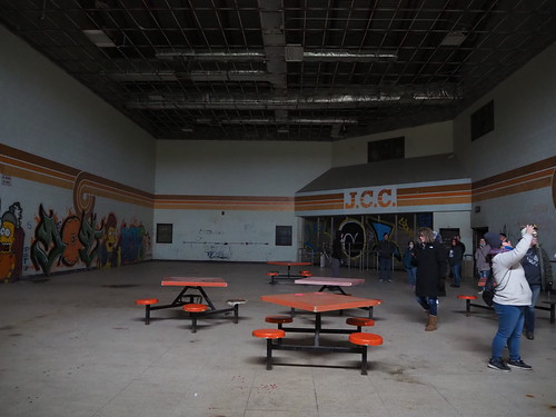
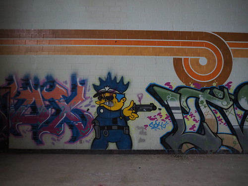
Then we headed into the cafeteria building, which was segregated by race into north and south cafeterias (I don’t know/remember which one was which). The north cafeteria in particular included some interesting Simpsons-based graffiti.

Joliet Prison north cafeteria
North cafeteria
Chief Wiggum graffiti at the north cafeteria at the Joliet Prison
Chief Wiggum graffiti in the north cafeteria
Joliet Prison south cafeteria
South cafeteria
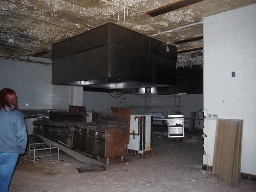
Kitchen at the Joliet Prison cafeteria
Kitchen

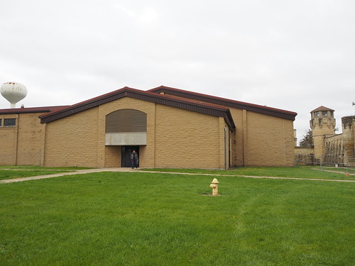
Then we left to head towards the cell house, passing by (but not entering) the gymnasium.

Joliet Prison gymnasium entrance
Gymnasium entrance

The tour guide then let one of the people on the tour open the door to the east cell house.

Man opening the east cell house door at the Joliet Prison
Man opening the cell house door
Cell block at the Joliet Prison east cell house
Eastern cell house cell block
Cell in the west cell house at the Joliet Prison
Eastern cell house cell

Apparently the eastern cell house cells had beds removed post-closing for maintenance reasons. Also a sobering fact that the left portion of the ceiling in the cell block was added to prevent inmates from trying to jump to their deaths, with apparently as many as three suicides per day.

We then left the cell block and walked by the hospital but couldn’t enter it.

Front of the hospital at the Joliet Prison
Hospital
Front hallway of the Joliet Prison hospital
Entrance to the hospital

We then entered the western cell house, which apparently housed inmates that were disliked even by the other inmates (use your imagination).

Cell in the west cell house at the Joliet Prison
Cell in the western cell house (including a bed this time)
Cell block in the west cell house of the Joliet Prison
Cell block in the western cell house

Here, note the closed doors instead of bars. Apparently this was to avoid inmates throwing stuff at the guards. The inmates here were so disliked that they even had their own yard to avoid contact with other inmates.

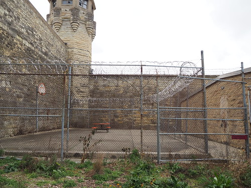
West cell house yard at the Joliet Prison
Western cell block yard

We then passed the school and headed towards the chapel.

School building entrance at the Joliet Prison
Entrance to the school building
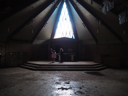
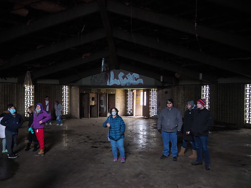
Chapel stage at the Joliet Prison
Chapel stage (it’s hard to see in this photo but many of the glass panes were missing)
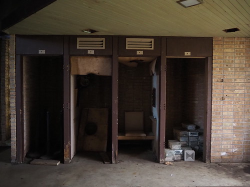
Confession booths at the Joliet Prison chapel
Confession booths
Joliet Prison chapel seating area
Seating area
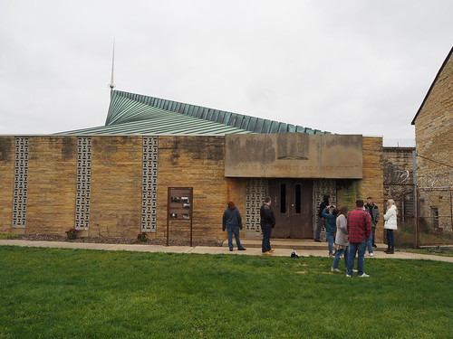
Joliet Prison chapel
Chapel entrance

It’s hard to see in the photos but the ceiling was in pretty bad shape due to apparently the roof being struck by lightning.

We then walked by a few other buildings to conclude the tour.

Joliet Prison library building
Library building
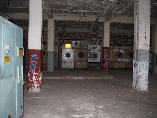
Joliet Prison laundry facility
Laundry machines
Joliet Prison sally port
Sally port

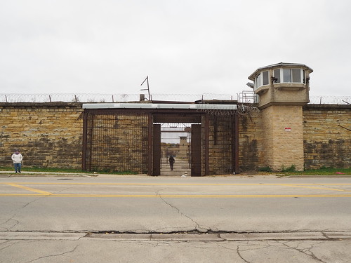
We then left via the eastern gate via which we entered.

Joliet Prison eastern gate
Eastern gate

I don’t really have much to say, I think the pictures speak for themselves. It was a very interesting tour.

Five lines done!

I have now photographed every station on five of the eight lines of the L: Blue, Brown, Orange, Purple, and Yellow! Of the three remaining lines I have eleven stations left if I’m counting correctly.

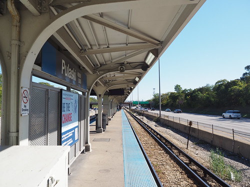
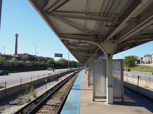
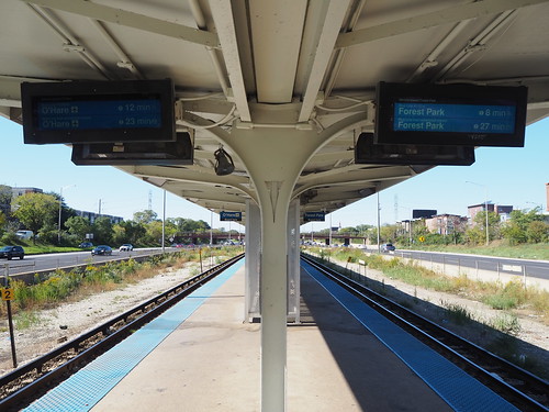
My most recent expedition was to photograph the rest of the Blue Line, and in keeping with the blue theme the sky also was a very deep blue. I photographed the rest of the Congress Branch:

Inbound track at Pulaski (Blue), looking east
Pulaski
Inbound track at Kedzie-Homan, looking west
Kedzie-Homan
Platform at Western (Blue - Forest Park), looking west
Western (Congress Branch)
Inbound platform at Illinois Medical District, looking west
Illinois Medical District
Platform at Racine, looking outbound
Racine
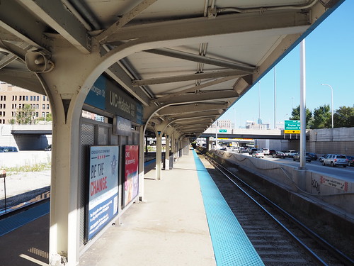
Inbound platform at UIC-Halsted, looking east
UIC-Halsted

In particular I got one very nice photo at UIC-Halsted, juxtaposing the station with the downtown skyline:

UIC-Halsted from Morgan Street

I also photographed Washington, which somehow I had never photographed all this time despite its central location:

Platform at Washington, looking north
Washington

I also photographed two abandoned stations along the Congress Branch in the process:

California (Blue) from California Avenue
California
Kostner (Blue), looking west from pedestrian bridge
Kostner

Then I headed up to Logan Square to get lunch, and on the way home photographed the new flooring at Chicago:

Platform at Chicago (Blue), looking northwest
New flooring at Chicago

Compare this to the flooring in 2019:

Blue Line platform at Chicago
Flooring at Chicago in 2019

Definitely an improvement, looked like they were doing the same thing at Grand and Division too.

Honestly not much more to say, this was just a status update and some more pictures. Eleven stations to go if I’m counting correct, and I’ll hopefully get them done in short order.

On the home stretch for a multiyear project

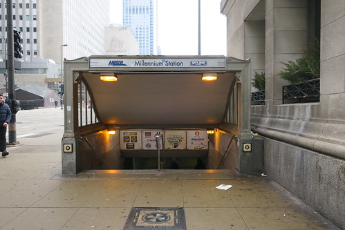
My ongoing project to photograph the Chicago L unofficially started on March 9, 2019, when I took a spring break trip to the city, unaware I’d live there a year and a half later. The first photo taken in Chicago (at least that I deemed worth publishing) is this one, of the entrance to Millennium Station:

Entrance to Millennium Station
Entrance to Millennium Station at Randolph and Michigan

Interestingly, the first four train stations I photographed in Chicago were all Metra, on March 9, 2019: Millennium Station, McCormick Place, 55th-56th-57th Street, and Museum Campus/11th Street. The situation there was I was going to the Museum of Science and Industry but stopped at McCormick Place along the way to photograph it, and then headed back to 11th Street to visit the Field Museum. The first photo I took and deemed worthy of publication on the L was at Adams/Wabash:

Adams/Wabash station after some rain
Adams/Wabash platform

The date on Flickr is listed as March 10, but it was actually taken very late on March 9 since my camera was still set on Eastern Time due to coming from Cleveland. Little did I know that this would start my most ambitious photography project so far. I photographed a number of stations in/near downtown as part of that trip, and then returned to Cleveland.

In December 2020 I flew out to Chicago to interview for the company that ended up hiring me, and photographed two stations: O’Hare (where I flew in) and Chicago (Red) (near my hotel).

In March 2020, I had been hired for my current job in Chicago and came back to visit apartments. At that point I knew I would be moving here and had in the back of my mind that I eventually wanted to photograph all the L stations. I stayed in Rogers Park (near Morse) and toured apartments all over the north side. I photographed a number of stations in the process, but knew I would come back.
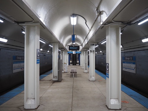
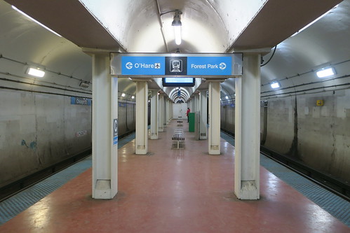
Since then, I have photographed all but about 25 stations. I have photographed all stations on the Loop, North Side Main, Ravenswood Branch, State Subway, Kennedy/O’Hare Branch, Evanston Branch, Skokie Branch, Englewood/Ashland Branch, and Jackson Park/East 63rd Branch. I also have photographed all but one station on the Milwaukee-Dearborn Subway and at least half of the stations on the Dan Ryan Branch, Cermak Branch, South Side Elevated, and Congress Branch. The big ones remaining are the Lake Street Elevated (just under half done) and Midway Branch. I am taking advantage of every good weather opportunity I get, so with any luck I will have this in the bag soon. If not, I’m not in any hurry. Once this is done, it will be without a doubt my most ambitious photography project so far.

I’m not sure what will come next – maybe photographing as much of Metra as I can? I’m not sure how realistic photographing every Metra station is given that there are over 200 of them and Metra doesn’t run anywhere near as frequently as the L (I don’t have a car) and some lines don’t run at at all on weekends.

Chicago Auto Show!

The Chicago Auto Show is usually in February, but got postponed until in 2021 due to the COVID situation. I went and checked it out, and it was a pretty cool experience.

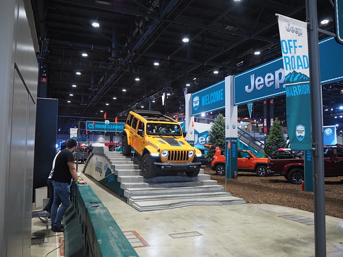
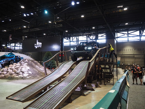
They had cars from most major car brands, and a few brands even had live demonstrations. I was able to ride in demonstrations for RAM Trucks and Jeep, which were pretty cool:

"Camp Jeep" incline at the 2021 Chicago Auto Show
Jeep incline demonstration
"Camp Jeep" ground clearance demonstration at the 2021 Chicago Auto Show
Jeep ground clearance demosntration
"Camp Jeep" unevenness demonstration at the 2021 Chicago Auto Show
Jeep uneven surface demonstration
Ram truck banked turn at the 2021 Chicago Auto Show
RAM Truck banked turn demonstration

Other than that, I don’t really have much to say, just some pictures, of which a selection is below. You can view them all here.

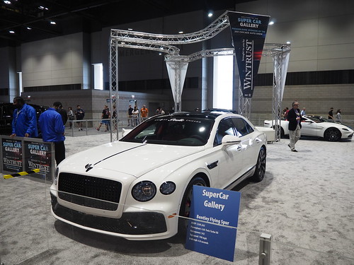
Bentley Flying Spur at the 2021 Chicago Auto Show
Bentley Flying Spur
Honda CR-V at the 2021 Chicago Auto Show
Honda CR-V
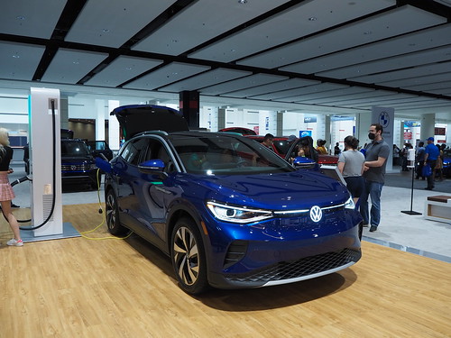
Volkswagen ID.4 at the 2021 Chicago Auto Show
Electric Volkswagen ID.4
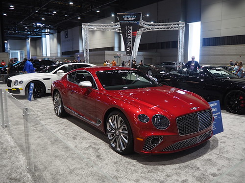
Bentley Continental GT at the 2021 Chicago Auto Show
Bentley Continental GT
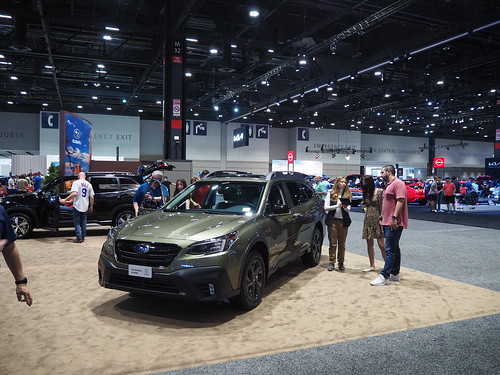
Subaru Outback at the 2021 Chicago Auto Show
Subaru Outback
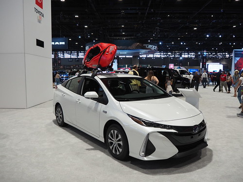
Toyota Prius Prime at the 2021 Chicago Auto Show
Toyota Prius Prime

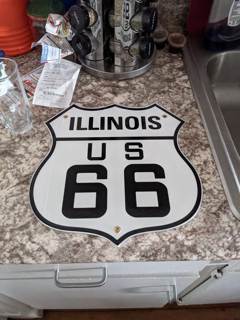
I did get a pretty cool souvenir at the gift shop though, a replica US-66 sign:

Replica US-66 sign

When I was waiting in line to experience the RAM truck, one of the brand reps saw me holding the sign and asked me if I’ve ever been on US-66. I must have made him feel old when I pointed out that it was decommissioned before I was born. I have been on “Historic Route 66” in Arizona though.

Sometimes, showing up is half the battle

At around 6pm today (June 7, 2021), a Purple Line train derailed just south of Bryn Mawr. Fortunately, no injuries were reported, and there wasn’t any major damage that I’m aware of from what I saw either in person or on the news.

Living in that area put me in a unique position to photograph the aftermath. While I was obviously not there photographing at the exact moment of the derailment, I was able to get some photos not long afterwards. I still can’t afford a drone and use a stepladder instead, which did limit my photographic capabilities, but I made do.

Specifically, the second car of the train derailed. The cars behind it and the front car seemed to remain on the tracks. The tracks on elevated structures have an additional rail in the middle for the purpose of keeping derailed trains from falling off the structure:

Track construction at Bryn Mawr
An example of tracks with the extra rail used to keep trains from falling off the elevated structure

Anyway, without further ado, here are some pictures:

Back of a derailed train south of Bryn Mawr
Back of the derailed train

I then headed to a parking lot by the site of the derailment, and while I was walking there they removed the four rear cars of the train that did not derail:

Derailed car on the North Side Main south of Bryn Mawr
Derailed car (the back car in the picture)

You can definitely see that the rear car in the picture is not properly lined up with the front car.

Later that evening, they re-railed the train and brought a “rescue train” to pull the affected cars back to the Howard Yard.

Derailed Chicago L train with rescue train
Derailed then re-railed cars (right) with the rescue train (left)

They then restored power to the affected cars:

Power restored to the derailed train
Internal lights aren’t on, but an external blue light is on

I attempted to take a video of the coupling of the rescue train to the derailed cars, but another train passed by in the process (a number of trains passed by on the other track during this time, presumably the trains that were taken out of service as a result of the derailment).

Finally, I got a video of the rescue train pulling the derailed cars away from the scene, presumably to the Howard Yard to be inspected.

Affected railcars being hauled back to the Howard Yard by the rescue train

From there, a number of CTA workers were looking at the site of the derailment with flashlights to see if there was an obvious cause in the track, such as a broken rail.

This was an interesting event to see unfold. Thankfully nobody was hurt and there doesn’t seem to be any major damage (any damage would just be to the one railcar, and even that would probably just be to the trucks, and any damage to the structure would just be the rails in that one spot). This was also one of my first times being able to document something like this in real time, the only other similar things being the last day of operation at 11th Street in Michigan City and the opening of the temporary stations at Argyle and Bryn Mawr. Hopefully I will get more chances to document interesting things in real time, though hopefully they won’t be derailments.

The start of something big in Uptown and Edgewater

Two weeks after heading to Michigan City for a station about to close for reconstruction, two other stations closed for reconstruction, this time much closer to me. At midnight on Sunday, May 16, 2021, the North Side Main Line started heavy construction for the Lawrence to Bryn Mawr Modernization Project. This is, to put it lightly, a massive project. They will be rebuilding the track structure between Lawrence and Bryn Mawr (and a little bit past each of those stations) to modernize it. The current structure is an embankment, which basically consists of two retaining walls with earth fill and ballasted track:

North Side Main embankment just south of Lawrence
The embankment from ground level
South end of Berwyn platform
Ballasted track running on top of the earth fill
North Side Main Line bridge over Hollywood Avenue, December 2020
A typical street crossing

They will be replacing this with a more modern elevated structure. They have similar structures in a few places, but unfortunately I don’t have any ground-level pictures (now that I’m writing this and realize it, I will quickly remedy that), but from above the tracks look like this (Wilson in this case, just south of the work zone):

Tracks north of Wilson

This new structure will be open underneath, since it will be supported by concrete pillars rather than a solid earth fill. In the process, they will also be rebuilding the four stations (Lawrence, Argyle, Berwyn, and Bryn Mawr). All four of those stations are fairly similar to their original 1920s designs, with narrow platforms, a single entrance (with a second exit-only staircase at the north end of Bryn Mawr), and not being accessible to passengers with disabilities. Lawrence and Bryn Mawr still feature wooden platforms, with the Bryn Mawr one particularly showing its age:

Southbound platform at Bryn Mawr
Old platform at Bryn Mawr

Berwyn and Argyle had their platforms replaced with concrete several years ago, but otherwise are pretty similar to Lawrence and Bryn Mawr.

South end of the platform at Argyle
Concrete platform at Argyle

The renovations to the stations will allow them to be fully accessible to passengers with disabilities, and also generally modernize them by making the platform wider, replacing the wood with concrete, and other things.

In the past when undertaking major reconstruction projects, the CTA has closed the line for several months with shuttle buses, like when they rebuilt the Dan Ryan Branch in 2013. In that case, they rerouted Red Line trains via the South Side Elevated (Green Line southern leg). However, in this case, since so many people take the Red Line (or at least did before the COVID-19 pandemic, and this project was planned long before then) and there aren’t any alternate routes, they still will run trains through the work zone. Since the line has four tracks, they will close two tracks at a time. The Purple Line Express will continue to run but will share tracks with the Red Line (I imagine this will be a dispatching nightmare). Lawrence and Berwyn will temporarily close, while Argyle and Bryn Mawr will remain in service, but using a temporary platform to accommodate trains running on different tracks than usual. Here is a very crude Microsoft Paint drawing explaining the situation:

Track situation prior to the start of the reconstruction project: Red Line runs on the inner tracks making stops, while the Purple Line runs on the outer tracks bypassing stops
Track situation during the reconstruction project: trains share tracks between Lawrence and Thorndale (I think they also share tracks at Wilson which is not reflected in the diagram) with Berwyn and Lawrence closed

The Last Hurrah

I set out to see the preparatory work in the afternoon on May 15 and take a photos of the stations about to close (Lawrence and Berwyn) as a sort of last hurrah.

Lawrence turnstiles the last day before closing
Turnstiles at Lawrence with a notice that the station was closing soon
South end of the North Side Main embankment from Lawrence
South end of the embankment from Lawrence
Back of a northbound train at Lawrence the day before closing
Train at Lawrence
Sign pointing to alterate stations to Lawrence
Sign near Lawrence directing passengers to head to Broadway to get to either Wilson or Argyle
Sign on Broadway to Wilson and Argyle stations
Sign at Lawrence and Broadway directing passengers to Wilson and Argyle
Looking south at Berwyn the day before closing
Platform at Berwyn
Faregates at Berwyn the day before closing
Turnstiles at Berwyn with a notice of the upcoming closure
Remaining fare machine at Berwyn
One of the fare machines at Berwyn had already been removed

The Transition

That evening, I periodically checked around the four affected stations to see what sort of preparatory work was being done. Nothing much seemed to be different until about 10:30pm, when they removed the wood covering over the Bryn Mawr temporary entrance:

Bryn Mawr temporary southbound mezzanine, immediately prior to opening
Bryn Mawr temporary southbound entrance, about 90 minutes before opening

The Argyle entrance was still closed at the time, so I returned home to post that photo and charge my camera. Then, I headed out again to check if there was anything new at Argyle, and unfortunately there was not, so I walked back to Bryn Mawr and then back to Argyle, at which point the wood paneling had been removed, making the fare mezzanine visible:

Temporary entrance to Argyle about 20 minutes prior to opening
Temporary entrance to Argyle, about 20 minutes prior to opening

I then headed to Berwyn, aiming to catch the last train at that station (which by my guess was the last one listed on Ventra to arrive prior to midnight). The train ended up arriving just after midnight, so this probably was the last train ever to stop at Berwyn (no southbound trains were listed on Ventra for a while and I couldn’t see any headlights coming from the north).

Last northbound train at the old Berwyn station
Last train ever to stop at the current Berwyn station!

From there I took it one stop to Bryn Mawr, where it stopped at the old station (now only used for northbound trains). From there, I hightailed it to the temporary southbound entrance. They were still in the process of removing the wrapping from the Bryn Mawr sign, so I waited for that, then got a photo.

Temporary Bryn Mawr entrance immediately after oepning
Bryn Mawr temporary southbound entrance

At that point, I just started photographing everything I could. A photographer from the construction contractor noticed me and explicitly invited me to take as many pictures as I can (and also informed me I was the second customer ever to board at that station). That was a nice change of pace, since usually employees get mad at me for taking photos (even though non-commercial photography is allowed without any form of permit). I took a bunch of photos of the mezzanine and passage to the platform:

Faregates at the temporary Bryn Mawr station immediately after opening
Faregates
Passage to the platforms at the temporary Bryn Mawr station immediately after opening
Passage to the platform
Bottom of the north stairs at the temporary Bryn Mawr station immediately after openingPassage to the exit at the temporary Bryn Mawr station immediately after opening
Bottom of the stairs
Temporary southbound platform at Bryn Mawr looking north, immediately after opening
Platform

Unfortunately around this time it started raining, so I was only able to take photos with my good camera under the canopy, and was limited to using my phone outside of it.

From there, I caught a train (the second one ever to stop at this temporary platform) to Argyle:

Second train to stop at the temporary southbound platform at Bryn Mawr
Second ever train to stop at the temporary southbound platform at Bryn Mawr

At Argyle I resumed photography, but the rain had intensified, limiting me again to under the canopy.

Temporary platform at Argyle, looking north immediately after opening
Temporary platform by the stairs

However, it eventually stopped raining, enabling me to photograph the rest of the platform.

Temporary platform at Argyle, looking south immediately after opening
Temporary platform and the existing platform at Argyle
Looking down the stairs at the newly opened temporary Argyle station
Stairs to the temporary southbound platform

While I was there, I also got to talk to some of the construction crew and learn a bit more about the project, and a few guys asked me to take a photo of them (I did make sure they were aware I would post it online):

People waiting at the newly opened temporary Argyle station
These people asked me to take a photo of them, so here it is

From there, I headed out of Argyle, photographing the exit along the way:

Bottom of the stairs to the newly opened temporary station at Argyle
Bottom of the stairs to the temporary southbound platform at Argyle
Mezzanine at the newly opened temporary Argyle station
Temporary mezzanine at Argyle

Interestingly, Argyle has the temporary mezzanine and regular mezzanine connected (and they both lead to both platforms), but closed the main mezzanine when opening the temporary one:

Closed regular entrance at Argyle
Main mezzanine temporarily closed at Argyle, with passengers directed to use the temporary one instead

From there, I walked up to Bryn Mawr, stopping at Berwyn to see what it looked like after they closed it:

Berwyn entrance immediately after closing
Closed entrance to Berwyn

Then I continued up to Bryn Mawr, noticing a sign at the corner of Bryn Mawr and Broadway that was not there earlier in the evening. Since Bryn Mawr now has a separate station and entrance for each direction (about a block apart), it’s important that people know which one to use, so they put up a sign at the corner to help out.

Sign to the separate Bryn Mawr stations at Bryn Mawr and Broadway
Sign directing people to the different platforms at Bryn Mawr

I also photographed more of the station since the rain stopped:

Temporary platform at the newly opened Bryn Mawr station, looking south
Full view of the platforms at Bryn Mawr, including an extension of the existing platform
Warming shelter at the newly opened temporary Bryn Mawr station
Warming shelter for cold weather

Moving Forward

Now a massive four year construction project has really kicked off. Berwyn and Lawrence are closed for four years and will probably be demolished relatively soon (I will provide photos as I am able once that happens). I really look forward to seeing the end result, even if the intermediate process is going to be a challenge. I don’t currently have a commute to work, but probably will long before this project is over, so I will be boarding at this station. I do also have the 147 Outer Drive Express bus as an alternate if this becomes too difficult.

The day after I visited Lawrence to see the station one last time before it closed.

Lawrence entrance the day after closing
Lawrence station after being closed

I also noticed there was a mural across the street from the entrance, and sadly that mural will probably be lost with the construction.

Lawrence mural the day after closing
Mural on the north side of Lawrence Avenue

It’s going to be quite the adventure, that’s for sure.