Last week I took a trip to Los Angeles and San Francisco, and I definitely set a record for the most transit systems I have ridden in a week.
Los Angeles
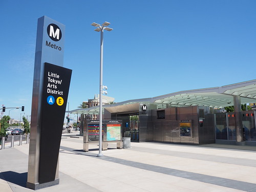
In Los Angeles I only rode one system: the Los Angeles Metro (both rail and bus). If you count the Angels Flight as a transit system, I suppose you could say I rode two. I’ve been on the LA Metro plenty of times before, and nothing new other than Aviation/Century has opened since the last time I was there.
Angels Flight in Los Angeles
Wilshire/Western on the LA Metro
San Francisco
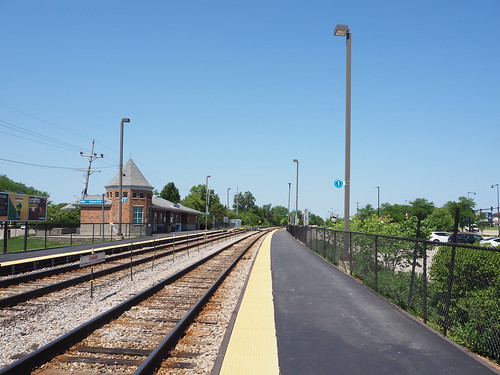
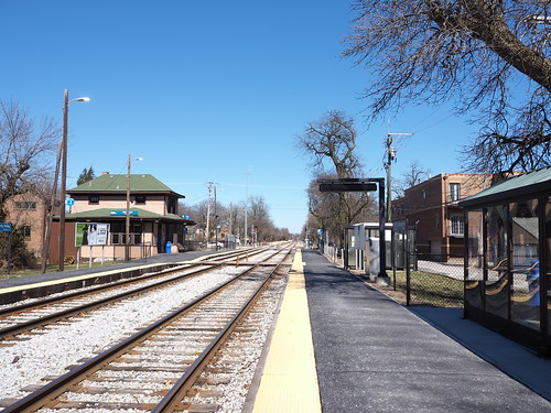
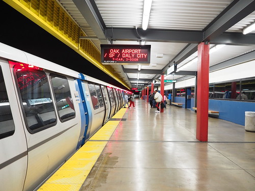
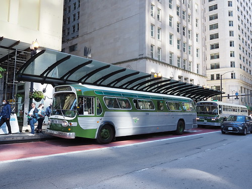
Meanwhile in San Francisco, I rode a lot of different systems. The main one on my mind was electric Caltrain, but I rode a whole bunch of others too. Surprisingly, I only spent a bit of time on Muni, but took the other systems for a lot longer since most of my travel was outside of San Francisco proper.
Muni at Embarcadero
In one day, I made a full circle around the Bay, starting in Oakland, then taking BART to Milpitas, VTA to downtown San Jose, Caltrain back to San Francisco, and finally BART back to Oakland.
BART at Lake Merritt
BART at Milpitas
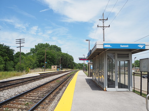
VTA at St. James
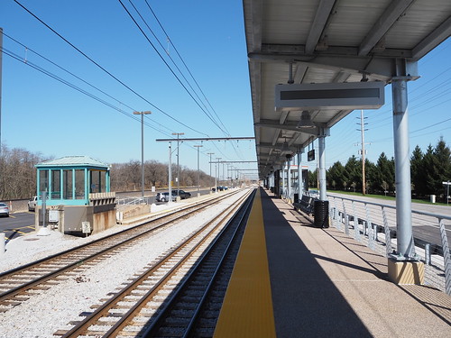
Caltrain at 4th and King
I also took a day trip up to Santa Rosa, taking BART into San Francisco, the Golden Gate Ferry to Larkspur, then SMART to Santa Rosa.
Ferry at Larkspur
SMART at Larkspur
Finally, I rented a car at the Oakland Airport and drove out to the Western Railway Museum, and after that went to Antioch to check out eBART.
Key System bridge car at the Western Railway Museum
Key System East Bay car at the Western Railway Museum
eBART at Pittsburg/Bay Point transfer platform
This means I have now taken every rail system in the Bay Area other than the Amtrak lines and ACE. Certainly was a fun journey, and I got to see a lot of cool places along the way.
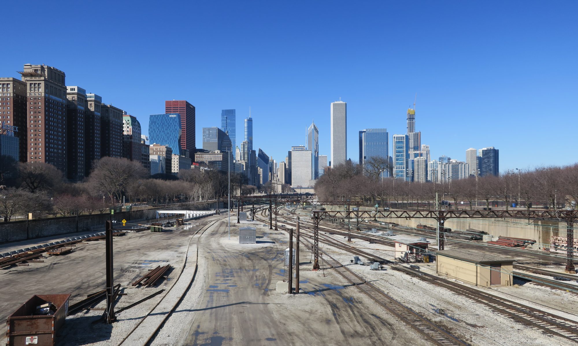
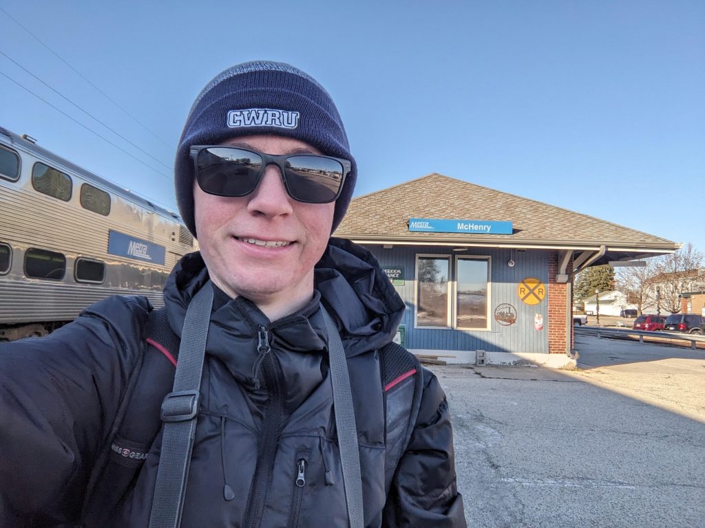
After just under six years, I have photographed all 243 stations on the Metra system, finishing off with McHenry. Anyone interested in seeing the photos can find them on this site.
McHenry, the last station I photographed
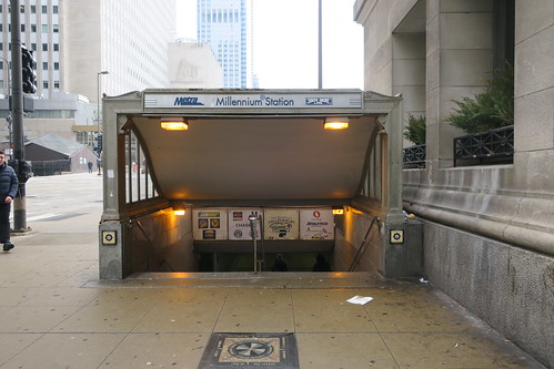
On March 12, 2019, I unknowingly started what would end up being a nearly six year long project. As part of a spring break trip to Chicago, I took a picture of Millennium Station on the way to visit the Museum of Science and Industry. I also took pictures of a few other stations on the Metra Electric District and Union Station on that trip. I didn’t at the time intend for this to be part of any sort of project, just a one-off railfan photo set.
The entrance to Millennium Station, the photo that started this all
McCormick Place, another station I photographed on that trip
After that trip I had a very strong desire to move Chicago, and a year later I would realize that desire after getting a job here. My original railfan ambitions were just to photograph all the L stations, but once I finished that in 2021, I set my sights a bit higher and decided to photograph all the Metra stations. It was certainly a much bigger challenge, since Metra runs a lot less frequently than the L with stations much farther apart and often lacking pedestrian infrastructure. Making it even more challenging is that not all of the stations have weekend service (I work Monday-Friday), so I had to devise some interesting ways to get to those stations.
Even for the stations with weekend service, getting to them was not always easy. I spent a lot of time waiting at stations for trains only running every one or two hours, walked many miles on suburban roads and trails between far-apart stations, picked up many diet cokes and chocolate milks at convenience stores near stations, and ate many meals at restaurants throughout the suburbs. Now, for some highlights:
Rails, Trails, and Ales
The Heritage Corridor doesn’t normally run on weekends, but the past few summers or falls, they have run promotional Saturday service to provide access to the natural areas near the line. I took advantage of this service to photograph the stations along the line, taking a few separate rides and walking long distances on the suburban streets, and riding a few Pace bus routes.
Lockport station, one of the stations on the Heritage Corridor
Rental car for the North Central Service
To visit the stations on the North Central Service, other than one time I had a day off work and rode out to Antioch, I rented a car to get to the various stations. I photographed every station from Prospect Heights to Lake Villa in one very long day trip with a rental car I picked up at O’Hare, and then also photographed a few stations on the Milwaukee District/North Line along the way.
Washington Street/Grayslake on the North Central Service
SouthWest Service
For the SouthWest Service, a fellow railfan with a car expressed interest in joining me for a day of Metra photography, so we went to all 12 stations from Wrightwood to Manhattan in one afternoon.
Manhattan, the end of the SouthWest Service
Station (re)openings
I was also able to attend the opening celebrations of a few stations along the way. Peterson/Ridge was the big one, being a new infill station along the Union Pacific/North Line to provide service to the western part of Edgewater.
Peterson/Ridge on opening day
I also was able to attend the opening celebration at 147th Street/Sibley Boulevard on the Metra Electric District in Harvey. The station was completely rebuilt over the course of two years. While the station had reopened earlier in the week, I was there for the opening celebration.
147th Street/Sibley Boulevard after reconstruction
Other random highlights
27th Street: unpleasant street access
27th Street definitely wins the award for worst entrance. I don’t normally do videos, but the entrance was so ridiculous that I needed to take a video to show just how obnoxious it was to get from the street to the platform.
The entrance at 27th Street
2023 Canadian wildfires
I also had an interesting experience photographing a few Union Pacific/North Line stations during the 2023 Canadian wildfires. The smoke in the air certainly gave a unique effect. Notice that there are still clear shadows and bright colors, but the sky is a dull gray.
Hubbard Woods during the Canadian wildfires
O’Hare Transfer: a missed opportunity
O’Hare Transfer seems like a major missed opportunity. It’s right next to an extremely busy airport, but the service is very infrequent and the connectivity to the airport really isn’t great. First you have to take the ATS out to the parking garage, and then walk outside a decent way to get to the Metra platforms. If they could find a way to improve connectivity and run much more frequent service, maybe something similar to the Union Pearson Express in Toronto, that would make Metra a much more attractive option to get downtown. Currently, if you factor in the time on the ATS and how long you’ll spend waiting for a train, the Blue Line is almost always the superior option.
O’Hare Transfer platforms
CPKC Final Spike Tour
In May 2024, CPKC brought out their steam locomotive as part of a tour. The Chicago leg of the tour was at the Franklin Park station, so I headed out there with a few friends to go see it.
CPKC 2816 steam locomotive at Franklin Park
Looking forward
There is more Metra to photograph going forwards. Pretty soon, the Auburn Park station will open, and in a few years we will hopefully see three new stations on the Milwaukee District/West on the Rockford extension. We also will see a few new stations on the South Shore Line this year as part of the West Lake Corridor. In addition to all that, there are a number of ongoing and planned station rebuilds and renovations, so I’ll be out to photograph those as they finish and time permits.
Today, the Peterson/Ridge station opened in Edgewater on the Metra Union Pacific/North Line. Groundbreaking was back in 2021, while the idea for this station dates back to about 2013. The station is a pretty nice modern-looking and accessible station, featuring an enclosed waiting area and ramps for accessibility. We had a brief bit of rain, but it quickly dried out. At the station, a bunch of Metra representatives were there handing out merchandise (such as wristbands, chip clips, etc.)
Outbound platform
Inbound platform
Outbound train
Drop-off area
Overall it’s a good station and hopefully will be a good driving force in the western part of Edgewater.
After three years, Double Track NWI is coming to a close. While most other interurban lines in the United States bit the dust decades ago, the South Shore Line has survived all these years, and now is getting a well-deserved upgrade. The most notable feature of this upgrade was the loss of the street-running track in Michigan City, but this also included double tracking the entire route from Gary to Michigan City that used to be mostly single-track and building several entirely new stations.
First, Miller. The station used to be a single-track low platform station with a sheltered but open-air waiting area. The second track was a connection to another line, not a passing track and was not electrified.
Old platform at Miller
Old shelter at Miller
Now, the station has two tracks, high platforms, and an entirely new station building. The station building contains seating, ticket machines, restrooms, and a currently unoccupied space for a snack bar or coffee stand.
One of the platforms
Station building exterior
Station building interior
Portage also saw an upgrade, though not quite as major. It used to be a single low-level platform to the north of the tracks with an adjacent parking lot. They kept everything that was there but also added a high-level platform to the south and a new parking lot to the south of the Dunes Highway (with a signaled pedestrian crossing).
Old station at Portage/Ogden Dunes
New high-level platform
Secondary parking lot
So, overall a pretty sweet project. The South Shore Line in many ways is the last of its kind, and I’m glad to see it’s not only continuing to operate, but being upgrade so it can provide even better service. This will provide clean, fast, reliable, and comfortable transportation for the people of Northwest Indiana for generations to come.
Two and a half years after the closure of the last of its kind street-running 11th Street station, the station has returned to life this past week. The South Shore Line is one of the last interurbans left operating in the United States, and until 2021 retained one street-running section in Michigan City. However, as part of a project to upgrade the line the street-running section needed to be removed since, despite how interesting it may be to railfans, it is slow, dangerous, and single-tracked.
Train on the old street running section in Michigan City
After a long period of running shuttle buses, the street running alignment has been replaced by a double track alignment with a one-way street adjacent to it. Here is a typical section:
New dedicated ROW for the South Shore Line and the street running next to it
The station itself has been replaced with a new modern station with high-level platforms instead of crossing a lane of traffic:
Rebuilt 11th Street station
In addition to building new platforms, a new station building is planned, which will not only feature a parking garage and ground-level retail and a waiting area, but also feature apartments above the building.
On my trip to and from the station, we got to go fast. We were no longer crawling for two miles, but instead actually going fast. Boarding also was very quick thanks to the high platforms.
While most interurbans bit the dust decades ago, this one held on and has survived to today, and now is receiving some much-needed upgrades that will allow it to continue being a vital transportation artery for generations to come.
I have been following the Los Angeles Metro since about 2014. In 2014 they had a bunch of different construction projects queued up, and I was eagerly following them to the extent I could from the other side of the country. The first project to come to fruition since I started following them was the Expo Line (now E Line) Santa Monica Extension, which I got to ride only a few months after it opened.
Downtown Santa Monica, terminus of the Expo Line extension
One project that I was really excited about was the Regional Connector, a tunnel downtown which would bridge a gap in the light rail system. Prior to the Regional Connector, to get from a station on the Blue or Expo Line to the Gold Line, you had to take the Red or Purple Line, meaning that a trip from the Westside to Pasadena would require three trains. This obviously wasn’t an ideal situation and was never intended to be a permanent solution, but was the status quo for roughly two decades. However, that gap has now been bridged by the Regional Connector, which breaks the former Gold Line into two pieces and joins each piece with one of the lines coming out of 7th Street/Metro Center. Now we have the A Line from Long Beach to Azusa and the E Line from Santa Monica to East LA.
I immediately noticed the difference going from the Westside to Chinatown. Instead of a transfer at 7th Street/Metro Center and then another transfer that involves a long escalator and a lot of walking at Union Station, I could just change trains in the tunnel, saving me a lot of time and walking.
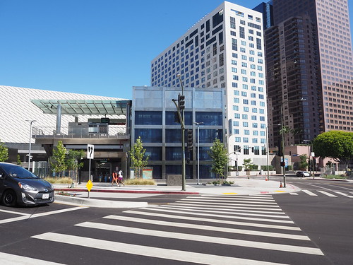
In addition to making getting around easier for people going across Los Angeles, this project also improves connectivity downtown by opening two new stations. The stations are, in my opinion at least, pretty impressive.
Platform at Little Tokyo
Entrance at Little Tokyo
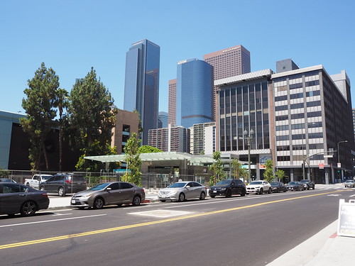
Platform at Grand Ave Arts/Bunker Hill
Entrance at Grand Ave Arts/Bunker Hill
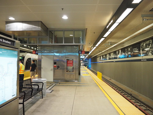
Platform at Historic Broadway
Entrance at Historic Broadway
In all, I’ve been waiting years for this to happen and am glad to see it come to life. A lot more is coming to the Los Angeles Metro in the coming years and I am excited to see it.
I am about halfway through photographing all of the stations on Metra right now. According to Wikipedia, there are 242 stations in the system, with two additional ones under construction. According to Flickr, I have photographed 120 of them so far (as of the time I write this there are three stations where I have the photos but haven’t uploaded them). My definition of a station may slightly differ from Wikipedia’s (for example I am counting Prairie Crossing on the North Central Service and Milwaukee District west as a single station), but regardless this puts me at about halfway done.
It certainly has been an adventure trying to photograph all of these stations when I don’t have a car. I was able to photograph the entire L system in about 2.5 years (and most of it was in 1.5 years after I moved here), but Metra is going to take a lot longer. For the L, the stops are mostly relatively close together, all lines run every day, and the frequencies are pretty good. Thus I was usually able to knock out 5-10 stations in a single expedition, using a combination of walking and trains between stations. However Metra isn’t so easy. For one thing, three lines don’t even run on weekends at all (I work a standard Monday-Friday schedule), so for those lines I’m limited to going during the week or finding alternate means to get to the stations. Then for the lines that do run on weekends, they run pretty sparse schedules, once an hour at best. Making things harder, way out in the suburbs the stations are often several miles apart and in many cases there isn’t any sidewalk or pedestrian path to take between them, limiting my ability to walk between them.
Despite these challenges, I have been able to get the photos I have so far. I was lucky enough that last summer, the Heritage Corridor offered promotional Saturday service, allowing me to photograph all but one of the stations on there (and the remaining one appears to be walkable from Joliet on the Rock Island District). I was also able to get a ride with a friend to photograph all of the stations on the SouthWest Service. The North Central Service will be more of a challenge, with so far only Antioch photographed (I took a day off work originally for another purpose but that ended up being cancelled, but since I still had the day off I took advantage of it being a sunny day).
For the other lines, I have used a combination of taking the train and walking long distances between stations where possible. For example there is a pedestrian trail between Ingleside and Fox Lake, allowing me to get those stations in one go. Also a lot of the stations closer to the city are in areas that do have sidewalks, allowing me to walk between them more easily (though it can still be a long walk).
Here are the tallies for each line, not counting the downtown terminus for each:
BNSF: 8 out of 25 (32%)
Heritage Corridor: 5 out of 6 (83%)
Metra Electric: 33 out of 48 (69%, including all stations within the Chicago city limits and on the South Chicago and Blue Island branches)
Milwaukee District/North: 6 out of 21 (29%)
Milwaukee District/West: 6 out of 21 (29%)
North Central Service: 2 out of 17 (12%)
Rock Island District: 15 out of 25 (60%, including all stations on the Beverly Branch)
SouthWest Service: 12 out of 12 (100%)
Union Pacific/North: 16 out of 26 (62%)
Union Pacific/West: 9 out of 22 (41%)
Union Pacific/West: 7 out of 18 (39%)
I have a lot more work to do for sure, but I’m getting there. I’ve got one line fully complete, only one station left on the Heritage Corridor, and four lines above halfway done. I also have photographed all of the stations on the South Shore Line, but will need to go back out there once Double Track is done to photograph the newer stations, and also once West Lake opens. Some of the stations are in Chicago city limits or inner suburbs and will allow me to walk between them, but some will require a combination of taking trains and walking. I’m not sure how I’ll get the stations on the North Central Service, but I’m sure I’ll make it work.
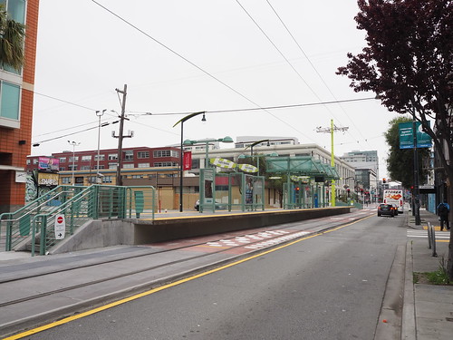
I traveled to San Francisco last week to meet up with some friends, and of course in the process took some photos of the new Muni Central Subway.
Formerly the T Third Street line after passing 4th and King continued along the Embarcadero and descended into a portal near Howard Street, continuing along the Market Street Subway and switching over to the K Ingleside. After the opening of the Central Subway, it now instead continues along 4th Street and descends into a tunnel at Bryant Street, continuing under 4th Street until crossing Market Street, then bends slightly north and continues under Stockton Street until reaching Washington Street and terminating there. Four new stations were built, one above-ground and three underground, with one station being a transfer to the Market Street Subway (both the other Muni Metro lines and BART) at Powell Street.
Actually getting these photos was an adventure since it was raining on and off the whole time, but I was able to get enough gaps in the rain at times I was able to get out with my camera to get the pictures I wanted. It also helped that a lot of the platforms were underground.
4th/Brannan looked pretty similar to the other above-ground stations on the T Third line with a high-level island platform in the street median with a ramp up at one end.
Platform at 4th/Brannan
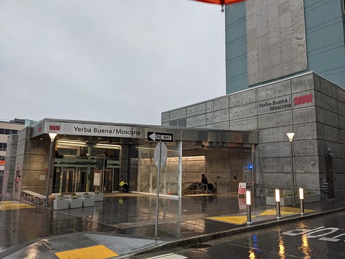
The underground stations were all very deep, starting with Yerba Buena/Moscone.
Entrance at Yerba Buena/Moscone
Platform at Yerba Buena/Moscone
The line then interchanged with the Market Street Subway (including the other Muni Metro lines and BART) at Union Square (known as Powell on the other lines). They added some new entrances since this added a new (roughly) north-south platform in addition to the northeast-southwest one already there. The photo of the entrance was one of the only moments of sunlight I got on this trip.
New entrance in Union Square
Mezzanine above the Central Subway platform at Union Square (the Market Street Subway is at the end behind where I’m standing)
Central Subway platform at Union Square
It’s also worth noting how long the escalator ride down is, since it has to tunnel under both the Muni Metro and BART tracks:
Escalator down to the platform at Union Square
Finally the line continued a few more blocks under Stockton Street, ending at Chinatown – Rose Pak.
Entrance at Chinatown – Rose Pak
Platform at Chinatown – Rose Pak
Ridership on the new extension has apparently not been great, largely due to the fact that it isn’t that well connected with other bus and rail lines and it doesn’t actually go all that far. However, there are a number of proposals to extend the line further into the northwest part of San Francisco which currently doesn’t have any rail service. There were once proposals to run BART along Geary, but unfortunately none of those came to fruition. This subway could be the first step towards filling that gap and bringing rail to northeast San Francisco.
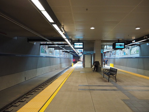
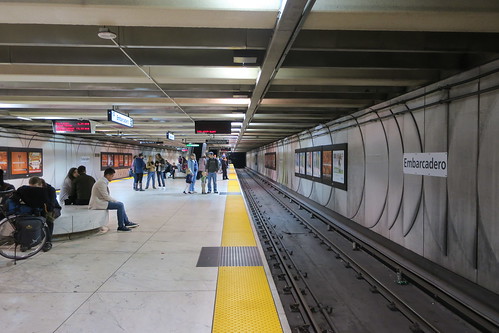
The architecture of the underground stations is pretty nice in my opinion. It’s definitely a lot more modern and impressive than a lot of the older systems, like what we have back in Chicago. I like that the stations are more open and pretty brightly lit, and the platforms are shiny compared to the dull concrete we have in Chicago. I hope that in the years to come they are well maintained and keep this appearance. Some of the older BART stations, like Embarcadero shown below, still maintain the bright and shiny appearance, so I have hope.
Platform at Embarcadero (taken in 2018)
In addition to the Central Subway project, the other big rail project in San Francisco right now is the electrification of Caltrain, the peninsula commuter rail line. I was able to take some photos of the new catenary system at San Bruno:
New overhead catenary at San Bruno
From their website, it looks like they hope to have electrification complete by the second half of this year, and electric passenger service starting second half of next year. This is exciting, and I hope that other commuter rail systems in the US consider electrifying as well.
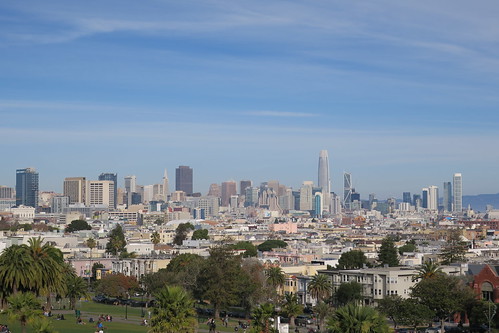
I also got a bunch of other photos, but want to focus on one other. In 2017/2018 (the week around New Years), I was on the J Church and passed Mission Dolores Park. I noticed that there was a really good view of the skyline from that station, so I hopped off and got a picture:
San Francisco skyline from Mission Dolores Park in 2018
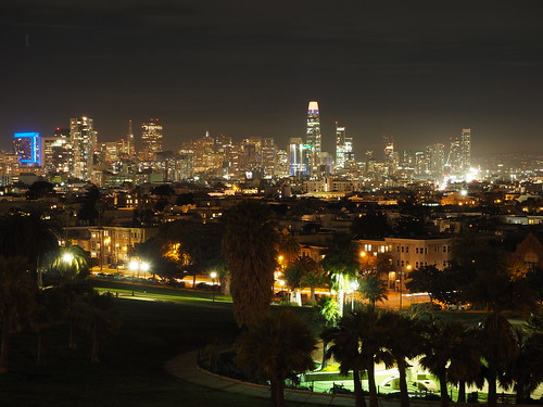
I liked how that picture came out, so I returned that evening for a nighttime picture:
San Francisco nighttime skyline from Mission Dolores Park in 2018
I was a little less satisfied with that picture. Due to a combination of a camera that wasn’t great for long distance night shots and my lack of skill with it, it didn’t come out as well as I wanted it to. When we decided we were going to San Francisco, I made plans to get a redo of that shot, and as luck would have it the first night we had enough of a break in the rain to make it happen:
San Francisco nighttime skyline from Mission Dolores Park in 2023
All things considered, I’m pretty satisfied with how that one turned out. It only took five years to get a chance to redo that shot, but I came back better than ever with a better camera and more knowledge on how to use it properly.
Another less dramatic change was the introduction of the new BART fleet. While the old trains are pretty worn out after their decades of service, the new ones are super sleek.
Old train on the left with a new train on the right
New train
New train interior
The new trains have a much more modern look to them, and they were quieter than the old ones too as an added bonus.
It was of course great reconnecting with friends, and it was great to see San Francisco again. I’m sure I’ll find myself there again someday.
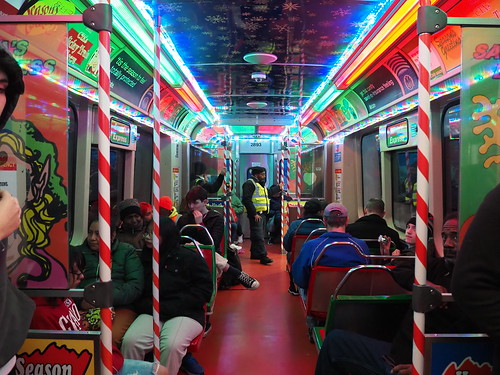
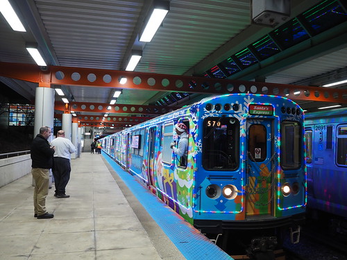
It’s that wonderful time of year, where the Chicago L runs the Holiday Train! I was able to catch it on the Green Line (and apparently the Orange Line). I caught it heading west/south on the Green Line towards Cottage Grove:
At Kedzie
Inside, it was decked out for Christmas:
Inside the Holiday Train
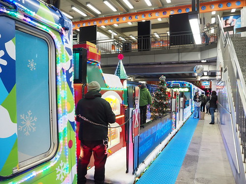
We then headed down to Cottage Grove, where I got some exterior pictures as they turned the train around:
Back of the Holiday Train at Cottage Grove
Santa flatcar
The train then headed back towards downtown, but then at Roosevelt they announced that instead of continuing back towards Harlem/Lake it would turn into an Orange Line train, running around the loop then heading out towards Midway. That was an unexpected twist of events.
At Midway
At Midway
Santa flatcar at Midway
At Midway, the train sat on the yard platform for a while, then was moved into the yard to end its run for the day.
It’s always nice to see some Christmas spirit on the CTA. It’s also a nice touch for something so many of us rely on every day. Christmas season has begun.
On October 1, 1947, the Chicago Transit Authority was formed, taking over operations for city buses, streetcars, and rapid transit lines. Today marks the 75th anniversary, and to mark that occasion, they ran several old railcars and buses in the Loop today.
First, I got to Daley Plaza around 8:45am so I could get a ticket on the first train. Not only did I get a ticket, I also scored a 75th anniversary pin and two awesome posters. The main boarding location was Clark/Lake, and the first railcar to arrive was a 4000 series train:
CTA 4272 at Clark/Lake
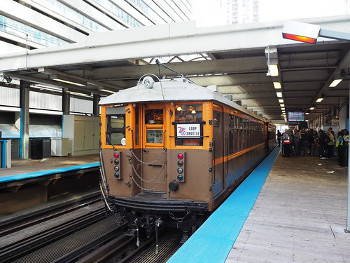
Then came the train I was booked on, a 6000 series:
CTA 6712, approaching Clark/Lake
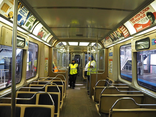
I then got to take a ride around the Loop in that car:
Interior of CTA 6712
After that, I was able to ride on a 2400 series train:
CTA 2455 arriving at Clark/Lake
I took that train around the Loop as well. The 2400 series felt a lot more familiar, not being all that different (at least from a passenger point of view) from the 2600 and 3200 series we still use today.
CTA 2489 interior
After returning to Clark/Lake a second time, I photographed trains from the other platform:
CTA 4271 at Clark/Lake
CTA 6711 at Clark/Lake
I then finally was able to catch a ride on the 4000 series train:
CTA 4000 series interior
I then returned to Clark/Lake yet again and photographed the 2400 series train and the 4000 series train together:
2400 series and 4000 series trains together at Clark/Lake
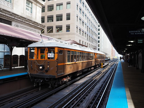
Then I headed over to Quincy to photograph the historic trains in the context of the one station that has retained its historic appearance.
CTA 2490 at Quincy
CTA 4271 at Quincy
CTA 6711 at Quincy
Then, I rounded out the day taking an old bus, GMC 301, around downtown from Daley Plaza:
CTA 301 at Daley Plaza
They also had bus 3706 on static display in Daley Plaza:
CTA 3706 in Daley Plaza
All in all cool to see. It’s a reminder of everything that it took to get us to where we are now. We are now awaiting the 7000 series L cars which will result in the retirement of the 2600 and 3200 series, and I guess that means the next time they do an event like this those will be part of their heritage fleet. Here’s to another 75 years of the CTA.