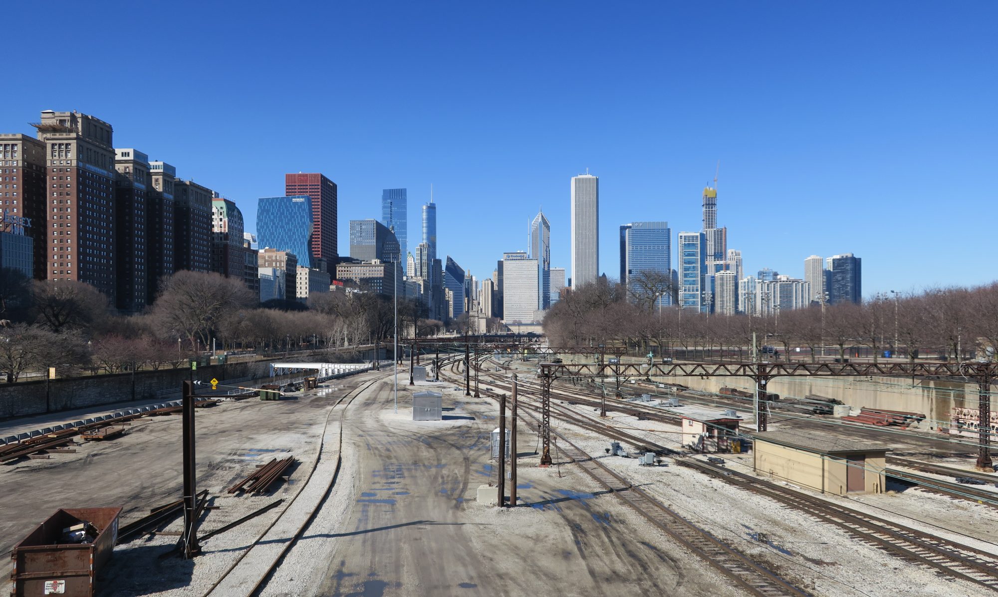
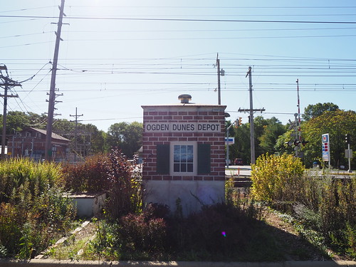
I took a pretty unusual route this time in order to 1. avoid paying more in fares than I have to (the South Shore Line is expensive and doesn’t offer any day passes, and the free westbound trips promotion I took advantage of earlier is no longer a thing) and 2. not have to constantly wait for trains. With this in mind, I checked Google Earth for where walking was feasible, as the stops are a lot closer together than further out on the line. I found that walking from East Chicago to Hammond was definitely doable, but Hammond to Hegewisch was probably not a good idea since there weren’t any direct routes with sidewalks. Hegewisch is on the CTA bus route 30, so that provided me alternate means home that was cheaper and ran more frequently than the South Shore Line. With that in mind, my route was this: 1. take the the train out to East Chicago, photograph there, 2. walk to Hammond, photograph there, 3. take the train one stop to Hegewisch, photograph there, then 4. take the 30 bus to 69th and transfer to the Red Line home.
With that plan in place, it was time to put it into action. This expedition started the day out as normal, by catching the Red Line at Bryn Mawr. The train got me downtown on time as usual, and I walked over to Millennium Station. Millennium Station had a few Metra trains operating on the South Shore Line platforms for some reason (probably maintenance on the Metra tracks/platforms).
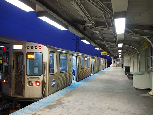
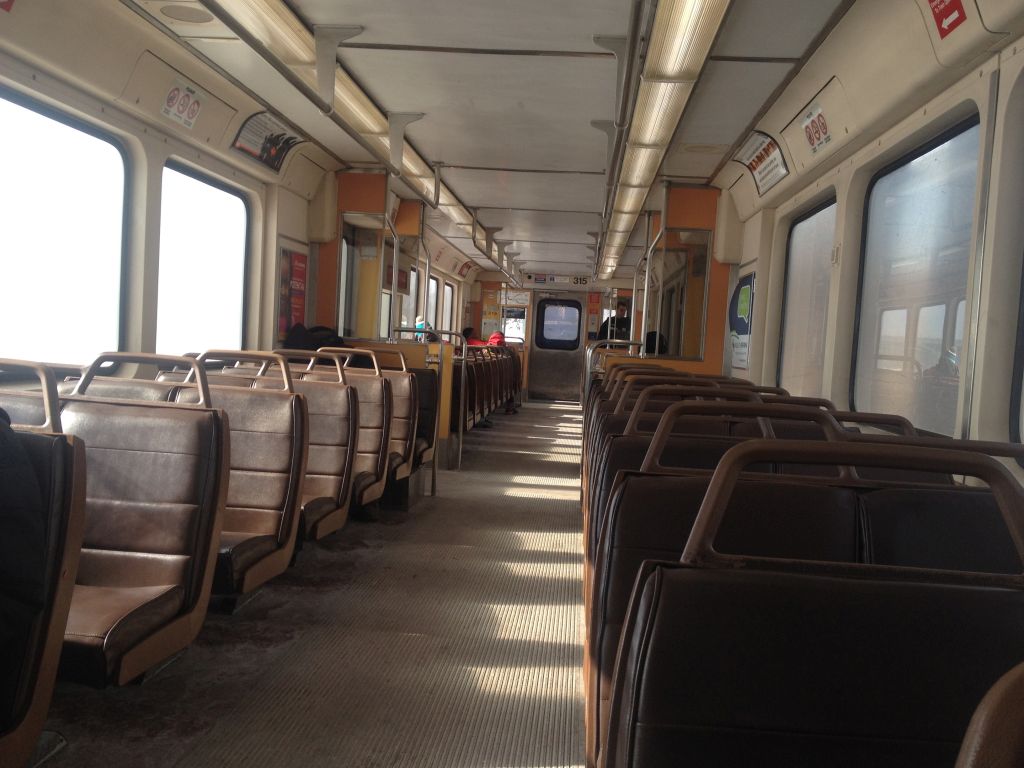
I got on the train, and noticed that half the seats were roped off to facilitate social distancing:
Seat roped off to faciliate social distancing
This was not the case last time I was on the South Shore Line in October 2020. It was good to see that they are helping with COVID preventative measures, especially when this is a system that had a “mask-optional car” last year. The train left right on time, sailing across the South Side. The first good sign of the day was when I was somewhere around Hegewisch, I was able to see the downtown skyline across the lake. That meant the visibility was over 10 miles, which is as good as it gets.
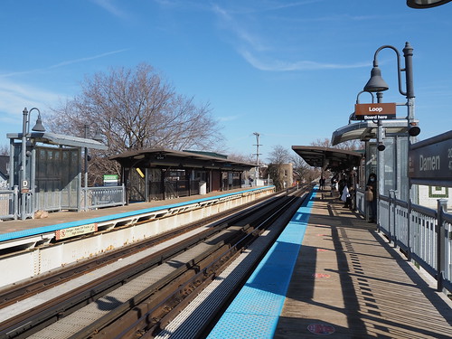
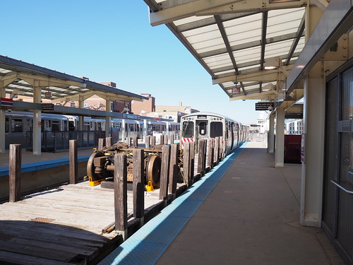
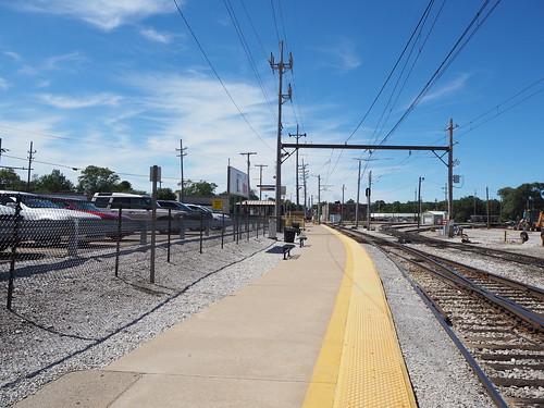
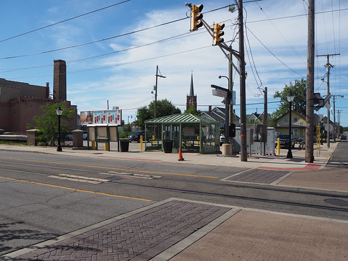
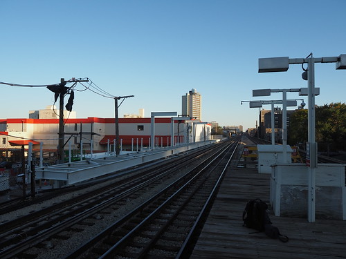
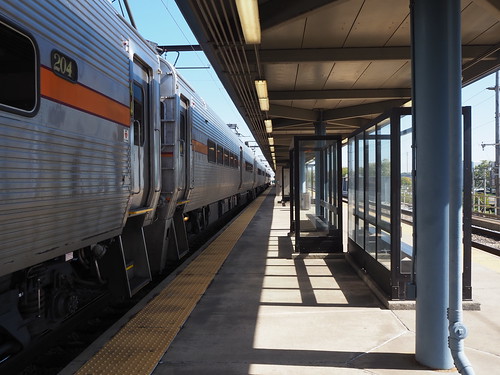
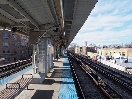
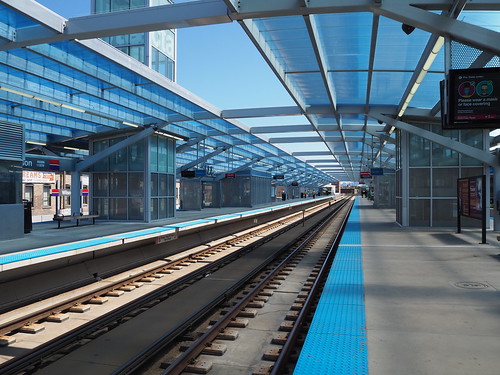
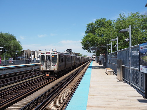
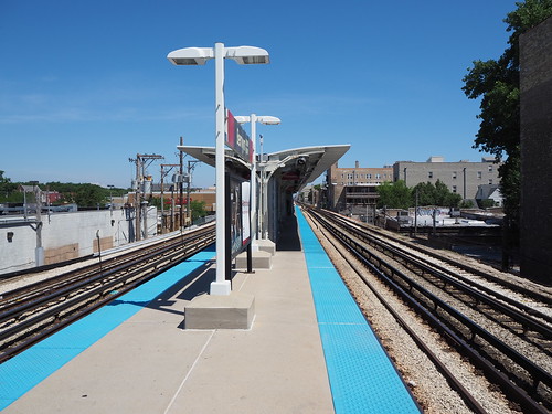
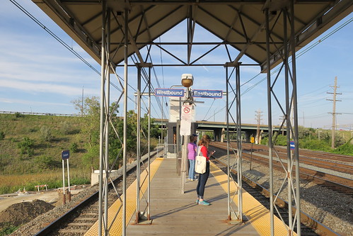
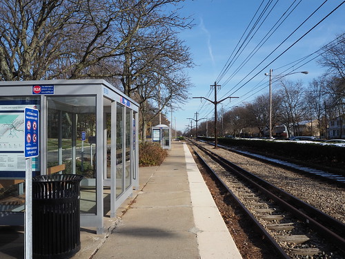
I got off at East Chicago, and immediately started snapping photos:
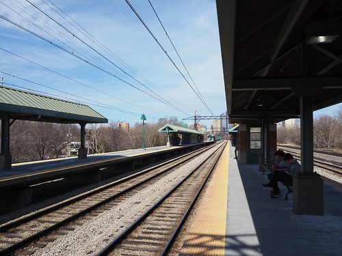
East Chicago platform
East Chicago headhouse
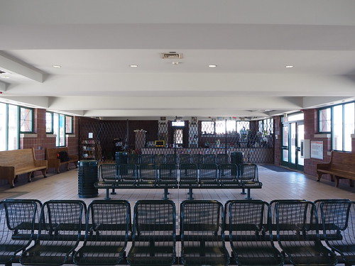
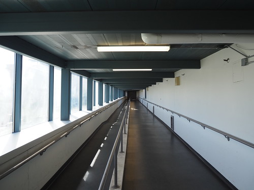
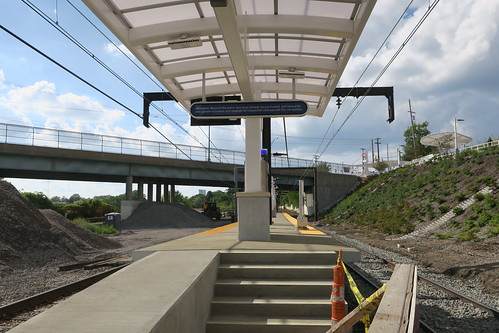
East Chicago seems to be the most substantial station on the line (other than those shared with Metra). It’s constructed on an alignment adjacent to the Indiana Toll Road, and has a center high-level platform with guantlet track to allow freight trains to pass the station without interference from the platform. There is a massive parking lot (and some overflow parking available nearby) and a station house. Due to the fact that there were two janitors cleaning the station lobby, I wasn’t able to photograph it, but it has a ticket counter, vending machines, ticket machines, water fountains, and restrooms. There also is an additional entrance further to the east to allow easier access from the far end of the parking lot.
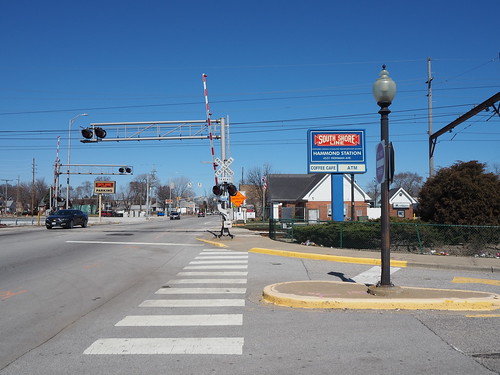
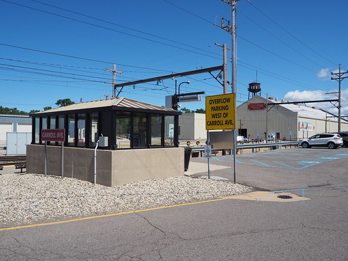
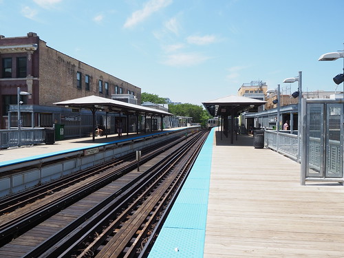
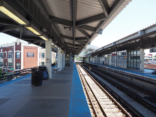
From there, I started walking towards Hammond, and after the better part of an hour, I got there.
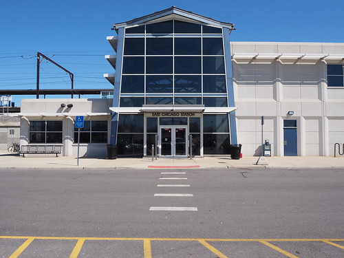
Main entrance to Hammond Station
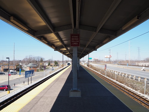
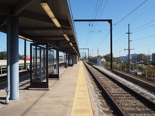
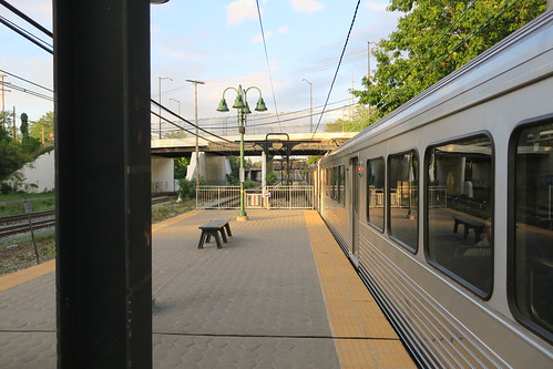
Hammond has a large station house adjacent to the station with a coffee shop (closed while I was there) and restrooms, a large parking lot, and two high-level platforms (one for each track, rather than an island platform). While East Chicago is elevated, Hammond is at ground level.
Hammond station house
Interior of the station, with a view of the closed coffee shop
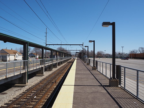
Outbound platform at Hammond
An interesting detail was that the outbound platform only had a canopy for a small part of the length, while the inbound platform had a canopy for the full length. I guess this is because there are probably a lot more people boarding inbound at Hammond than outbound.
Entrance to the platforms at the west end, by the station house
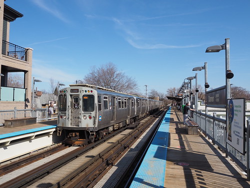
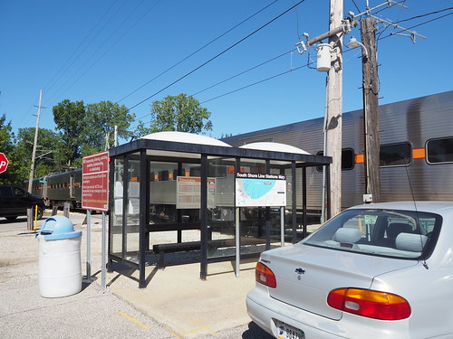
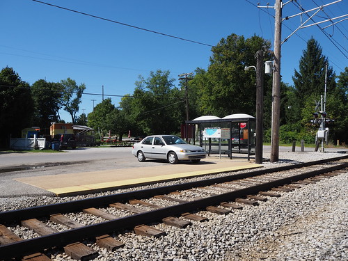
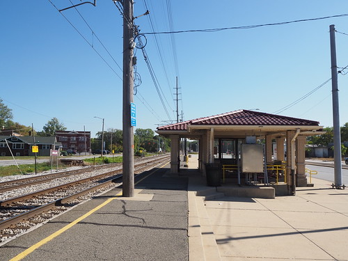
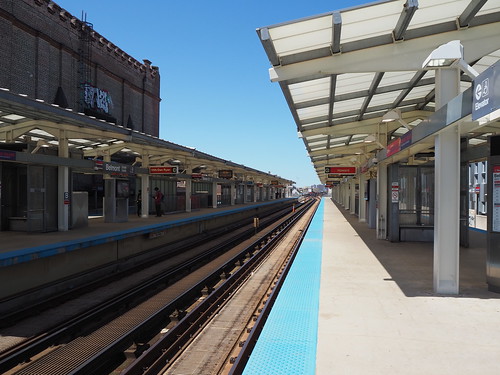
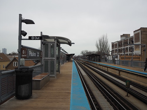
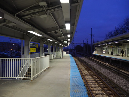
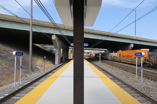
While waiting for the next inbound train, I ate my lunch, a peanut butter and jelly sandwich. Eventually, an inbound train arrived and I boarded it, only to get off one stop later at Hegewisch:
Inbound platform at Hegewisch
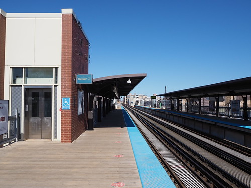
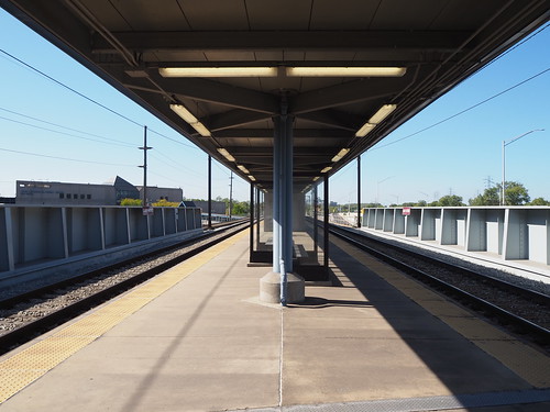
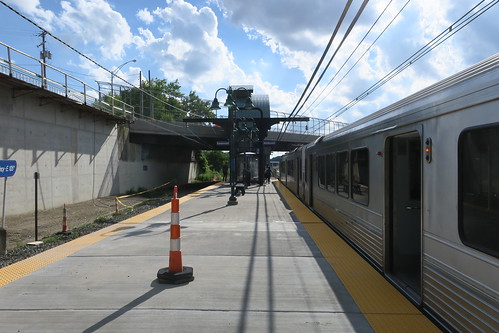
Hegewisch was laid out pretty similarly to Hammond, with a station house and two side platforms at ground level. Hegewisch also only had a full-length canopy on the inbound platform.
Station house at Hegewisch
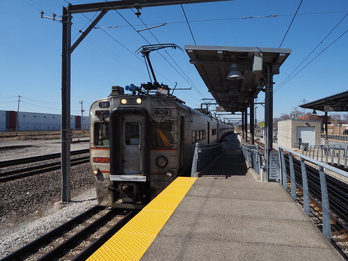
While I was photographing Hegewisch, an outbound train stopped there:
Outbound train arriving at Hegewisch
Hegewisch’s station house also had a coffee shop (also closed at the time), restrooms, and waiting area:
Waiting room at Hegewisch
From there, I caught the 30 bus to 69th.
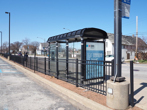
Bus shelter at Hegewisch
Along the way, there was a detour due to bridge construction, so we went over the 95th Street Bridge. To my disappointment, we did not jump the bridge while it was up, like Elwood Blues did with the Bluesmobile in the Blues Brothers.
Then at 69th, I caught the Red Line home. I wasn’t able to get too many photos there since there were a lot more people than I expected on a Saturday, but I did get a few pictures of the platform.
Platform at 69th
This was my first time on the L anywhere south of Cermak Road, and my first time boarding on a freeway-median station (I have taken the Blue Line through the O’Hare Branch, but never actually boarded or disembarked there). I will definitely return to continue my photography, but that’s a project for another day.
We had a pretty big cold snap for most of February this winter, so I was not about to go photographing anything during that time. It also didn’t help that the COVID situation was pretty bad for a while. However, the past two weekends have been quite pleasant (40 degrees or warmer and bright and sunny) and the COVID situation has improved. I took advantage of the weather to get out and photograph some more L stations. I had already photographed Paulina and Irving Park on the Brown Line, but none of the other ones. My first expedition took me out to Albany Park, on the Brown Line. I walked out to Kimball and started there.
My photos of Kimball were less than impressive, admittedly:
The entrance to Kimball
Platform with an empty track
There were a few reasons for a rough start to this photo expedition. It’s been a few weeks since I’ve done any photography, so I’m a bit out of practice. I like to shoot outdoor pictures in sunny weather whenever possible to get brighter and more vivid colors, but it does mean I need to be a bit more careful in terms of timing and positioning to have the sun where I want it (ideally the sun is high in the sky but behind me). Unfortunately I didn’t really think that through, and the sun was still in front of me when photographing the Kimball entrance, resulting in a lot of glare. Then in the station itself, I was limited in what I could do because there were a ridiculous number of CTA employees there, and also a surprising number of passengers given that it was the middle of the day on a Saturday. I understand all the CTA employees being there, given that it’s the end of the line and adjacent to the yard, but it limited what I could photograph.
The outer portion of the Brown Line is a bit different from most of the rest of the L. It runs at ground level (with street crossings) rather than elevated, and the stations accordingly have a very different design. Also note all the snow in the picture. Even though it hadn’t snowed in a while and had been above freezing for about a week, there was still a lot of snow on the ground left to melt, and I heard water going down gutters even though it was completely sunny out.
Francisco also had an interesting mosaic design on the entrance ramp:
Mosaic on the Francisco main entrance ramp
And, of course, there were grade crossings adjacent to the station:
The station looked more or less the same as Francisco, and from there I waited for the next train to Western.
Outbound platform at Western
Unfortunately I didn’t have the opportunity to capture that many pictures at Western because a CTA employee spotted me taking photos and (incorrectly) informed me that I needed a permit to take photos. I explained that I am taking non-commercial photos and their own photo policy says “The general public is permitted to use hand-held cameras to take photographs, capture digital images, and videotape within public areas of CTA stations and transit vehicles for personal, non-commercial use.” My photos are for non-commercial purposes and were taken with a hand-held camera in a public area, therefore I was in compliance with the rule. She didn’t seem to care and told me “well in the future, be aware of this.” I will definitely return to take more photos, hopefully on a day that person isn’t stationed there.
Regardless, I headed over to Rockwell, and along the way got a photo of the tracks rising from grade level to the elevated structure:
Tracks rising from ground level to the elevated structure between Rockwell and Western
I also got a photo of the bridge over the North Branch of the Chicago River:
Brown Line bridge over the North Branch of the Chicago River
Unfortunately there doesn’t seem to be any pedestrian path along the river, so I couldn’t get a closer picture (this picture was taken from another bridge). Maybe one day I will be able to rent a kayak to get a photo from closer. From there, I entered Rockwell:
Platform at Rockwell
Rockwell is unusual in that it only has one entrance, while the other ground-level stations (except Kimball) have an entrance at both ends of the platform. Other than that though, it looks like the other ground-level Brown Line stations.
From Rockwell, I caught the next train to Montrose.
Platform at Montrose
Montrose had a cool set of exit-only stairs that met at a right angle (usually they either meet head-on or have separate exits) for a combined exit:
Brown Line structure and alley north of Montrose, just south of the curve
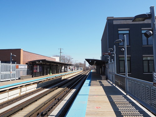
Platform at Damen
Outbound train entering Damen
There, I decided to call it a day and headed back home (this time using the train instead of walking). I caught the next inbound train to Belmont and transferred there. While waiting for the Red Line at Belmont, I saw a rather interesting traffic jam. A southbound Brown Line train was holding just south of the station on the Red Line track (southbound Brown Line trains were running on the Red Line track due to construction). However, it was not far enough past the station to clear the signal for the track by the platform, so a southbound Red Line train behind it had to hold north of the station. Where it was holding, it blocked the Clark Interlocking where the Brown Line diverges from the Red Line, so a northbound Brown Line train was stuck at the station since it couldn’t proceed due to the junction being blocked. (Note that the Red-Purple Bypass project will prevent this kind of problem in the future, but that’s still a work-in-progress right now.)
Eventually they announced over the PA system that there was “police activity” at Wellington, which was causing the delay. A few minutes later, the first southbound train resumed moving again, allowing the second southbound train to enter the station and clearing the interlocking for the northbound Brown Line train, clearing the traffic jam and allowing trains to resume as normal. While waiting, I got a photo of the current state of the Red-Purple Bypass:
Red-Purple Bypass
Then a northbound Red Line train came and I took that back home.
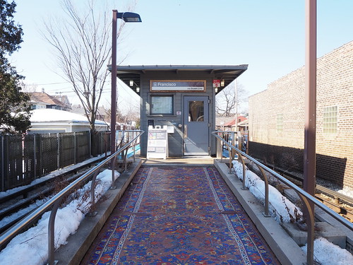
The next weekend, Saturday, March 6, I continued my work. I first walked to Addison on the Brown Line to finish photographing the Brown Line, with only Addison and Southport left. They were doing some welding on the track structure at Addison by the entrance (I don’t have any pictures since I didn’t want to risk damaging my eyes by looking at welding), but otherwise it was a pretty quiet morning there.
Inbound platform at Addison
I definitely was off to a better start than I was at Kimball the previous weekend. Not a bad photo to start the day. From there, I caught the next inbound train to Southport.
Southport Station
Entrance to Southport
From Southport, I walked over to Belmont. I got a bit confused in terms of what direction I was walking from Southport since I was paying too much attention to my photos and not what direction I was going (I was watching for cars and other people though). At Belmont, I got a treat I hadn’t seen before: a work train.
Work train heading north on the Red Line track, strangely with a “Midway” destination sign
Flatcar carrying a rail truck on it
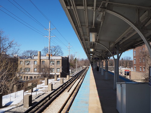
I don’t know what that train was for, but it was cool to see. With that, I had conquered the Ravenswood Branch! From there, I set about finishing my work on conquering the Evanston Branch. I had already photographed Howard, Main, Dempster, Davis, Central, and Linden on other expeditions, so I just had to get the remaining three: South Boulevard, Foster, and Noyes. I caught the next northbound Red Line train at Belmont to make that happen.
At Howard while waiting to transfer to the Purple Line, I saw that work train again. Since there were so many people out, I didn’t photograph it again, but my guess is it was headed to the Howard Yard.
Eventually, a Purple Line train came, and I took that to Noyes.
Platform at Noyes
Several of the northern Purple Line stops used to be stops on the interurban North Shore Line, which had separate platforms (with separate fare collection). The platforms have mostly been demolished, but the supports remain:
Remnants of the North Shore Line platform at Noyes
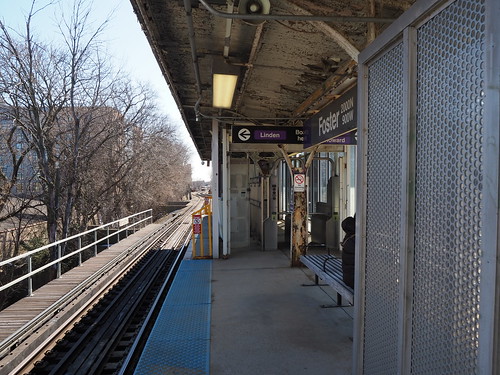
Leaving Noyes, I walked to Foster, only a few blocks south:
Platform at Foster
It was also interesting that Foster and Noyes had platform-level faregates, while most other elevated stations do fare collection at ground level. It was difficult to photograph this because people tend to congregate by the entrance.
Platform-level faregates at Foster
Finally, for what I figured would be my last station to photograph for the day, I took the next train to South Boulevard:
Platform at South Boulevard
South Boulevard is interesting for having a “team track,” a diverging spur track. According to chicago-l.org, it dates back to when the line still carried freight for local businesses to load/unload content from railcars. Unfortunately, I couldn’t photograph the team track from ground level since there was a fenced-off area between the parking lot and the end of the track, so I was only able to photograph it from the platform:
“Team track” diverging from the northbound track at South Boulevard
From there, I started walking back to Howard. Just outside the Howard Yard, I saw another photography opportunity: where the Purple and Yellow Lines cross Chicago Avenue (which changes names to Clark Street just south of there):
Purple Line bridge
Yellow Line trench
Then, as I was walking east on Howard Street, I saw a new angle from which I could photograph the Howard Station that captured a good full-profile image of the station in a way I hadn’t before:
Howard Station from the northwest on Howard Street
With that, I had photographed every station on the Ravenswood and Evanston Branches! Not bad. I will definitely go back for better pictures at some of those stations as time permits, but still a good start to my project to photograph every Chicago L station. The remainder are going to be a bit trickier, since they require going downtown (or in the case of the outer portion of the Blue Line, catching a bus). Because COVID is still a thing, I’m trying to avoid going downtown if possible, and I hardly think this photography project counts as “essential travel.” The vaccine is coming though, so fingers crossed we can safely resume mostly-normal life soon.
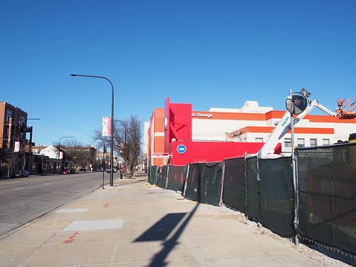
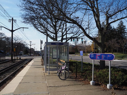
The temporary southbound Bryn Mawr station has been in the works for quite a while. The station is located between Bryn Mawr and Hollywood, right off of Broadway and will open sometime early 2021 once heavy construction starts on the Lawrence to Bryn Mawr modernization project. From what I could see from the street, progress had been going well, but I never bothered to photograph it much, but a few days ago I was walking by there on December 23 (Festivus!) and noticed it was actually starting to look something like a (temporary) train platform and not just a construction site:
Temporary entrance, viewed from the north on Broadway
I didn’t have my real camera with me, just my cell phone, and it was dark, so the photo was not the best quality. Still, definitely looked like something I wanted to photograph in more detail when I had the chance. The issue remained that there was a covered fence that I couldn’t easily reach over, and I didn’t have anything that would help me (I didn’t even have a selfie stick, not that it would help with my big camera).
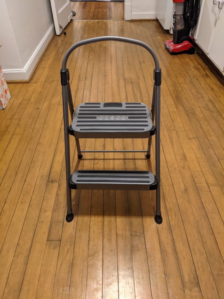
I decided that I would make my own overhead photography system. However, I currently can’t afford a drone and am definitely not ready for one anyway (I’m gonna wait until I’ve mastered photography on the ground before I start adding piloting a drone to the mix). So, I improvised, and came up with this:
My wonderful overhead photography system
Yup, it’s a stepladder. The fence is just taller than I can reach over with my camera, so I figured with the help of a stepladder I’d have just the boost I need to see over the fence.
I knew this would be a little more suspicious than a drone, given that I would be standing right next to a fence on top of a stepladder holding a camera. While nothing I was doing was actually trespassing, I knew people would not have taken kindly to seeing this. Thus, I figured Christmas would be the perfect day to try this, given that likely the construction workers would probably all have the day off. As an added bonus, it was also completely sunny and pretty cold (22 degrees at the time I took the photos according to my phone). This both led to good photography conditions and a further disincentive for others to be outside. So, with my stepladder and camera, I got cracking.
First, I just started with what I could get without a stepladder:
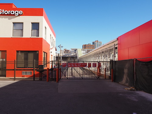
The entrance and fence from the south on Broadway (you can also actually see the CTA logo now since it’s not washed out due to the darkness and cell phone camera)
The passage from the north – this goes directly adjacent to the Public Storage parking lot
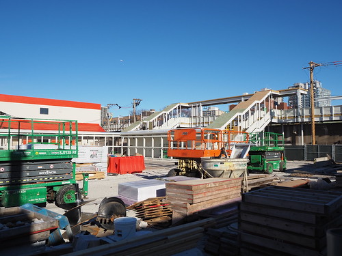
Then I actually got into action with the stepladder from Broadway and an alley running along the south end of the site.
The stairs to the platform (I don’t know if there will be an elevator, but I’m guessing not since the existing Bryn Mawr station doesn’t have one)
The entrance structure from the southeast
Then I made my way to the alley by the railroad embankment. It didn’t look like I would be able to get much of a view with the stepladder from there, since the passageway being built would block my view of anything further.
The alley between the construction site and the tracks, passing under the stairs
The alley from Hollywood
Tracks crossing over Hollywood (not actually part of the construction site, but this will be replaced as part of the larger project so I figured I should photograph it for archival purposes)
Then I finally went to the other side of Broadway to get some less up-close pictures of the entrance.
The entrance
…and that’s what will soon be the southbound station at Bryn Mawr for around two years (after which they’ll need to open a new temporary northbound station on the other side of the tracks). Northbound passengers will still use the existing station for the first portion of the project. The idea is that all lines will be funneled onto two tracks (from a normally four track line), so the island platform right in the middle can serve southbound trains when all trains run on the western two tracks and northbound trains when all trains run on the eastern two tracks, and the direction not served by the island platform will be served by a temporary station.
I will make sure to continue photographing this as I am able. Odds are there won’t be much more interesting to see until the temporary station actually opens, but I will absolutely be there to photograph that.
The Chicago Transit Authority is currently in the process of rebuilding the Clark Interlocking, where the Ravenswood Branch (Brown Line) diverges from the North Side Main Line (Red/Purple Lines). Long story short, the current interlocking is all at one level, and when northbound Brown Line trains diverge, they must cross three other tracks, blocking them. In order to reduce delays and increase train capacity, the junction is being rebuilt so that northbound Brown Line trains will use a flyover to pass over the other three tracks so trains can continue underneath them.
I am doing my best to photograph the progress as it goes on, though I am somewhat limited in what I can do from the ground while the system is elevated, and I am avoiding unnecessary travel on public transportation due to the ongoing pandemic, which means I can’t get pictures from the nearby Belmont station platform either. Still, here’s what things looked like back over the summer:
Progress in June, 2020
I haven’t been down there for more photography since then, and this weekend I decided that given the sunny weather, I should go down there again. This time though, I walked and did not enter the station to minimize COVID-19 risk. Here’s how it looks now:
Progress in December, 2020
They’re starting to lay the trackbed now, so that’s definite progress. The apartment building that was under construction in my June photo also looks completed, at least from the exterior. The track passes surprisingly close to the building though, and given that the building was still under construction in June, there’s no way they could have built it without knowing about and coordinating with the CTA construction. I guess one lucky tenant will have the train going right outside their window. Interestingly a situation like this exists on the Singapore LRT where it passes very close to buildings at some points, but on that system they actually frost the windows to preserve privacy for the occupants of those buildings. I know there is no way the CTA rolling stock supports that, and I somehow doubt our new railcars will either. Still, I don’t live there, so not my concern.
A side note: when I was there, I got one-upped by a guy taking a photo from above with a drone. That’s way better than what I can do from the ground given the elevated nature and the fact that I can’t (or at least really shouldn’t) walk on the tracks. One of these days I’ll try using a drone, but I want to master my photography skills from the ground before I start adding flying to the equation. I talked a bit with the guy flying the drone, and he indicated that they will be laying track for the actual overpass (i.e. above the existing track) fairly soon.
While I was there, I also photographed the track in the area, and I definitely got a very strong “Chicago” vibe from it:
Alley underneath the Brown Line tracks
Inbound train approaching the station
I then walked back home and got a few photos on the way back. I realized I haven’t really photographed Edgewater, my own neighborhood, much, which is a shame given its distinct (and awesome) character, so I got some photos there too.
Addison station from street level
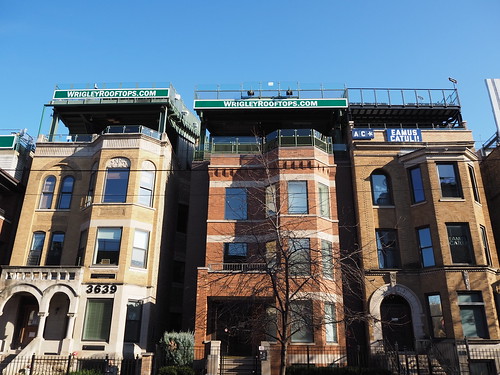
Wrigley Rooftops
Edgewater Beach Hotel
Apartment building at Sheridan and Catalpa, I don’t know the name of it
The Bryn, apartment building at Sheridan and Bryn Mawr
Anyone who has read basically any post on this blog will know I’m really big into urban transit. For some reason, I have found myself obsessed with the South Shore Line far more than any Metra line. I guess the reason being the South Shore Line’s uniqueness, both relative to Metra and to other commuter rail systems? Anyway, I have set out to photograph the entire South Shore Line. I also felt a stronger urgency to photograph the South Shore Line since a project is supposed to start relatively soon that will double-track the line between Gary and Michigan City and rebuild the stations along the line in the process. While this project will definitely be a major service improvement, I wanted to document what’s there now before it happens.
I have currently photographed every station in and east of Gary, but still have Hegewisch, Hammond, and East Chicago left. Since those are a lot closer to Chicago, they’ll be easier to get to. The further out ones were a bit more of a challenge.
The first big challenge is cost. The South Shore Line does not sell daily or weekly passes, only monthly passes. This means that I would have to pay a separate fare for each leg necessary to get all the stations, and when you add that up between all the stations, it gets real expensive real quick. However, I encountered a nice twist of fate. As part of the measures to welcome people back during the pandemic times, they temporarily made westbound travel free through the end of October. This was a game changer, since it meant in any given day I could take the train all the way out to the furthest east point I intended to photograph that day, then take short hops to various stations on the way back. In doing so, I would only have to pay the fare for the one outbound trip, since all the hops inbound were free.
The second big challenge was scheduling. This is not the L, this is a commuter rail line. Consequently, it does not run all that frequently, especially on weekends. This meant I needed to plan ahead based on the train schedule to avoid spending hours at a single station and not being able to photograph any others. I managed to make that work with a bit of cleverness and planning, but it did mean that my photography expeditions were full day endeavors. So, without further ado, here is how it went.
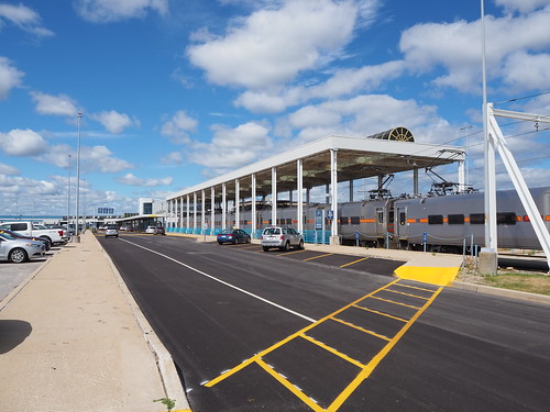
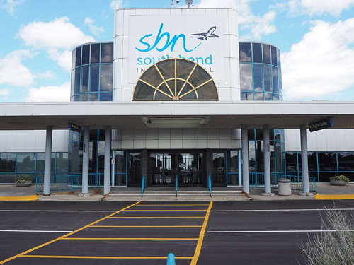
Expedition 1: South Bend and Michigan City
I figured I might as well knock out the furthest and most expensive stop first, so I went all the way out to South Bend. The weather that day was mostly sunny with scattered clouds. I caught the Red Line downtown, then got on the 8:45am train to South Bend (the first one of the day). I got to South Bend and quickly got to work taking pictures, since my train was going to leave again about an hour later.
South Bend Airport station
The main entrance to the airport itself
The platform
From there, my plan was to take the train to Carroll Avenue and walk to 11th Street, since those two stations weren’t all that far apart. I got back on the train at South Bend, and the conductor recognized me from the trip out. When getting our destinations (they need to know where everybody’s getting off since there are a few flag stops) he automatically assumed I was going back to Chicago since he knew I got on there. I quickly explained I was going to Carroll Avenue and that was resolved. I didn’t particularly want to explain why I was going the route I was (not all transit employees like people photographing their systems), but later on he asked what I was doing and I had my camera bag pretty obviously visible so there was no hiding it and I explained briefly what I was doing, and he actually said it sounded like a cool project. It was nice to get approval from a transit employee for once.
Once I got to Carroll Avenue and got off the train there, I got to work photographing the station. The station is a low platform with a wheelchair lift and located directly adjacent to both a South Shore Freight facility and the main South Shore Line storage yard and maintenance shops. I really was hoping to get some photos of the yard, but unfortunately it didn’t look like there was anywhere I could (legally) go to get a good photo. Still, I got plenty of pictures of the station. The sky had also cleared up some more, so I got some nice bright shots.
The platform
My train after letting me off
The shelter
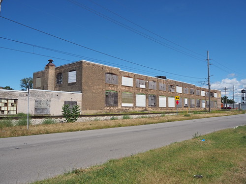
I was going to head out but then found my path was blocked by a pair of freight locomotives in the main driveway, so I had to wait for them to move before I could go anywhere. Once they did, I started walking towards 11th Street. Along the way I found a few abandoned buildings.
Locomotives blocking the driveway
Abandoned building just outside of the station
Another abandoned building at Michigan and Porter
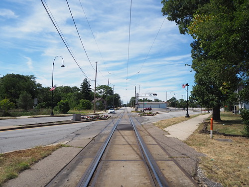
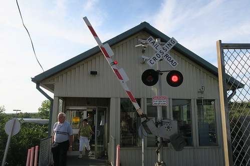
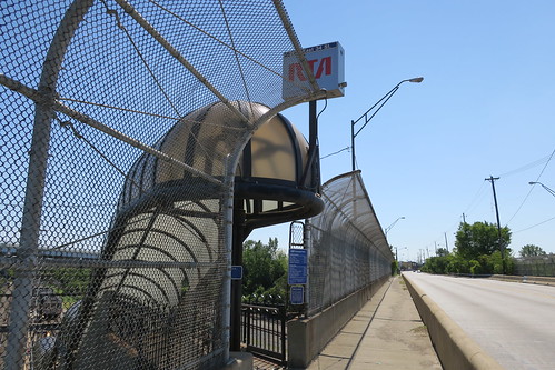
Then, I got to where the tracks enter the street. This is a very uncommon sight and will disappear in a few years, so I made sure to photograph it.
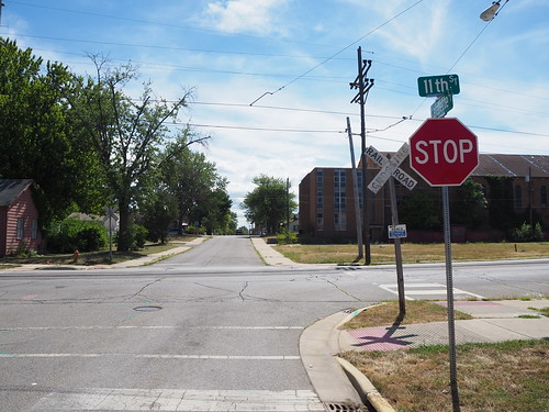
East end of 11th Street, where the tracks enter the street
I then made my way down 11th Street to the station. There were a few people waiting at the station for the next (eastbound) train, so I didn’t take any pictures with them in it and waited for their train to arrive before taking pictures where the interior of the shelter was obviously visible. The 11th Street station is unique in that it is located in the middle of the street. No platform whatsoever, and you have to cross a lane of traffic to board. It’s similar to a tram stop, except this is a full-sized commuter train. The train runs in the middle of the street for two miles and some change, a very unusual setup these days. This is a relic from the interurban heritage of the line.
Some in-street trackage
An outbound train stopped at the station
I then continued down 11th Street and eventually got to the point where the tracks switch from 11th to 10th and cross the Amtrak line. There were also a few abandoned buildings there.
Crossing the Amtrak line
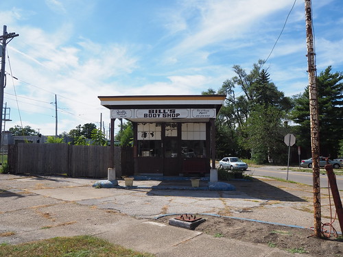
Abandoned auto body shop
Abandoned print shop
Seeing the abandoned buildings and run-down houses, I had the song “Boulevard of Broken Dreams” going in my head. That song wasn’t referring to any literal street, but I felt like if there was any street it applied to, this was probably pretty close. I didn’t take any pictures focusing on abandoned houses since I felt bad about doing that, since, ya know, that used to be someone’s home. I did take pictures of abandoned commercial properties though.
Then, I got to where the tracks leave 10th Street and return to their own right of way.
The tracks leaving 10th Street for the rest of the journey to Chicago
Tracks in 10th Street
A typical intersection with the street running track – no bells or anything, just a crossbuck and stop sign
From there I headed back towards the 11th Street station. Once I got back to the station, I started getting photos of everything I couldn’t before. I also finally got to eat lunch (a sandwich I brought with me) and got a soda from a convenience store for a little caffeine. From there, I waited for my train. One thing that amused me at 11th Street was the electronic sign reminding me to watch the gap between the platform and the train. Uh, there is no platform at all? I have to step up from the street.
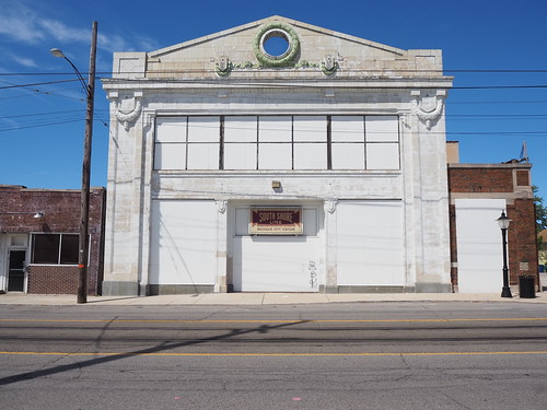
The former station house – from what I can tell this will be converted into a parking garage as part of the reconstruction project
The station shelter
Expedition 2: Hudson Lake, Beverly Shores, and Dune Park
Taking advantage of another sunny day, I planned another expedition. Doing some research on Google Earth, I found that I could walk from Beverly Shores to Dune Park via the Calumet Trail, so my plan was to take the first train for the morning to Hudson Lake, then take a train from there to Beverly Shores and walk to Dune Park in order to maximize how many stations I could photograph on a weekend schedule.
The trip to Hudson Lake was pretty uneventful. I got on the train at Millennium and got off at Hudson Lake. The one important thing was I originally got on in the third car, while you can only get on/off at Hudson Lake in the first or second car since the platform is only long enough for one car (the doors at the back of the first car and front of the second car are the ones that stop by the platform). Thankfully I found this out from the conductor when he checked my ticket and saw it was to Hudson Lake, so I knew to head to one of those cars when we were getting near Hudson Lake. Once I got to Hudson Lake, it felt like I had entered a whole new world. After having been in Chicago for such a long time and only leaving to visit South Bend (and then just the airport) and Michigan City, my mind was entirely on urban areas. Hudson Lake is very much rural, so that was a bit of a shock. Still, I got to work photographing the station (not much of a task, given that the station is just a short concrete platform, shelter, and small parking lot).
My train after dropping me off
The station in all its glory
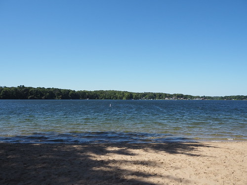
From there with an hour and some to kill, I walked around Hudson Lake photographing various things. It took a while to find a public beach, but eventually I did. I got some photos of the water from the beach and also found a sand mermaid someone made. There were a surprising amount of boats docked there as well. Then I continued walking around the lake and photographing the sights. Eventually I made my way back to the train station and caught the train to Beverly Shores.
Sand mermaid
Boats docked at the beach
View across the lake
Typical street near the lake
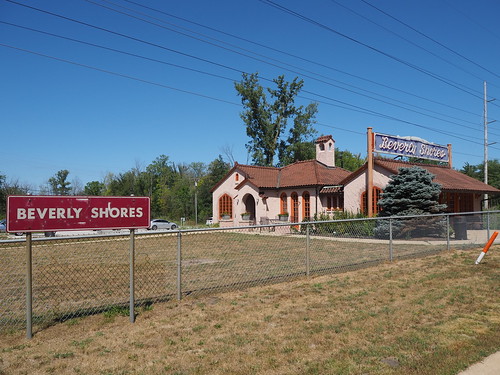
I got off at Beverly Shores with little fanfare, but did make sure to notify the conductor since it’s a flag stop and there was no guarantee anyone else was getting on. I then started photographing there. The station is strange in that while the actual railroad facilities are pretty minimal (standard platform, shelter, and parking lot kind of deal), there was an old station house that is now an art gallery. That station house was built in Mediterranean revival style, which felt very out of place for rural Indiana. Still, it was a cool piece of architecture, even if out of place.
The station platform
The station building turned art gallery
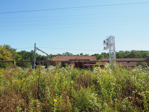
Then, after I took a bunch of photos, I headed to the Calumet Trail to begin walking to the Dune Park station. The trail felt kind of desolate. While near the Indiana Dunes, I was not actually on the lakeshore. Instead, it was just a wide clearing in the forest containing (from left to right) the road, the railroad, power lines, and the trail.
Pretty standard view on the trail
Power substation
Trail with a view of the railroad
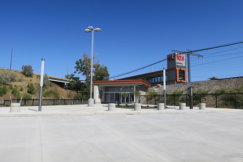
Dune Park Station! Made it!
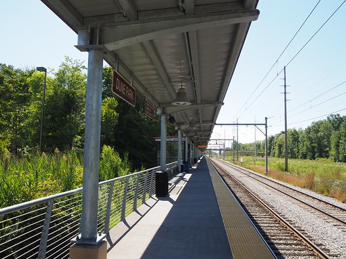
Still, despite the feeling of desolation, it was a nice feeling walking down it. I did see random pieces of power company infrastructure along the way and made sure to photograph those. Then after a few miles, I got to the Dune Park station. That station is an oasis in an otherwise fairly empty area. It has a big station house with a waiting room and high platform, despite not being all that close to any population centers. I immediately got to work photographing the station, and since it had a waiting room, nobody was hanging out on the platform, making it easier to avoid including people in my photos. I also got a soda from the vending machine there (gotta have that caffeine). Eventually my train arrived and I headed back home.
The platform at Dune Park
Main station house entrance
With that, I had photographed every station from Dune Park to South Bend.
Expedition 3: Portage/Ogden Dunes and Gary
For my third major expedition, I finished out the future construction zone. This time I actually took a day off work and went during the week since the first available opportunity with clear skies was during the week. Doing this meant that I could travel with the weekday schedule though, which meant more frequent trains. The weather definitely did not disappoint. It was in the 60s and completely clear skies. I could not have asked for better weather.
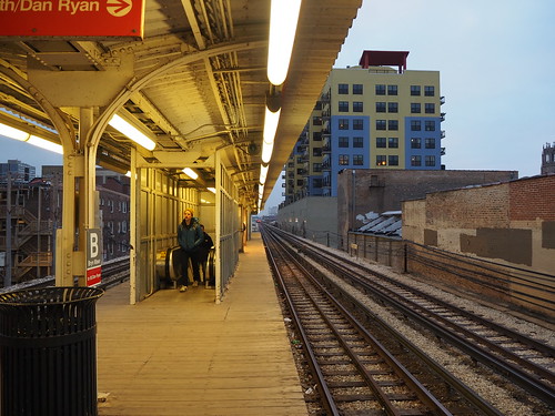
As usual, I caught the Red Line at Bryn Mawr in the morning. I hadn’t taken the Red Line in a while and they had started some construction work on a temporary platform for when the Red Line reconstruction project begins, so I photographed that while waiting for my train:
Temporary platform adjacent to the southbound express track
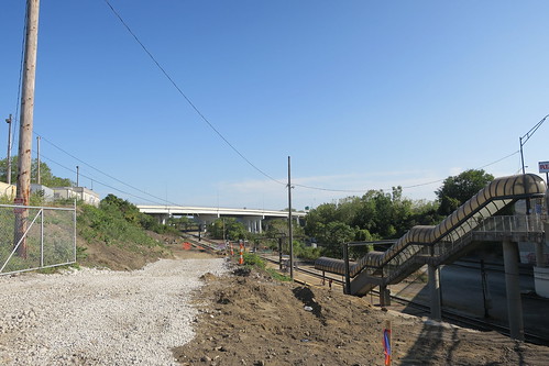
My train arrived in less than five minutes (yay, weekday schedule) and got me to Millennium Station without any trouble. At Millennium Station, my South Shore Line train was already waiting and boarding, so I just hopped right on. It didn’t leave for another 20 minutes, but I figured I’d rather wait on the train than in the station. Anyway, the train headed out right on schedule and got me out to Portage/Ogden Dunes.
Once there and the other person disembarking there had left the station, I got to work photographing. The weather was absolutely beautiful, making for really good photography conditions. The station is interesting in that it is the only one on the line with mini-high platforms. All other stations either have low platforms that are not wheelchair accessible at all (Gary/Chicago Airport, Miller, Beverly Shores, Hudson Lake), use wheelchair lifts (Gary Metro Center, Carroll Avenue), or have high platforms. This made for an unusual detail to photograph. This was also my first time at a two track station with only one platform, so most eastbound trains require passengers to cross the westbound track to board/disembark. These both will be changed with the construction project, which will build a new high platform for the eastbound track (though it looks like it will keep the low platform with mini-high platform for the westbound track). Also, while I was there, several freight trains and two Amtrak trains passed by on the tracks to the north of the station.
One of the mini-high platforms
The single platform
The single platform looking the other way (west)
A cutesy power box at the entrance to the station
Inbound bilevel train
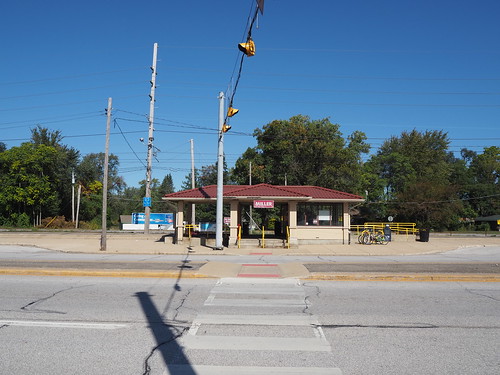
After photographing, I found that there were power outlets in one of the shelters, which gave me a chance to top off the batteries in my phone and camera. Some idiot had turned on the heat though, even though it was in the 60s. To make things even hotter, the shelter basically trapped sunlight, so it was really hot in there. I was able to turn off the heat, but it took a while to cool down to a reasonable temperature. Anyway, a while later, with a fully charged phone and camera, I caught the next train to Miller. Miller is just a low platform with one track (there is a second track, but that is a diverging line that does not carry South Shore Line trains). Once again, I waited for everyone to leave, then got to work.
The train after dropping me off
The station shelter by the platform
The shelter from across the street
A sign for the parking lot
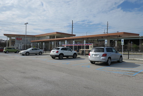
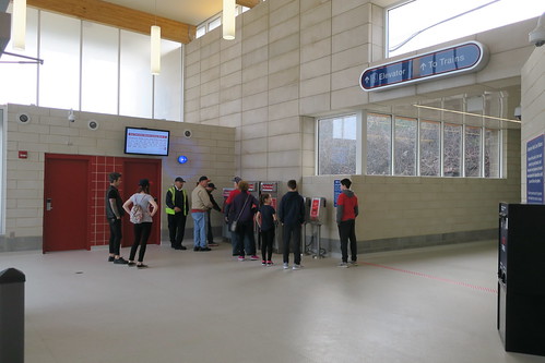
From there, my plan was to head to downtown Gary on the bus. However, I couldn’t find the bus stop. There was a reroute in effect due to some nearby street construction, but the GPTC website just listed the streets it was going on without an actual map. My guess for where the bus was going to arrive seemed to be incorrect, and no bus actually came at/soon after the scheduled time. With that unfortunate stroke of luck, I headed back to the train station since there was a train coming not that long later. That train did come, though about 10 minutes late. That train got me to Gary Metro Center within a few minutes. I got off there and also got started photographing once everyone had left the platform. It was a bit tricky since it was afternoon and sunny, so the shadow of the station canopy was not straight down but instead over the westbound track. This resulted in a major difference in lighting between the two, but I think in the end it came out ok. Gary Metro Center is definitely a major transit center, being directly connected to the main local bus hub and Greyhound station for Gary. The train portion is unusual in that it while part of a major transit center and on an elevated embankment, it has a low platform. From what I can tell, this is so freight trains can pass the station. without colliding with the platform. Other stations with high platforms deal with this by either having a second track that avoids the platform (Dune Park) or a guantlet track to provide extra clearance for freight trains (Hegewisch, Hammond, East Chicago). At Gary Metro Center, they just built the station with a lower platform and use a mobile wheelchair lift for accessibility.
My train after letting me off
Eastbound track
Middle of the platform
Main building from the train platform
After photographing the platform, I headed into the main station building itself via the skybridge connecting it with the platform. A guy on the platform asked me if I was taking professional photographs. I don’t know why he was asking, as he wasn’t even a railroad employee. I responded that my photos are definitely not professional. It would be awesome if I could get paid for photographing train stations, but in the end I have a day job doing web development (also a fun thing, don’t get me wrong). I crossed the skybridge and entered the main station house. From the station house I walked around the plaza and parking lot photographing from various angles.
The skybridge
Waiting room
Parking lot entrance
Something about 1998? Not sure what
The main building and skybridge
Eastbound train
Then, I caught the R1 bus to get me to the Gary/Chicago Airport station (aka Clark Road). When I got on the bus, the driver asked me where I was going, so I said “Gary Airport train station” and he seemed really confused (it seemed like he thought I wanted to go all the way to Chicago?). I then followed that up with “Clark Road” and it still didn’t click with him, but then eventually another passenger emphasized that I meant the Clark Road train station and he got it. The bus got me there fairly quickly, and I started photographing the last station of the day. Thankfully, the sun was still high enough in the sky to avoid shadow issues.
The Gary/Chicago Airport station is another interesting one in that it’s a flag stop and a pretty basic station. It’s just a shelter adjacent to a single low-level platform, so like Portage/Ogden Dunes, eastbound passengers need to cross the westbound track to get on/off the train. However, unlike there, the platform is not the full length of the train and only can fit four cars (there are only two places where the track can be crossed, and one of them is road crossing by the platform, while Dune Park had four along a full length platform, allowing potentially all eight cars to board/disembark). The picture on Wikipedia (from 2016) shows it having some old cracked asphalt for the platform, but it looked like it had some fresh concrete since then, and the station looked pretty nice, even if minimal. As far as I’m aware, there are no plans to renovate the station due to its low ridership.
A rather simplistic entrance
Shelter and platform
Platform from the far end
Platform looking west
After another inbound train arrived, I took that to Millennium Station, then caught the Red Line back home.
One of these days once I get another sunny day I’ll also photograph Hegewisch, Hammond, and East Chicago (most likely all in the same day). That’ll be easier (and cheaper) since they’re a lot closer, so if I can’t get there while westbound travel is still free, having to pay a fare for each leg won’t be quite as expensive as it would be for the stations further out. I can even get to Hegewisch entirely on the CTA. Once that’s done, I will have conquered the South Shore Line! I haven’t taken pictures of Van Buren Street Station yet either, but I consider that to be part of the Metra Electric District and not the South Shore Line for the purposes of completely photographing lines.
Over the span of a year and four months (March 10, 2019 to July 5, 2020), I have taken photos of every station on the North Side Main Line, from Merchandise Mart to Howard. This all started on my spring break trip during my junior year of college, where I visited Chicago. That trip was mostly focused on downtown, but at one point on March 10, 2019 I did find myself at Sheridan station:
My first published photo on the North Side Main Line, at Sheridan
I also got some pictures of the Merchandise Mart station on that trip, since that’s a major landmark in Chicago and located near downtown:
My first published photo of the Merchandise Mart station
All the rest of that trip I got photos of other stations in/around downtown, including areas like the Milwaukee–Dearborn Subway, the State Street Subway, and the Loop. I went all the way out to the end of the northern leg of the Milwaukee–Dearborn Subway up at Division, but never went anywhere north of the river on the State Street Subway.
Division Station on the Blue Line
As it would turn out, that would be my last time photographing Chicago with my Canon camera. The next time I was in Chicago was for my interview with BlueBolt, by which time I had my newer and more powerful Olympus camera, and managed to get a few photos along the way.
O’Hare Station
Once I had the job and started looking for an apartment, I knew approximately where I wanted to be (Uptown/Edgewater area), so for my spring break trip my senior year I returned to Chicago to scope out apartments in that area. Unlike the previous trip, where most of it was downtown, this was mostly focused on the North Side. I stayed up in Rogers Park, and got around via the Red Line. I got plenty more photos of the North Side Main on that trip, taking photos as I traveled to visit apartments. I needed my camera to photograph the apartments, anyway.
Jarvis Station
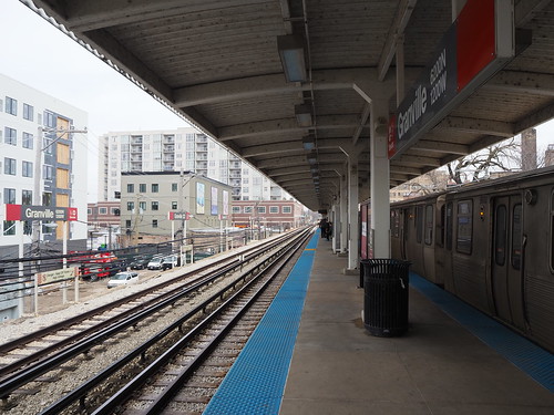
Granville Station
Bryn Mawr Station
Thorndale Station
Belmont Station
I also got some pictures of various other stations along the way, some of which I was headed to anyway for various reasons, and some of which I specifically went to for the purpose of photographing. Since this was during my spring break, I couldn’t really choose the weather. Some days were good, but some were also cloudy. However, I knew I was going to be living in Chicago in a few months, so that didn’t really bother me.
Once I moved to Chicago in May, I didn’t really get out much due to the stay-at-home order. Even after it was lifted, I limited how much I went out since I didn’t particularly want to catch COVID-19 or spread it to others. Also, my primary focus for photography was on the parts I could access without going downtown (to avoid crowding), which is to say the North Side Main, Ravenswood Branch, Evanston Branch, and Skokie Branch. Progress initially started slow, but over time I got photos of more and more stations. I started with stations like Wilson, Bryn Mawr, and Howard, but also went up to Linden and down to Belmont:
Wilson Station
Belmont Station
Bryn Mawr Station
Howard Station
However, this most recent weekend, since I had a long weekend due to July 4th, I figured I could make use of a three day pass, my extra free time, and a period of good weather to get as many photos as possible. As an added bonus, due to the holiday weekend, crowding was pretty low. I made it my goal to finish with pictures of every station on the North Side Main, which I accomplished by Sunday. Here’s a picture of each station that hasn’t been included earlier in this post:
Chicago Station
Sedgwick Station
Armitage Station
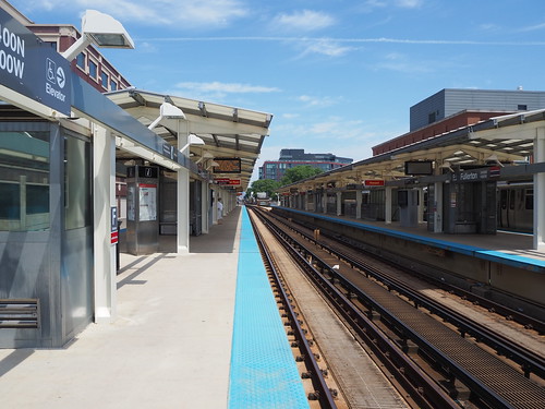
Fullerton Station
Diversey Station
Wellington Station
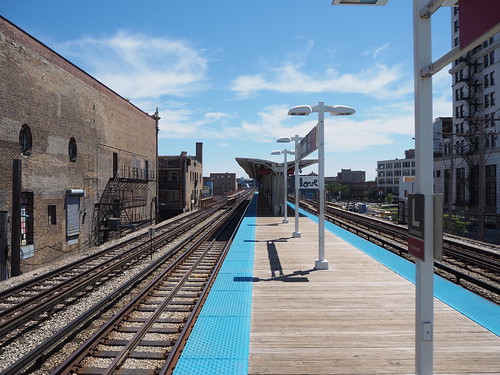
Addison Station
Lawrence Station
Argyle Station
Berwyn Station
Somehow when I visited Chicago to scope out apartments, I didn’t get any pictures of Morse, which is the station I was staying closest to. I guess in how busy I was with getting places from there, I never thought to get out my camera. I also only realized that as I was putting this post together on July 4 (I had just assumed I took photos of the station I was using frequently for a week), so the next day I headed out with my camera to get photos there and fill in the gap. So, to finish off the set, here’s photos of the remaining stations:
Morse Station
Howard Station
I also have conquered the Skokie Branch (Yellow Line), since in my quest to photograph Morse, I also went to Oakton–Skokie, having already photographed Dempster–Skokie during my apartment expedition. I will at some point go photograph Dempster–Skokie during the day though.
Oakton–Skokie Station
Dempster–Skokie Station
So with that, I’ve hit a major milestone in photographing the Chicago L! I’m warily watching news reports about COVID-19, and if it flares up in Chicago again (so far it hasn’t, but could any day), that’ll put the kibosh on my transit photography for a while. Even if it stays at the level it is, I’m going to avoid going through downtown in order to avoid the highest crowding, limiting my photography to the Ravenswood and Evanston Branches.
So during this COVID-19 shutdown, my photography is going on hiatus since I am going to be a good citizen and follow the stay-at-home orders. I have no idea how long this is going to take, but I figure it’ll be a while. Looking through my Flickr, the last photo I took that got posted was this:
Platform at the Belmont Blue Line station from the far end
I took that as part of a free afternoon I had while doing apartment visits in Chicago, not realizing it would be my last photo expedition for a number of weeks, if not several months. Not a bad photo to end with, if I must say so myself. I aligned it about as perfectly as I can hope by hand, and the lighting looks pretty good while still being a clear shot (it helped that this station is fairly well lit and has a light colored design), so it definitely shows how my photography has improved. I also took that picture with my newer camera with everything manual except focus (I’m still getting a feel for that), while my previous Chicago trip was with my older, smaller camera and with all the settings on auto.
Once this blows over, hopefully sooner rather than later, I will finish what I started with my Chicago photos. I definitely am going to explore all over the L, since it’s a really interesting system with a very non-uniform design due to the varying owners and vintages of all its components. I also will try to get as many photos as I can on Metra and the South Shore Line, though that’s inherently limited by the train frequency and the (much) higher ticket cost. There are also a ton of buildings and landmarks I want to photograph, and unlike Cleveland, high density extends throughout the city, rather than just downtown, so that’ll be a fun project. This will take multiple years, but is something I very much look forward to.
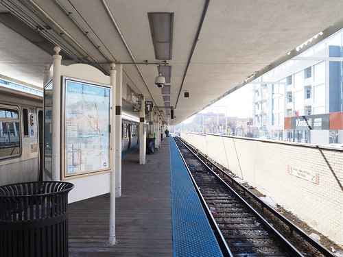
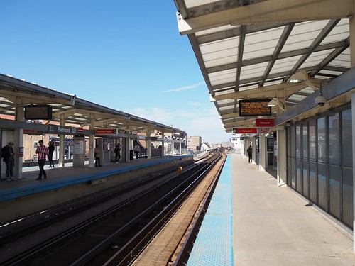
So today I continued my apartment hunting adventure. As was the case with the past two days, my day started with an apartment visit. This time, it was in Edgewater. Not all that much to say on that front, so I’ll continue to the fun stuff. I had some hot bar food from Mariano’s for lunch, which was pretty good. I will likely be shopping either there or Jewel-Osco for groceries, so I figured I might as well start getting familiar with their stores. Once that was done, I got back on the L and headed towards another barrage of apartment visits. This was the first set I saw not on the Red Line, but instead on the Brown Line, making this my first time taking that line (I also have not yet ridden the Green or Pink lines). I got off at Paulina:
Outbound platform at Paulina
From there, I headed to my first apartment of this set of visits. I then traveled across that part of the city (the realtor driving me between apartments), and visited a number of units in Lakeview and Uptown, but further west than I was before. After that was done, I caught the Brown Line at Irving Park. Due to fairly large the number of people there (it was about 3:30pm at this point, so rush hour was approaching), I didn’t get any photos, and it was cloudy anyway. I headed back downtown and hung out there for a while, then headed back north to get dinner. Since I wanted something light, I took the train back to Bryn Mawr to go back to Mariano’s and get a chicken caesar salad:
Southbound tracks at Bryn Mawr
After some dinner, I figured I would explore a more remote part of the L system, and figured I’d head to Howard and from there either go to Linden or Skokie, depending on which train arrived first. It just so happened that both were there, so I opted for Skokie for no particular reason. Thus, I boarded the Yellow Line and went out to Dempster-Skokie.
Train waiting at Dempster-Skokie
Dempster-Skokie termination platform
Dempster-Skokie main entrance
From there, I headed back to Howard, then transferred to the Red Line and called it a night. It’s feeling a lot more real that I’m moving here now that I’m apartment hunting. With any luck, I’ll have a place to live soon. From there, I’ll have a whole new city to explore.
Since I’m moving here soon, I need to find a place to live. My plan for this trip was to scope out neighborhoods, tour apartments, and do other things necessary to get ready to live here.
To start with, my journey was an interesting time. I had a flight from Cleveland to Chicago-Midway scheduled at 4:25pm. Since there was work being done on the Red Line between East 55th and Tower City that took that section out of service, I needed to budget extra time. Also, to avoid a train-bus-train combo, I took the HealthLine to Tower City instead. Being the paranoid person I am, I left at about 12:30 after a quick lunch from Panera (which is conveniently located right next to the East 115th Street HealthLine stop). That gave me four hours to get to the airport, which was less than 20 miles away. Anyway, from there things went without any problems. I made it to the airport and through security with over two hours to departure. Thus, I killed some time at the airport waiting for my flight. My flight then went without any trouble.
The fun began when I actually arrived in Chicago. The place I’m staying is very close to the Rogers Park Metra station, but somewhat further from the L. I normally wouldn’t mind walking, but I had a suitcase and didn’t want to be walking through a city more than I absolutely had to carrying a suitcase. Therefore, I planned my trip so that I would catch the Orange Line to Washington/Wells, then transfer to Metra at the Ogilvie Transportation Center. One catch: I was cutting it close. I had to get from the gate to Ogilvie in under an hour, and that included picking up a checked bag. The instant I got my bag off the carousel (which conveniently was one of the first ones), I made a mad dash for the L. Of course, I just missed the train, so I had to wait a while for the next one. While all this was happening, I was constantly eyeing my watch for how much time I had left to catch Metra, seeing how much time I had. Soon after another train pulled in, but it didn’t leave for several more minutes. Eventually, my train left and headed in towards Downtown Chicago. The L went pretty smoothly, but I still knew I was basically playing Tetris with train schedules. I got to Washington/Wells at 5:38, and I had to be on board the train at Ogilvie by 5:45. Thus, I got to make a mad dash across Downtown to catch Metra. I was sprinting with a backpack and suitcase across Downtown and being as opportunistic as I could with stoplights. After finally making it to Ogilvie, I had a new challenge: how on earth do I actually get in? There were a bunch of doors, but most were for adjacent shops. The actual entrance wasn’t exactly clear it was for the station, since it had a bigger sign for a restaurant. Anyway, I finally found my way in, ran as quickly as I could to the platform, and boarded the train with two minutes to spare. From there, it was a pretty uneventful journey. I got to Rogers Park right on time and quickly got to my lodging.
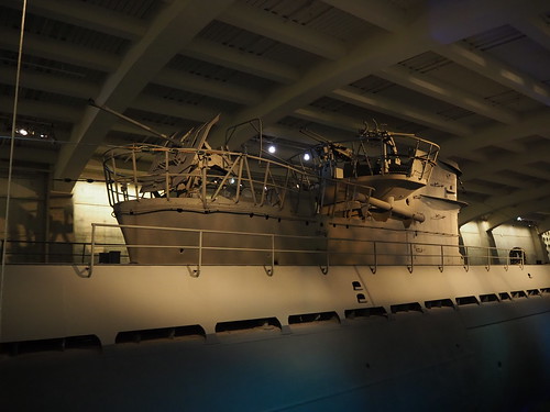
On Sunday, since I had a Metra weekend pass from the day before, I decided to go the Museum of Science and Industry. The Metra Electric District left Millennium Station at 10:10 and 10:40 on Sundays, followed by a very long gap. I caught the Red Line at Morse, hoping to make the 10:10 train. I ended up missing it (due in part to an unexplained delay at Loyola), so I instead caught the 10:40 train. That whisked me right to the museum, and I had a fun time. The museum remains very cool, and is absolutely giant. They have a model railroad of Downtown Chicago as well as a bunch of freight/intercity stuff across the country. They also have U-505, a captured German World War II submarine.
The conning tower of U-505
Then, I grabbed some lunch at the museum cafe, having a chicken caesar salad. After that, I caught the 2:10 Metra Electric back to Millennium Station.
Platforms at 55th-56th-57th Street
My train back downtown
Once back downtown, I caught the Red Line and headed up to Belmont to begin checking out some of the apartments I will be touring and get a feel for the neighborhoods.
Red Line tracks at Belmont
From there, I explored the Lakeview, Uptown, and Edgewater neighborhoods. I found that Lakeview is probably a bit too happening for me, but Uptown and Edgewater looked like good matches, since both of those are within easy access of Lakeview (I still want to be able to access all the things happening in Lakeview, just not necessarily be living right there) and a bit quieter. They also have the right kind of density for me. I will be touring several apartments in that area over the next few days, so here’s hoping.
Anyway, after walking up to Thorndale, I caught the train up to Rogers Park to see what’s up there.
Northbound track at Thorndale
From there, I headed up to Jarvis to look at the neighborhood there. Tonight I’m going to get dinner somewhere in Chinatown, so that’ll be nice.
Chicago definitely has the right feel for a city for me, and I think I have found where I want to live in it (that is, Edgewater or Uptown). The L makes it very easy to get around, and the Red Line runs super frequently, even on Sunday, which is very nice. Here’s hoping I can find a good apartment. My tours begin tomorrow, so stay tuned.
My interest in photography as a way to document the world matured during my time in Cleveland, and as my time there comes to a close, I have begun to think about the change that occurred in my relatively short time here.
Railcar Renovations
My first experience with transit in Cleveland was in February 2015 as part of a campus visit to Case Western Reserve University. Some photos from that trip are available in my previous post explaining the evolution of my photography. One photo I didn’t include in there was the interior of the train:
I first experienced the new fleet when I did a prospective student visit after being admitted. I took the train back to the airport and experienced the renovated interior for the first time. It looks a lot nicer, with better-looking seats, brighter lights, an easier-to-clean floor, better color scheme, etc.
Little Italy Station
In early 2015 when I first visited Cleveland, the two stops near CWRU were Cedar-University and Euclid-East 120th. The latter would cease to exist before I returned, being replaced by the new Little Italy-University Circle station a block away later that year. Not long later, the original Euclid-East 120th Street station would be demolished.
The platform at Little Italy
The entrance to the station from Mayfield Road
Tower City Track Replacement
Starting around the time I came to CWRU, the RTA began replacing Track 8 (the main westbound track) at Tower City. The original track looked something like this:
Current eastbound track – the original westbound track also looked like this, with the trackbed paved over
For the time it took to replace the track during the first part of my freshman year, westbound trains were diverted to a non-revenue track separate from the main station. This temporary station had its own fare control and everything:
Entrance to the temporary westbound Tower City station, August 2016
Turnstiles at the temporary westbound station
ADA ramp to the temporary Red Line platform
Temporary westbound track from the platform
Eventually, late in 2016, the project was completed and the new westbound track completed, and service was restored to the main station for both directions. The new track used ballastless track, a major improvement over the original. Take a look:
New westbound track! (December 2016)
Now, in early 2020, they’re performing similar work on the stub tracks on either side. Since both through tracks are still in service, service isn’t affected and trains simply don’t terminate directly at Tower City for the time being.
Tower City track 10 reconstruction, March 2020 [added on March 7, 2020 after original publication]
Warrensville-Shaker
During the second half of 2016, the Warrensville-Shaker station on the Green Line was replaced. I don’t have any pictures of the original station, but I do have some pictures of the new one:
New track and platforms at Warrensville-Shaker, with the mini-high platforms not quite complete yet and landscaping remaining to be done, October 2016
New station, November 2016
Lee-Shaker
In 2017, the RTA replaced the Lee-Shaker station. It was a basic median streetcar station on Shaker Boulevard, but was at a particularly high-traffic location and thus could use both a modernization and ADA accessibility. I actually was (according to Google Images) the first person to post pictures of the new station online.
New shelter and mini-high platform at Lee-Shaker, September 2017
Eastbound train waiting to cross Lee Road
Brookpark
The Brookpark Station saw a complete replacement during my Freshman year. The station that existed in 2016 was a “temporary” station that had been in use for about ten years.
Old headhouse at Brookpark, September 2016
I first came to Cleveland during the reconstruction process, so I saw the platform shortened so it only fit one car plus one door on the other car (before this construction project started, the platform could fit a full train). However, the platform was one of only three wooden platforms on the system (the others being East 79th and East 34th, and only East 79th is still wooden now). The headhouse also was on the opposite side of the westbound track from the island platform with no tunnel or bridge, requiring passengers to cross the track to access the platform.
Grade crossing at the old station
Old wooden platform
Throughout my freshman year, construction activity was going on. I was impatiently waiting for it to be done, constantly looking for press releases. I distinctly remember taking the train out to the airport very early in the morning with an operator who seemed like he had just started his shift and was very enthusiastic, and he said “Next stop: Brookpark! The new station is coming very soon, folks…” The time I was waiting for finally came around in April, when trains began stopping at the new platform. The new station was a much more modern station:
New headhouse on the eastern side, April 2016
New platform
New entrance on the western side, which opened much later than the rest of the new station (photo taken September 2017)
Headhouse interior
In all, the new station looked much more modern and was more functional than the one it replaced. I was quite pleased with the new results. Interestingly, this removed the only grade crossing on the Red Line for a time, but another one would open later at East 34th Street (read on…)
East 34th Street
The East 34th Street station as I first remember it was a fairly outdated and run-down station. It was a simple island platform (with a low section for the Blue/Green lines and a high section for the Red Line) accessible by a single set of stairs from East 34th Street.
Red Line platform
The lone entrance from East 34th Street
Worn-down concrete with exposed rebar on the stairs
My sophomore year, the renovation project began. I did my best to come down to the station when I had the chance so that I could document the change.
The old stairs next to some pre-landscaping for the new ones
The groundwork for the new stairs begins
Foundation for the new Red Line platform
The new stairs are on the way up
Progress on the low platform for the Blue/Green lines and the entrance in May 2018
Progress on the new entrance, May 2018
Then, as I went back to North Carolina for the summer, work continued. I came back in the fall to see the work mostly completed:
Overhead view of the new station, September 2018
Not-quite-finished Red Line platform, September 2018
After the removal of the Brookpark grade crossing the previous year, this one was added
The new entrance
The new station also looked much more modern and fresh, giving a nice upgrade to the Campus District. It was also renamed “Tri-C – Campus District” to reflect its proximity to Tri-C.
East 105th-Quincy
For a long time, East 105th-Quincy was known for only opening the front door of the front car of each train due to the platform being too short. Needless to say, this was a cause of a lot of confusion for riders not familiar with the situation and delays for everyone else. Riders in the second car had to go between cars if they wanted to get off, and the single door slowed everyone down.
The short platform (I’m standing at the end of the platform in this photo)
A train too short for the platform it is serving
Beginning in late 2017, work began to lengthen the platform. Not only did they lengthen the platform, but they also opened a second entrance, maknig this one of only two stations in the entire system with two entrances, the other being West 65th-Lorain.
Concrete supports in place, October 2017
Metal framing, May 2018
…but the work still isn’t complete yet
As of September 2018, the platform had been lengthened to the point where a two car train could open all of its doors.
The platform is getting longer, September 2018
A train opening all of its doors, September 2018
However, that was only one part of the project. Next, the new entrance was to open in 2019.
New entrance on East 105th (the Opportunity Corridor), April 2019
The new platform, now fully in service, April 2019
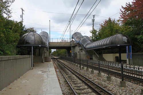
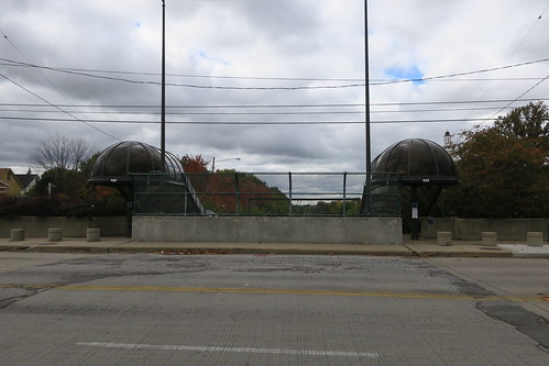
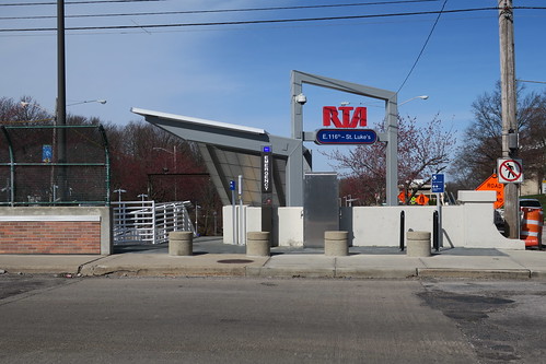
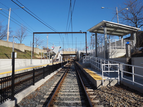
East 116th Street
East 116th Street also saw a major renovation, going from being a fairly old station similar to what East 34th originally was (especially the staircases) to another modern station.
Original station, October 2016
Original entrance to East 116th Street
Then, the renovations began! The temporary station in place during the renovations consisted of two wooden platforms and a fairly basic entrance located further down the block to allow work on the new station to proceed unobstructed:
Temporary wooden platforms, May 2018
Temporary entrance
Demolition of the old station, May 2018
Then, the new station was built mostly over the summer, so I wasn’t able to document it. So, let’s jump to the big finish:
New entrance, May 2019
New entrance (including both sides)
New eastbound track, February 2020
New platforms
The new station, like the others, was a major improvement. It fit in nicely with the surrounding neighborhood, was ADA accessible, and was generally just much nicer-looking.
Blue Line renovations
I was notified on Wikipedia that the RTA was performing some upgrades for various stations on the Blue Line, so when I got the time and clear skies, I went out there to document the upgrades. The upgrades appeared to be new signage and shelters, with the platform structure itself remaining unchanged. The first station where I saw such upgrades was Avalon:
New shelter at Avalon, November 2019
New signage at Avalon
Final thoughts
A lot changed in four years, and I was glad to be here to document it. These renovations gave me exciting material for photography and always gave me an excuse to get out of University Circle for a while. They are in keeping with Cleveland’s city motto of “Progress and Prosperity” (even though one of the stations was in Shaker Heights) and helped modernize the city. It looks like I’ve seen the last major project that will be completed before I leave here in May, but I know there’s plenty of work going on in Chicago that I will be able to photograph as well.