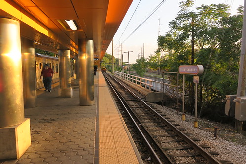
I recently had the good fortune of being able to take a vacation to Toronto. The chief reason I took this trip when I did was because Line 3 of the Toronto Subway, also known as the Scarborough RT, is closing soon.
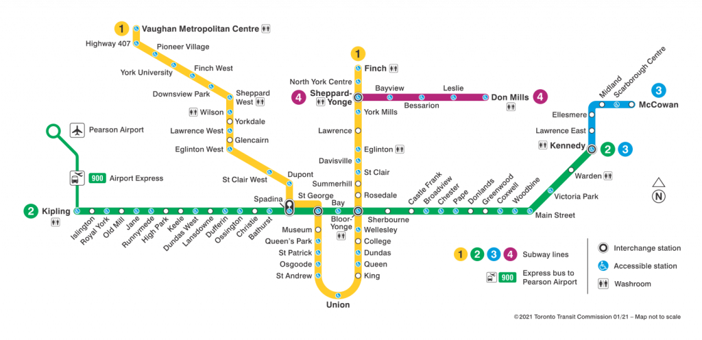
For some context, here is a map of the Toronto Subway as of the time I post this:
Toronto Subway map (from TTC)
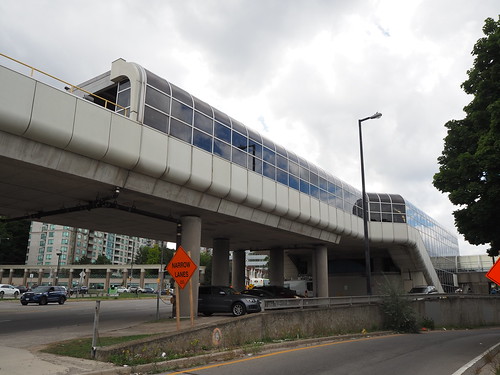
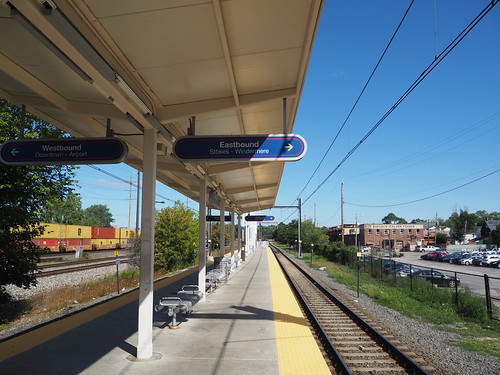
Line 3 is that short blue one way off to the east. It serves Scarborough, a suburban part of Toronto, Unlike Lines 1, 2, and 4, which run conventional rapid transit equipment mostly underground, Line 3 runs smaller automated railcars powered by linear induction motors and is fully above-ground. The idea was that since Scarborough was a lower-density area than most of the rest of the Toronto Subway service area, they would use a somewhat “lighter” technology that cost less to operate and maintain.
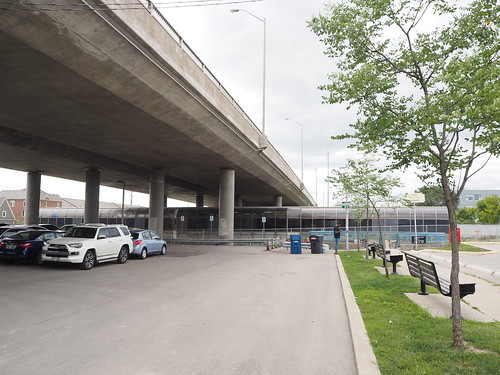
The route is only six stations over four miles, and is entirely suburban, requiring a connection at Kennedy to reach downtown Toronto. Additionally, the ridership is very low compared to the rest of the system, with only one station besides Kennedy (Scarborough Centre) ranking better than 40th out of 75 among subway stations.
Owing to the fact that the line currently has fairly low ridership, operates different technology than the rest of the subway, and the fixed infrastructure and rolling stock are old enough that they all would need to be majorly overhauled or replaced entirely, the government of Ontario has decided to replace it with an extension of Line 2. The extended Line 2 would cut farther east to a more residential area instead of the current industrial corridor seen between Ellesmere and Kennedy.
I wanted to see what was there before it’s lost to time, so here’s what I found:
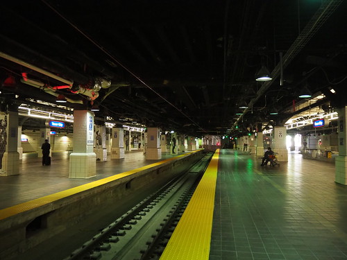
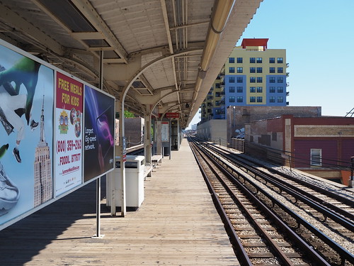
Interior of a train
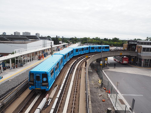
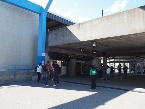
Train departing Kennedy
Train at Kennedy
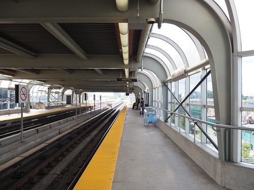
The design of the stations definitely looked pretty dated. There hasn’t been much change since they opened in 1985, and you can definitely see that in their design. I also was delayed because of mechanical problems at Kennedy, reflective of the issues the line faces right now.
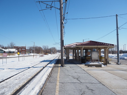
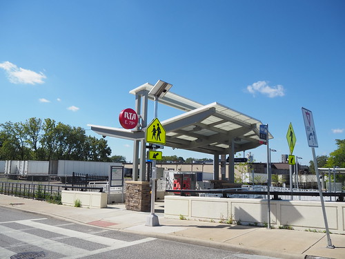
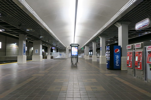
Scarborough Centre
Entrance at Scarborough Centre
Scarborough Centre was definitely the most active part of the line. I actually saw a good number of people getting on here. It’s right next to the Scarborough Town Centre shopping mall, and also has a number of connections with TTC and GO buses. This is the only station (other than Kennedy) that will be served in approximately the same location by the Line 2 extension.
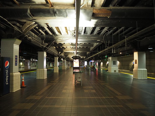
Entrance at Ellesmere
Other entrance at Ellesmere
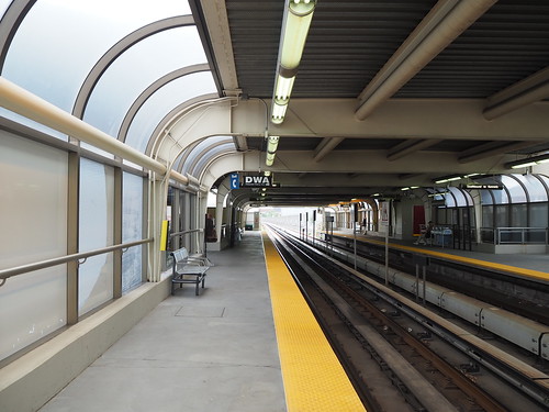
Platform at Ellesmere
Ellesmere is the lowest ridership station in the entire Toronto Subway system, and I could see why. It’s pretty isolated, and it doesn’t even directly connect with Ellesmere Road (which bypasses the station on the overpass). There really isn’t anything around the station.
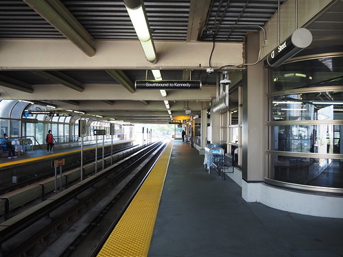
Platform at Lawrence East
Entrance at Lawrence East
Lawrence East also felt somewhat isolated, but not as bad as Ellesmere. It helps that it has a bus connection on Lawrence.
McCowan
McCowan
Platform at McCowan
I’m surprised McCowan doesn’t have higher ridership numbers, given that it’s located in what looks to be a reasonably high density area with several bus connections. I guess this can be attributed partly to its proximity to Scarborough Centre.
Entrance at Midland
Platform at Midland
Midland, on the other hand, doesn’t surprise me it has low ridership (second lowest in the entire system after Ellesmere). It only has one bus connection and appears to be in a fairly low density area without any major housing or employment centers or other destinations nearby.
With all this, it makes sense why they’re replacing this with an extension of Line 2 and rerouting it. The current train mainly just serves commuters from the Scarborough Centre area heading to Kennedy, and they have to make a transfer there, while a Line 2 extension would eliminate that transfer. The rerouting will also hopefully attract more passengers by going through a residential area instead of an industrial one. Of course avoiding having one short line that’s incompatible with the rest of the system (increasing maintenance costs and adding operational complexity) will also be a good thing. However, it is a shame that the residents of Scarborough will have to go roughly seven years without rail service between when Line 3 closes and the Line 2 extension opens.
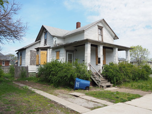
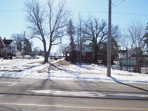
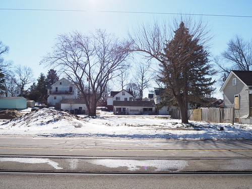
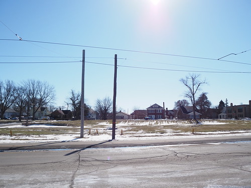
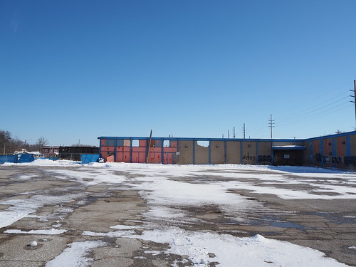
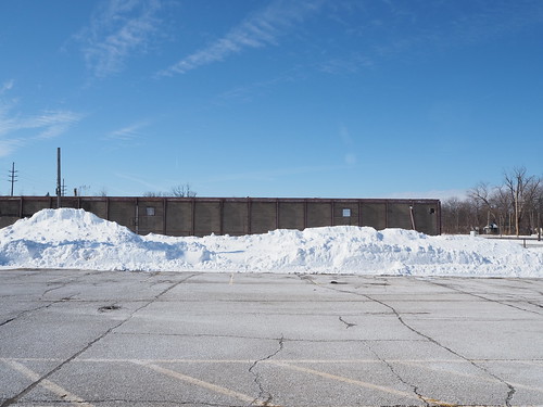
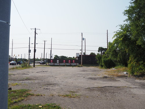
As promised in my earlier photo set on demolition in Miller Beach (Gary), here is a photo set of all the demolition in Michigan City. I originally was planning to do this in March or April after all the snow melts, but the construction schedule forced a change of schedule. It looks like they’re planning on starting new construction on 11th Street right at the beginning of March, and I wanted to photograph everything after demolition was (mostly) completed but no new construction had started. As a result, there were a few buildings left standing that will be demolished in the future and there is a bunch of snow in my pictures.
Unlike Miller where only a few buildings near the station were demolished to make way for station expansion and a new parking lot, the demolition in Michigan City was widespread. They are moving from the current alignment of a single track down the middle of 10th and 11th Streets to a double track alignment adjacent to a one-way street, repurposing the southern (eastbound) lane to take the place of a second track. As part of the process, a number of buildings need to be demolished. Additionally the area north of 11th Street between Franklin and Pine Streets is being demolished to allow building a new parking garage and station building. As a result, there were a large number of houses and other buildings that needed to be demolished.
Additionally, to my knowledge, only commercial properties were demolished in Miller. However most of the buildings demolished in Michigan City were homes.
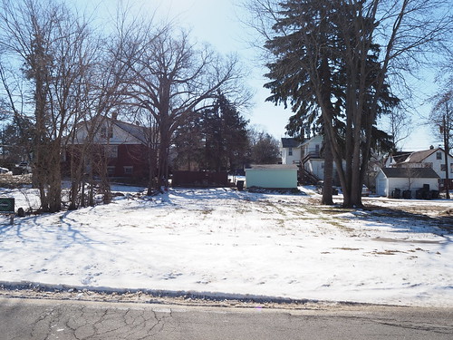
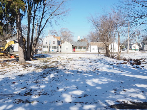
I did my best to capture as many homes as possible before demolition, but I didn’t really make concrete plans for this project until after some demolition had already begun so in a good number of these I am missing the “before” photo. Due to the large number of buildings, I don’t have much to say for most of these, just pictures.
Without further ado, I present the Requiem for Northwest Indiana, Part 2: Michigan City. This is without a doubt the longest post I have ever made here.
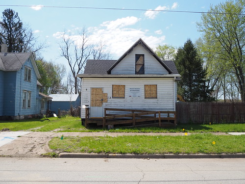
716 E 11th St
Before demolition
After demolition
523 E 11th St
After demolition (from a side street)
517 E 11th St
Before demolition
After demolition
After demolition (from the back)
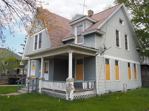
513 E 11th St
Before demolition
Before demolition
Before demolition
After demolition
After demolition
509 E 11th St
Rear view
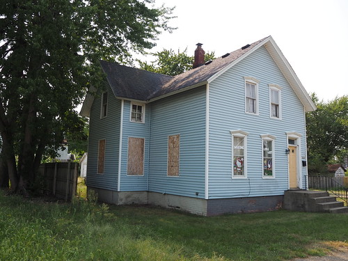
505 E 11th St
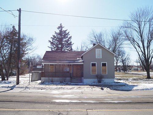
This house is still standing but will be demolished soon.
Back of the house
Front of the house
501 E 11th St
416 E Main St
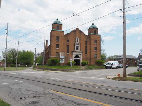
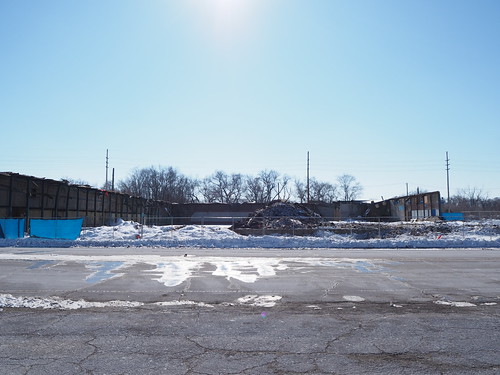
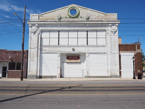
1102 Cedar St (First Christian Church)
This site used to house the First Christian Church. This is by far the biggest building that was demolished, it was nearly a whole block long by itself. It is also used on Wikipedia (as of the time I write this) as the headline image in the article about the South Shore Line.
For those not aware, the South Shore Line is currently undertaking a major project to double track the line from Gary to Michigan City (currently mostly a single track) and make a number of other improvements to the line, including improving access and parking to stations, making most stations accessible to passengers with disabilities, increasing speeds, and other things. However, as is often the case with major public works projects, there are property impacts. Specifically, buildings near the Miller station (in Miller Beach, Gary), Portage/Ogden Dunes station, and all along 10th and 11th Streets in Michigan City need to be demolished to allow for the construction.
I have been undertaking a major project to catalog the construction, and as part of that I have been photographing as many buildings as I can before and after demolition. New construction hasn’t started yet, but demolition is mostly complete, giving a strange intermediate state with a lot of empty land full of what once was. This is a grim reminder of that progress always comes at a cost.
I thus present the Requiem for Northwest Indiana. This is part 1, specifically focused on the area around the Miller station.
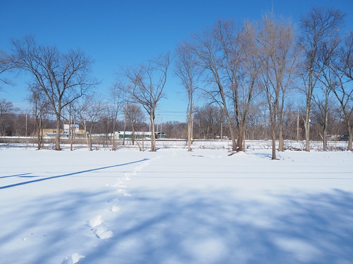
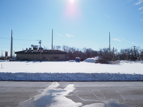
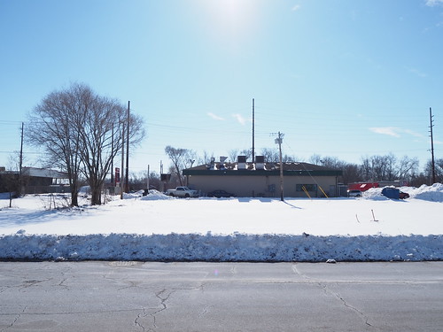
For this photo set, I took the train out to Miller and arrived just before noon. This was my first time traveling out there in the snow (and thanks to the snow last week there was quite a lot). I got off the train at a snowy station:
Miller station in the snow
And now, I present the buildings that were lost.
Warehouse
The largest structure demolished as part of this process was a warehouse. This barn had been seized by eminent domain before I photographed it and judging by the condition was probably already abandoned well before then.
Warehouse before demolition from the west
Another view of the warehouse before demolition from the northwest
The demolition was still in progress, but most of the walls had been demolished by this point.
Warehouse during demolition from the north
Warehouse during demolition from the west
Barn
There was a barn nearby that also had been slated for demolition. I have no idea what the barn was used for or who owned it. I also imagine this had been abandoned for quite a while before I photographed it.
Barn before demolition
Empty lot after demolition from the north (the fence is no longer there either)
Empty lot from the south
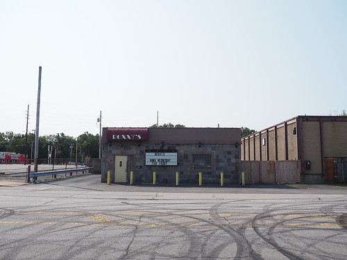
Roxxy’s
Roxxy’s was a bar along the Dunes Highway. According to Google Maps it celebrated its 75th birthday relatively recently (the picture was uploaded in April 2019). I actually had to submit an update to Google to explain that the business was now gone (for my “proof” I gave one of the pictures below).
Roxxy’s before demolition
Same view of Roxxy’s after demolition
View from the side of the former site of Roxxy’s
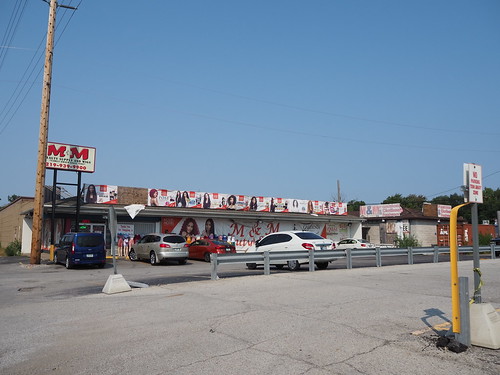
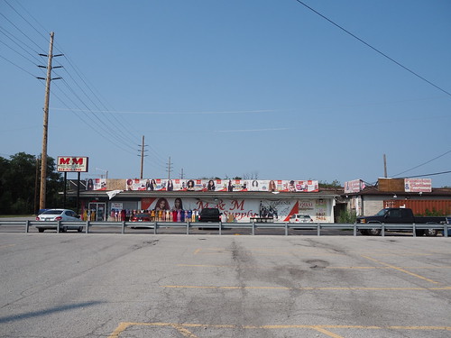
M&M Beauty Supply
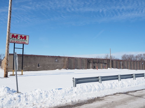
Just south of Roxxy’s was the M&M Beauty Supply. According to Google Maps, they have a few other locations in/around Gary. The building itself was demolished, but the sign remained, at least for the time being. As I did with Roxxy’s, I had to submit an update to Google Maps explaining that this location no longer existed.
M&M Beauty Supply before demolition
Another view of M&M Beauty Supply before demolition
In this case, I was able to pretty closely mirror the viewpoints of the “before” pictures (I did not have the pictures with me when doing this photo set).
M&M Beauty Supply lot after demolition
M&M Beauty Supply lot after demolition
Garage
At about 5811 US-12, there was some sort of garage building that also looked like it had been abandoned well before I got there. I do not know what used to be there, unfortunately.
Garage at 5811 US-12 from the north before demolition
Garage at 5811 US-12 from the southwest before demolition
Empty lot where the garage used to stand from the north
Empty lot where the garage used to stand from the south
Porky’s Pit
Next to the garage was Porky’s Pit, a barbecue place which also appeared to be abandoned before I started my “before” pictures.
Porky’s Pit prior to demolition from the north
Empty lot where Porky’s Pit used to stand after demolition from the north
Empty lot where Porky’s Pit used to stand after demolition from the south
Empty Lots West of Lake Street
Next to Porky’s were two empty lots that were still empty before I started. They were overgrown at the time but it looks like they’ve been cleared.
Empty lots west of Lake Street from the north before land clearing
Empty lots west of Lake Street from the north after land clearing
Empty lots west of Lake Street from the south after land clearing
With all of this, demolition in Miller Beach is mostly complete. New construction will start soon, and it will be interesting to see what develops. However we cannot lost sight of what was lost in the process.
In March or April (once all this snow melts), I’ll continue this project in photographing all the demolished buildings in Michigan City.
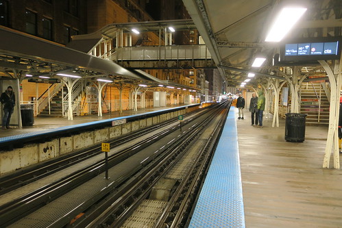
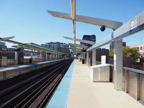
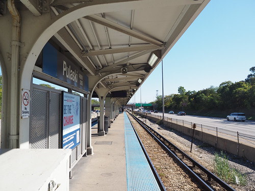
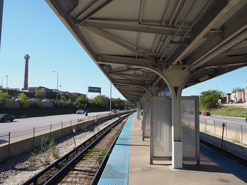
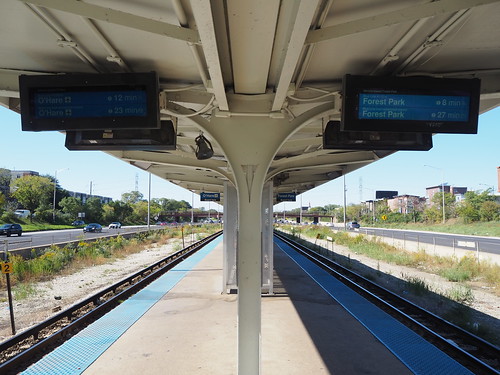
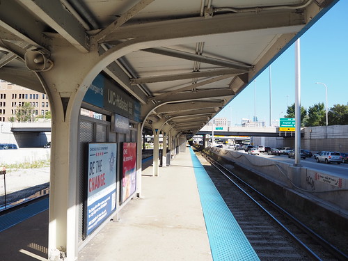
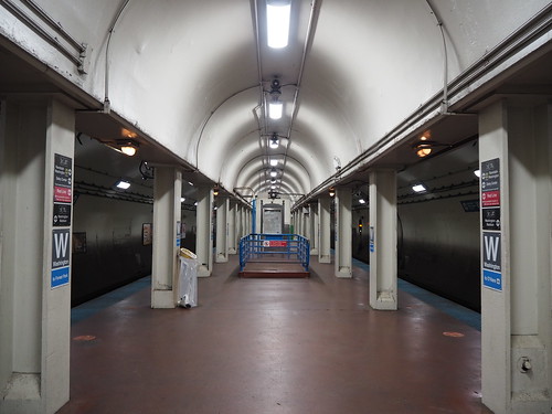
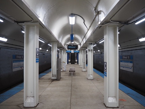
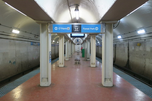
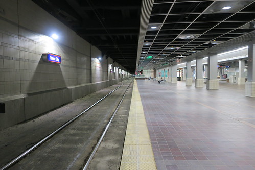
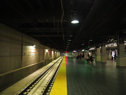
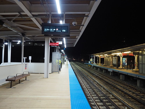
At long last, I have photographed all 145 stations on the Chicago L! If you just want to see the pictures and not read the rest of this post, check them out here.
My first published photo was taken on March 9, 2019 at Adams/Wabash:
Photo at Adams/Wabash
…and my last published photo to complete the set was taken at Morgan on November 6, 2021:
Photo at Morgan
This was a really fun project, even if exhausting at times, especially near the end where I was trying to finish before it started snowing and we were less likely to get clear skies so I had to take advantage of the chances I got. This involved a lot of days getting up, eating breakfast, loading a day pass onto my Ventra card, and heading out the door to the Red Line then spending most of the day out on the train in parts of the city far from home and ending the day with an hour or two of sorting photos and choosing which ones to upload.
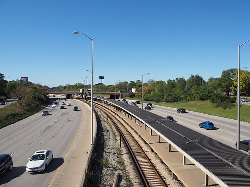
In the course of this project I really came to appreciate the diverse nature of the system. It ranges from utilitarian like Bryn Mawr (for now) to very old-fashioned like Ashland (Green Line) and Quincy to modern like Washington/Wabash and Wilson and everything in between. Meanwhile, the track structures range from elevated to embankment to ground-level to freeway median to open-cut to tunnels. Adding to that, the scenery ranges from industrial to suburban to medium density to ultra-high density as well. Really a big mix of everything.
This project also was a really cool way to experience the city, since I didn’t just go to the stations and take some photos and leave, but instead often walked between adjacent stations and on occasion got lunch on the go (best one was Italian Beef at Nicky’s near 35th/Archer). Walking through the neighborhoods really helped me get a good feel for the area. This also helped me improve my photography skills and figure out more about what conditions are/aren’t good and which techniques work and which ones don’t.
Going forward, I do have a few gaps to fill, between certain parts of stations I couldn’t/forgot to get to for various reasons or stations that received significant changes since I originally photographed them (for example, the three Blue Line stations under Milwaukee Avenue received new flooring). I’ll hit those as I have time, but am not in any hurry. I also of course will continue photographing the ongoing construction in my part of the city. I want to photograph Metra stations (I already have photographed all the stations on the South Shore Line), but am in less of a hurry to do that. After all, Metra doesn’t run anywhere near as frequently as the L does (and some lines don’t run on weekends at all).
I have now photographed every station on five of the eight lines of the L: Blue, Brown, Orange, Purple, and Yellow! Of the three remaining lines I have eleven stations left if I’m counting correctly.
My most recent expedition was to photograph the rest of the Blue Line, and in keeping with the blue theme the sky also was a very deep blue. I photographed the rest of the Congress Branch:
Then I headed up to Logan Square to get lunch, and on the way home photographed the new flooring at Chicago:
New flooring at Chicago
Compare this to the flooring in 2019:
Flooring at Chicago in 2019
Definitely an improvement, looked like they were doing the same thing at Grand and Division too.
Honestly not much more to say, this was just a status update and some more pictures. Eleven stations to go if I’m counting correct, and I’ll hopefully get them done in short order.
I arrived mid morning at Little Italy-University Circle, one of the first stations I photographed during my time at CWRU by virtue of it being right by campus. Most of my photos of that station were from freshman year, when my photography skills were nowhere near what they are now. Here’s an example:
Photo of the Little Italy-University Circle station I took in 2016
Compare with a photo from this time:
Photo of Little Italy-University Circle from 2021
Definitely an improvement: better lighting (I got lucky with the weather admittedly), better angling of the camera, etc.
From there I went to Cedar-University, one stop down the line, and serving the southern portion of the CWRU campus. The story was similar to Little Italy for the most part: my photos from 2016 weren’t the best quality due to my inexperience. However, also important was that Cedar-University had a major bus loop attached which I never photographed.
First, see a typical photo of that station from 2016:
Photo of the Cedar-University station from 2016
Now compare with a photo taken in 2021:
Photo of the platform at Cedar-University taken in 2021
Much better lighting (once again lucked out with the weather, but also knew to photograph in the middle of the day instead of in the evening as I did with the first photo), better angles, all that.
Then, I photographed the bus loop which I somehow never did in my four years at CWRU:
Bus loop at Cedar-University
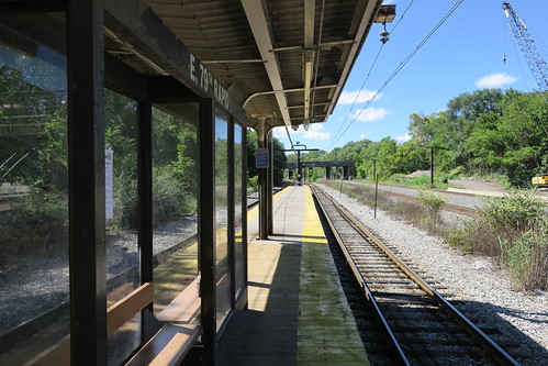
Having finished there, I started the main focus of my expedition, photographing the stations renovated since I had left Cleveland. First, I went to East 79th. For reference, here’s what the station used to look like:
Platform at East 79th in 2016
The station at the time was a pretty simple affair: a staircase (behind where I’m standing with the camera) and a wooden platform with a basic bus-like shelter and a roof. The renovations, on the other hand, significantly improved it:
Renovated East 79th station platform in 2021
Renovated East 79th platform in 2021 from across the track
New entrance to East 79th in 2021
The new station has a concrete platform, a ramp for ADA accessibility, new signage, a significantly improved roof, and a much better-looking entrance. Overall it is a significantly improved passenger experience from the original. It did add one interesting twist though, a grade crossing. For a while the only grade crossing on the Red Line was at Brookpark, where passengers had to cross a track to reach the platform. Renovations at the station in 2016-2017 removed that grade crossing and replaced it with a tunnel under the track, but later on one was added at East 34th which saw a similar renovation to East 79th, including a set of ramps on the adjacent hillside.
Grade crossing to access the platform at East 79th
From there I headed to Tower City. When I was a freshman at CWRU in 2016, they replaced the northern track, which resulted in westbound trains going to a temporary station on a normally non-revenue track. They did the same thing again to replace the southern track, and the work was completed prior to my arrival. Here is what the track looked like prior to renovation:
Old eastbound track at Tower City in 2016
After several years with a new northern track but retaining the old southern and stub tracks, they were all replaced. Here are the new and improved tracks:
New eastbound track at Tower City in 2021
Red Line stub track at Tower City in 2021
Meanwhile, the Blue and Green Lines were not operating due to an eight week construction project shutting down the lines entirely, with them being replaced by shuttle buses in the meantime. However, I did notice that the ceiling had been removed:
Old platform ceiling at Tower City in 2018
Platform with ceiling removed at Tower City in 2021
I don’t know the reasoning for removing the ceiling, and whether it’s temporary or permanent, but it definitely takes away some of the character of the station. I hope it will be added back. Given that a lot of the mall above was temporarily closed for construction, it wouldn’t be surprising if that were another part of the construction.
From there I took the shuttle bus out to Farnsleigh. Here’s what it looked like prior to renovation:
Farnsleigh station in 2016
It’s a pretty basic median station on the Blue Line with two platforms and a shelter. Now see it post-renovation from approximately the same viewpoint:
Heading back to Cleveland was a nice experience, and this photo expedition brought things full circle. I got to see the stations I first photographed when I was still fairly inexperienced and bring to it a new camera and better skills. It really shows how far I’ve come in photography and also brings some closure to my time in Cleveland which was sadly cut short by the pandemic. I’ll definitely be back there another day, and it’ll be nice to see what’s changed and what’s stayed the same then. According to the RTA website, no new station renovations are planned, though they do intend to replace their railcar fleet.
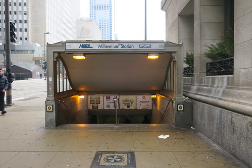
My ongoing project to photograph the Chicago L unofficially started on March 9, 2019, when I took a spring break trip to the city, unaware I’d live there a year and a half later. The first photo taken in Chicago (at least that I deemed worth publishing) is this one, of the entrance to Millennium Station:
Entrance to Millennium Station at Randolph and Michigan
Interestingly, the first four train stations I photographed in Chicago were all Metra, on March 9, 2019: Millennium Station, McCormick Place, 55th-56th-57th Street, and Museum Campus/11th Street. The situation there was I was going to the Museum of Science and Industry but stopped at McCormick Place along the way to photograph it, and then headed back to 11th Street to visit the Field Museum. The first photo I took and deemed worthy of publication on the L was at Adams/Wabash:
Adams/Wabash platform
The date on Flickr is listed as March 10, but it was actually taken very late on March 9 since my camera was still set on Eastern Time due to coming from Cleveland. Little did I know that this would start my most ambitious photography project so far. I photographed a number of stations in/near downtown as part of that trip, and then returned to Cleveland.
In December 2020 I flew out to Chicago to interview for the company that ended up hiring me, and photographed two stations: O’Hare (where I flew in) and Chicago (Red) (near my hotel).
In March 2020, I had been hired for my current job in Chicago and came back to visit apartments. At that point I knew I would be moving here and had in the back of my mind that I eventually wanted to photograph all the L stations. I stayed in Rogers Park (near Morse) and toured apartments all over the north side. I photographed a number of stations in the process, but knew I would come back.
I’m not sure what will come next – maybe photographing as much of Metra as I can? I’m not sure how realistic photographing every Metra station is given that there are over 200 of them and Metra doesn’t run anywhere near as frequently as the L (I don’t have a car) and some lines don’t run at at all on weekends.
At around 6pm today (June 7, 2021), a Purple Line train derailed just south of Bryn Mawr. Fortunately, no injuries were reported, and there wasn’t any major damage that I’m aware of from what I saw either in person or on the news.
Living in that area put me in a unique position to photograph the aftermath. While I was obviously not there photographing at the exact moment of the derailment, I was able to get some photos not long afterwards. I still can’t afford a drone and use a stepladder instead, which did limit my photographic capabilities, but I made do.
Specifically, the second car of the train derailed. The cars behind it and the front car seemed to remain on the tracks. The tracks on elevated structures have an additional rail in the middle for the purpose of keeping derailed trains from falling off the structure:
An example of tracks with the extra rail used to keep trains from falling off the elevated structure
Anyway, without further ado, here are some pictures:
Back of the derailed train
I then headed to a parking lot by the site of the derailment, and while I was walking there they removed the four rear cars of the train that did not derail:
Derailed car (the back car in the picture)
You can definitely see that the rear car in the picture is not properly lined up with the front car.
Later that evening, they re-railed the train and brought a “rescue train” to pull the affected cars back to the Howard Yard.
Derailed then re-railed cars (right) with the rescue train (left)
They then restored power to the affected cars:
Internal lights aren’t on, but an external blue light is on
I attempted to take a video of the coupling of the rescue train to the derailed cars, but another train passed by in the process (a number of trains passed by on the other track during this time, presumably the trains that were taken out of service as a result of the derailment).
Finally, I got a video of the rescue train pulling the derailed cars away from the scene, presumably to the Howard Yard to be inspected.
Affected railcars being hauled back to the Howard Yard by the rescue train
From there, a number of CTA workers were looking at the site of the derailment with flashlights to see if there was an obvious cause in the track, such as a broken rail.
This was an interesting event to see unfold. Thankfully nobody was hurt and there doesn’t seem to be any major damage (any damage would just be to the one railcar, and even that would probably just be to the trucks, and any damage to the structure would just be the rails in that one spot). This was also one of my first times being able to document something like this in real time, the only other similar things being the last day of operation at 11th Street in Michigan City and the opening of the temporary stations at Argyle and Bryn Mawr. Hopefully I will get more chances to document interesting things in real time, though hopefully they won’t be derailments.
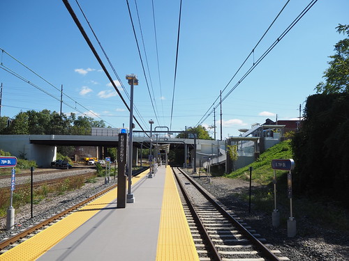
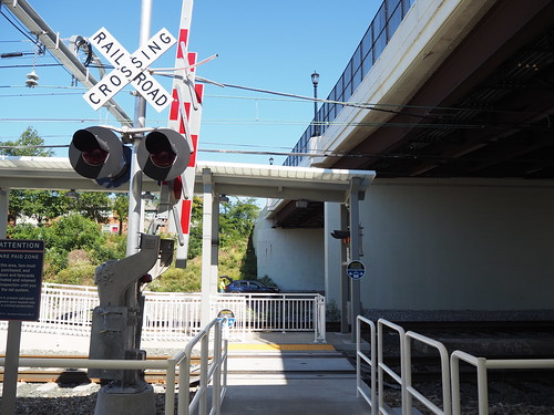
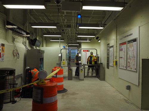
Two weeks after heading to Michigan City for a station about to close for reconstruction, two other stations closed for reconstruction, this time much closer to me. At midnight on Sunday, May 16, 2021, the North Side Main Line started heavy construction for the Lawrence to Bryn Mawr Modernization Project. This is, to put it lightly, a massive project. They will be rebuilding the track structure between Lawrence and Bryn Mawr (and a little bit past each of those stations) to modernize it. The current structure is an embankment, which basically consists of two retaining walls with earth fill and ballasted track:
The embankment from ground level
Ballasted track running on top of the earth fill
A typical street crossing
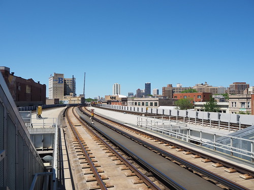
They will be replacing this with a more modern elevated structure. They have similar structures in a few places, but unfortunately I don’t have any ground-level pictures (now that I’m writing this and realize it, I will quickly remedy that), but from above the tracks look like this (Wilson in this case, just south of the work zone):
Tracks north of Wilson
This new structure will be open underneath, since it will be supported by concrete pillars rather than a solid earth fill. In the process, they will also be rebuilding the four stations (Lawrence, Argyle, Berwyn, and Bryn Mawr). All four of those stations are fairly similar to their original 1920s designs, with narrow platforms, a single entrance (with a second exit-only staircase at the north end of Bryn Mawr), and not being accessible to passengers with disabilities. Lawrence and Bryn Mawr still feature wooden platforms, with the Bryn Mawr one particularly showing its age:
Old platform at Bryn Mawr
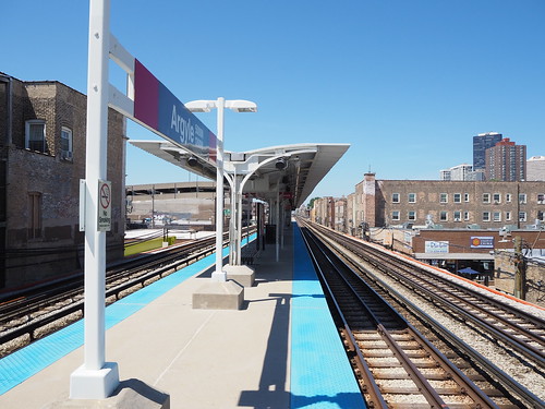
Berwyn and Argyle had their platforms replaced with concrete several years ago, but otherwise are pretty similar to Lawrence and Bryn Mawr.
Concrete platform at Argyle
The renovations to the stations will allow them to be fully accessible to passengers with disabilities, and also generally modernize them by making the platform wider, replacing the wood with concrete, and other things.
In the past when undertaking major reconstruction projects, the CTA has closed the line for several months with shuttle buses, like when they rebuilt the Dan Ryan Branch in 2013. In that case, they rerouted Red Line trains via the South Side Elevated (Green Line southern leg). However, in this case, since so many people take the Red Line (or at least did before the COVID-19 pandemic, and this project was planned long before then) and there aren’t any alternate routes, they still will run trains through the work zone. Since the line has four tracks, they will close two tracks at a time. The Purple Line Express will continue to run but will share tracks with the Red Line (I imagine this will be a dispatching nightmare). Lawrence and Berwyn will temporarily close, while Argyle and Bryn Mawr will remain in service, but using a temporary platform to accommodate trains running on different tracks than usual. Here is a very crude Microsoft Paint drawing explaining the situation:
Track situation prior to the start of the reconstruction project: Red Line runs on the inner tracks making stops, while the Purple Line runs on the outer tracks bypassing stopsTrack situation during the reconstruction project: trains share tracks between Lawrence and Thorndale (I think they also share tracks at Wilson which is not reflected in the diagram) with Berwyn and Lawrence closed
The Last Hurrah
I set out to see the preparatory work in the afternoon on May 15 and take a photos of the stations about to close (Lawrence and Berwyn) as a sort of last hurrah.
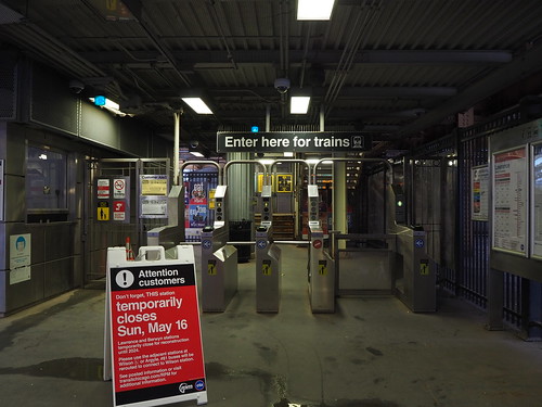
Turnstiles at Lawrence with a notice that the station was closing soon
South end of the embankment from Lawrence
Train at Lawrence
Sign near Lawrence directing passengers to head to Broadway to get to either Wilson or Argyle
Sign at Lawrence and Broadway directing passengers to Wilson and Argyle
Platform at Berwyn
Turnstiles at Berwyn with a notice of the upcoming closure
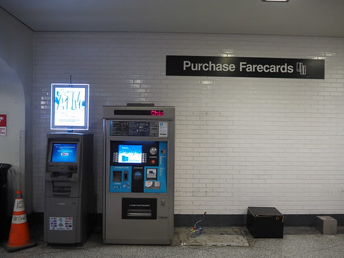
One of the fare machines at Berwyn had already been removed
The Transition
That evening, I periodically checked around the four affected stations to see what sort of preparatory work was being done. Nothing much seemed to be different until about 10:30pm, when they removed the wood covering over the Bryn Mawr temporary entrance:
Bryn Mawr temporary southbound entrance, about 90 minutes before opening
The Argyle entrance was still closed at the time, so I returned home to post that photo and charge my camera. Then, I headed out again to check if there was anything new at Argyle, and unfortunately there was not, so I walked back to Bryn Mawr and then back to Argyle, at which point the wood paneling had been removed, making the fare mezzanine visible:
Temporary entrance to Argyle, about 20 minutes prior to opening
I then headed to Berwyn, aiming to catch the last train at that station (which by my guess was the last one listed on Ventra to arrive prior to midnight). The train ended up arriving just after midnight, so this probably was the last train ever to stop at Berwyn (no southbound trains were listed on Ventra for a while and I couldn’t see any headlights coming from the north).
Last train ever to stop at the current Berwyn station!
From there I took it one stop to Bryn Mawr, where it stopped at the old station (now only used for northbound trains). From there, I hightailed it to the temporary southbound entrance. They were still in the process of removing the wrapping from the Bryn Mawr sign, so I waited for that, then got a photo.
Bryn Mawr temporary southbound entrance
At that point, I just started photographing everything I could. A photographer from the construction contractor noticed me and explicitly invited me to take as many pictures as I can (and also informed me I was the second customer ever to board at that station). That was a nice change of pace, since usually employees get mad at me for taking photos (even though non-commercial photography is allowed without any form of permit). I took a bunch of photos of the mezzanine and passage to the platform:
Faregates
Passage to the platform
Bottom of the stairs
Platform
Unfortunately around this time it started raining, so I was only able to take photos with my good camera under the canopy, and was limited to using my phone outside of it.
From there, I caught a train (the second one ever to stop at this temporary platform) to Argyle:
Second ever train to stop at the temporary southbound platform at Bryn Mawr
At Argyle I resumed photography, but the rain had intensified, limiting me again to under the canopy.
Temporary platform by the stairs
However, it eventually stopped raining, enabling me to photograph the rest of the platform.
Temporary platform and the existing platform at Argyle
Stairs to the temporary southbound platform
While I was there, I also got to talk to some of the construction crew and learn a bit more about the project, and a few guys asked me to take a photo of them (I did make sure they were aware I would post it online):
These people asked me to take a photo of them, so here it is
From there, I headed out of Argyle, photographing the exit along the way:
Bottom of the stairs to the temporary southbound platform at Argyle
Temporary mezzanine at Argyle
Interestingly, Argyle has the temporary mezzanine and regular mezzanine connected (and they both lead to both platforms), but closed the main mezzanine when opening the temporary one:
Main mezzanine temporarily closed at Argyle, with passengers directed to use the temporary one instead
From there, I walked up to Bryn Mawr, stopping at Berwyn to see what it looked like after they closed it:
Closed entrance to Berwyn
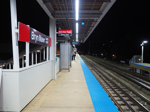
Then I continued up to Bryn Mawr, noticing a sign at the corner of Bryn Mawr and Broadway that was not there earlier in the evening. Since Bryn Mawr now has a separate station and entrance for each direction (about a block apart), it’s important that people know which one to use, so they put up a sign at the corner to help out.
Sign directing people to the different platforms at Bryn Mawr
I also photographed more of the station since the rain stopped:
Full view of the platforms at Bryn Mawr, including an extension of the existing platform
Warming shelter for cold weather
Moving Forward
Now a massive four year construction project has really kicked off. Berwyn and Lawrence are closed for four years and will probably be demolished relatively soon (I will provide photos as I am able once that happens). I really look forward to seeing the end result, even if the intermediate process is going to be a challenge. I don’t currently have a commute to work, but probably will long before this project is over, so I will be boarding at this station. I do also have the 147 Outer Drive Express bus as an alternate if this becomes too difficult.
The day after I visited Lawrence to see the station one last time before it closed.
Lawrence station after being closed
I also noticed there was a mural across the street from the entrance, and sadly that mural will probably be lost with the construction.
Mural on the north side of Lawrence Avenue
It’s going to be quite the adventure, that’s for sure.
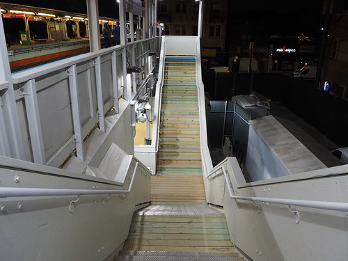
On May 1, 2021, the 11th Street Station in Michigan City closed for reconstruction. The closure is expected to last about two and a half years, after which a new, more modern station will take its place. This is a bit of a bittersweet moment, as the new station and other associated improvements will provide a much better experience for riders (faster, fewer delays, easier boarding, etc.) but this is also the end of nearly 100 years of history.
The station as it existed prior to the closure was a fairly unique setup. It was in the middle of a street running segment on 11th Street in Michigan City, where the train runs in the middle of the street. The street is configured with one lane in each direction, with a third “lane” in the middle which carries the track.
Street running track in Michigan City, with one lane in each direction plus a third “lane” in the middle to carry the track
Trains run down that track in the middle, and they also have to stop at red lights, just like cars. The crossings are generally unsignaled, with just a stoplight or stop sign.
Street crossing the street-running track
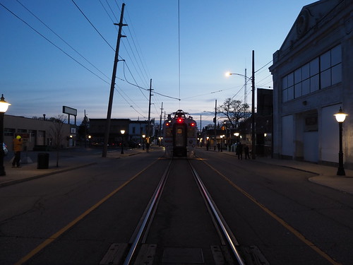
Train running in the middle of the street
The station is similar to a streetcar stop. The train stops in the middle of the street, and then passengers have to cross a lane of traffic to board or disembark. There is a stoplight to protect passengers from oncoming traffic while trains are stopped. The station just consists of a shelter, parking lot, and no platform. There used to be a station house adjacent to the current location of the station, but the building has since fallen into disuse.
Station shelter at 11th Street
Former station house at 11th Street
Boarding a train from the street
This station design is a relic from the line’s interurban heritage. Interurbans basically operate like streetcars within cities but like regular trains between cities. The way the line was originally built, it had a number of street running segments, including this one in Michigan City, as well as segments in East Chicago and South Bend. The other ones were removed long ago: the East Chicago segment was rerouted to a new alignment adjacent to the Indiana Toll Road in 1956 and the South Bend segment was removed with the line first truncated before entering the street and then rerouted to a new station at the airport in 1992.
The Michigan City segment remained the last holdout on the line, continuing to operate street running tracks. Plans had existed for a long time to remove the tracks from the street, however due to the expense and property impact involved, it took a long time to come to fruition. Finally, as part of a larger project to double track the line from Gary to Michigan City (the line east of Gary is mostly a single track), they decided they would commence work on removing street running track in Michigan City. The new alignment will replace 10th and 11th Streets with one way streets and putting a second track where one of the lanes used to be.
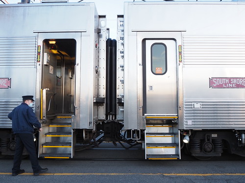
While the South Shore Line initially announced that there would be no extended station closures during the double tracking project, they recently announced that the 11th Street Station would close starting May 1, 2021. I decided to seize the opportunity to photograph trains on the last day. I took the 5:58 train from Millennium Station out to Michigan City with plans to spend the night. I usually only get out to Indiana on weekends, where they only run single-level cars, but this time since it was a weekday they ran a bilevel railcar. I got to Michigan City right on schedule, and got off at 11th Street.
The train I took to Michigan City
I found out I was hardly the only person with the idea to photograph the station. There is a pretty large railfan community in the area, and a lot of them were also out there photographing, and I felt way outclassed since they definitely knew way more about this than I did and a lot of them had way fancier camera equipment. Still, I got to talk to some of them, and it was really cool to meet them.
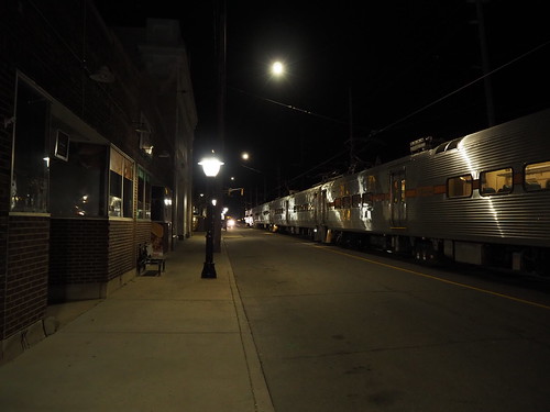
While I didn’t stay for the last ever train to stop at the street-running 11th Street station (I didn’t particularly want to stay up until 2:18am), I did photograph a few more trains, including the last inbound train ever to stop there (there were several more outbound trains after it).
Last inbound train to ever stop at the street-running 11th Street Station
I quickly realized I was out of practice in terms of nighttime photography, as all of my recent photography expeditions have been during the daytime (and mostly during sunny weather). Still, I did my best.
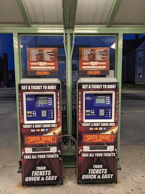
One interesting detail is that the ticket machines were turned off, even though there were still trains running. I wonder if this means that passengers would have to pay the surcharge for buying a fare onboard the train.
The ticket machines have been turned off
I spent the next few hours chatting with other railfans, photographing trains as they went by, including another passenger train and a freight train:
Passenger train at 11th Street
Freight train passing 11th Street
From there, I caught a ride to the hotel where I was staying.
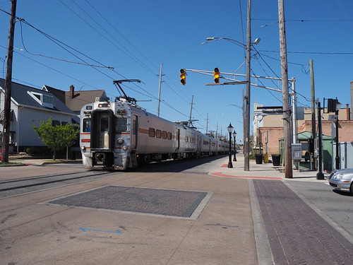
The next day, after getting my second COVID vaccine dose (I got it in Michigan City since at the time of my first dose, it was still pretty hard to get one in Chicago), I went back to the station to see if any demolition or construction had started yet. None had, but I got a few photos of the station from angles I hadn’t before. One other person was out photographing at this time. A train also passed by during this time, not stopping at the station. I realized I hadn’t gotten a good photo of a train including the shelter (to make it clearer how it looks when passengers actually board), so I took such a photo with this train, even if it wasn’t actually stopping.
Outbound train bypassing 11th Street
Then, I got to work photographing various points along the line as well as the buildings that were slated for demolition (or at least the ones that had notices on them at the time).
Building slated for demolition
Firme office slated for demolition – the only commercial building I saw slated for demolition, probably because the land will be needed for building the new station
Willard Avenue grade crossing, one of two crossings with lights
I also got some photos of some very old interurban cars used on the line.
Old Chicago South Shore and South Bend cars formerly used on the South Shore Line
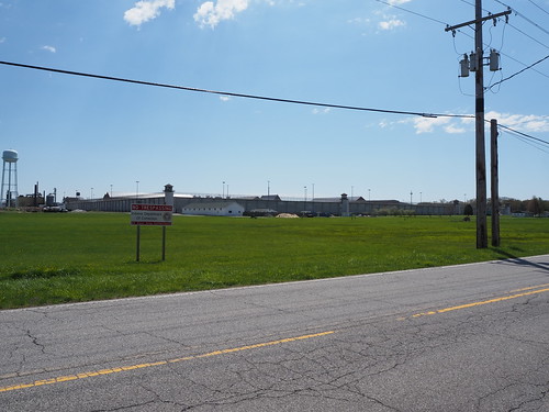
I also got a photo of the Indiana State Prison (from across the street):
Indiana State Prison
Then I headed back to downtown Michigan City for lunch, and went to a burger place called Royale. The food was excellent, even if service was kinda slow. From there, I explored Downtown Michigan City a bit more, heading to the waterfront. Due to the blowing sand, I didn’t get many photos since I didn’t want to damage my camera. I did get a photo of the lighthouse though:
Michigan City lighthouse
Then I walked over to Carroll Avenue (the other train station in Michigan City) since I could no longer board at 11th Street to get home. Along the way I photographed the eastern street running portion in Michigan City a bit more, as well as a few more condemned buildings.
Another condemned building
Along the way, another train passed by.
Outbound train passing Lafayette Street
Then, I got to the end of the street running.
The eastern end of the tracks in 11th Street
Tracks entering the street
From there, I walked over to Carroll Avenue.
Entrance sign at Carroll Avenue
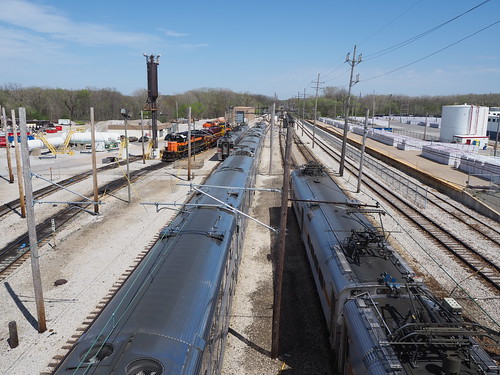
I also took some photos of the rail yard and shops.
Railcars at the yard
Then, I went to the station to wait for my train home. An outbound train passed by while I was waiting:
Outbound train leaving Carroll Avenue
Finally, my train entered from the yard.
Inbound train waiting on the yard lead at Carroll Avenue
From there, I caught the train back to Chicago.
I look forward to seeing the progress in upgrading the line. It will be cool to see a new modern station in Michigan City (as well as Miller, and some improvements at other stations as well). The new station will have a full parking garage, two tracks, and high platforms, which will significantly improve the experience for passengers. The double track work will allow them to run more trains and improve reliability, while removing the tracks from the street in Michigan City will significantly improve speed and safety. Still, it is a bit sad to see a piece of history be lost.
With that, the last street-running station on the South Shore Line is no more, and all that’s left are the memories.


